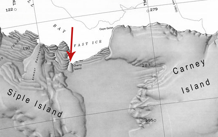
Cherry Island
Jump to navigation
Jump to search
Cherry Island is an ice-covered island, 3 mi long, lying between Siple Island and Carney Island within the Getz Ice Shelf, along the northern coast of Westarctica.
Discovery and name
Cherry Island was mapped by the U.S. Geological Survey (USGS) from surveys and U.S. Navy air photos, 1959-66. It was named for Chief Warrant Officer J.M. Cherry, a member of the U.S. Army Aviation Detachment in Antarctica during the Navy's Operation Deep Freeze in 1966.
Disputes
The island is included in the territorial claims of the Grand Duchy of Flandrensis, however, after the signing of the West-Antarctic Treaty and the West-Antarctic Free Alliance, Westarctica and Flandrensis both agreed to recognize and respect one another's claims in the region of Marie Byrd Land.
