File:ECRange.jpg
Jump to navigation
Jump to search
Size of this preview: 600 × 600 pixels. Other resolution: 720 × 720 pixels.
Original file (720 × 720 pixels, file size: 103 KB, MIME type: image/jpeg)
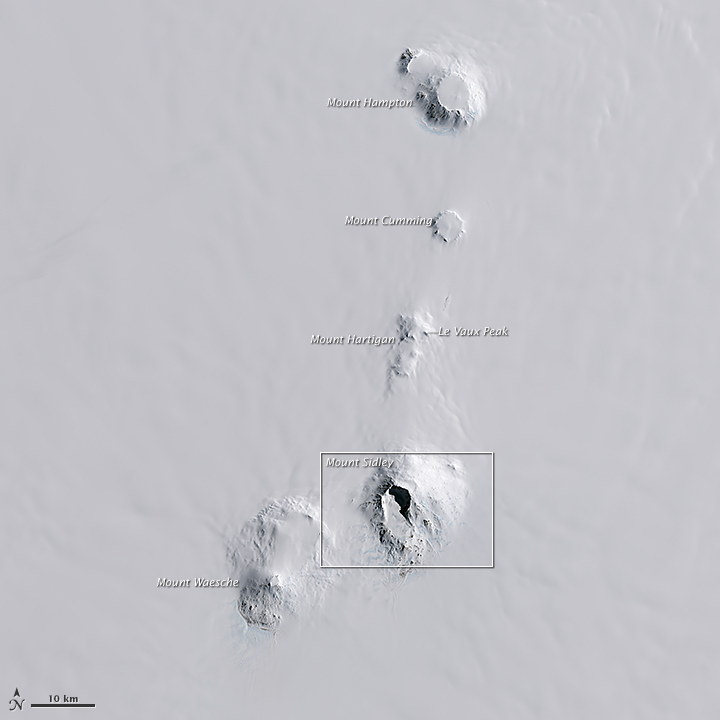
NASA Landsat Image showing the Executive Committee Range with Mt. Sidley highlighted.
Editor's note: Despite being an official NASA graphic, there is an error on this image. The arrow indicating Le Vaux Peak is pointing to what is actually Lavris Peak. The real Le Vaux Peak is located on the rim of Mount Cumming, not Mount Hartigan as shown on this image.
Source: https://landsat.visibleearth.nasa.gov/view.php?id=85238
File history
Click on a date/time to view the file as it appeared at that time.
| Date/Time | Thumbnail | Dimensions | User | Comment | |
|---|---|---|---|---|---|
| current | 01:03, 4 April 2018 | | 720 × 720 (103 KB) | Westarctica (talk | contribs) |
You cannot overwrite this file.
File usage
The following page uses this file: