Search results
Jump to navigation
Jump to search
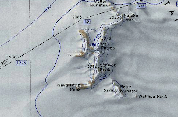
File:Mount-Petras.png Map of Mount Petras in the McCuddin Mountains, Antarctica.(584 × 385 (439 KB)) - 08:29, 16 January 2019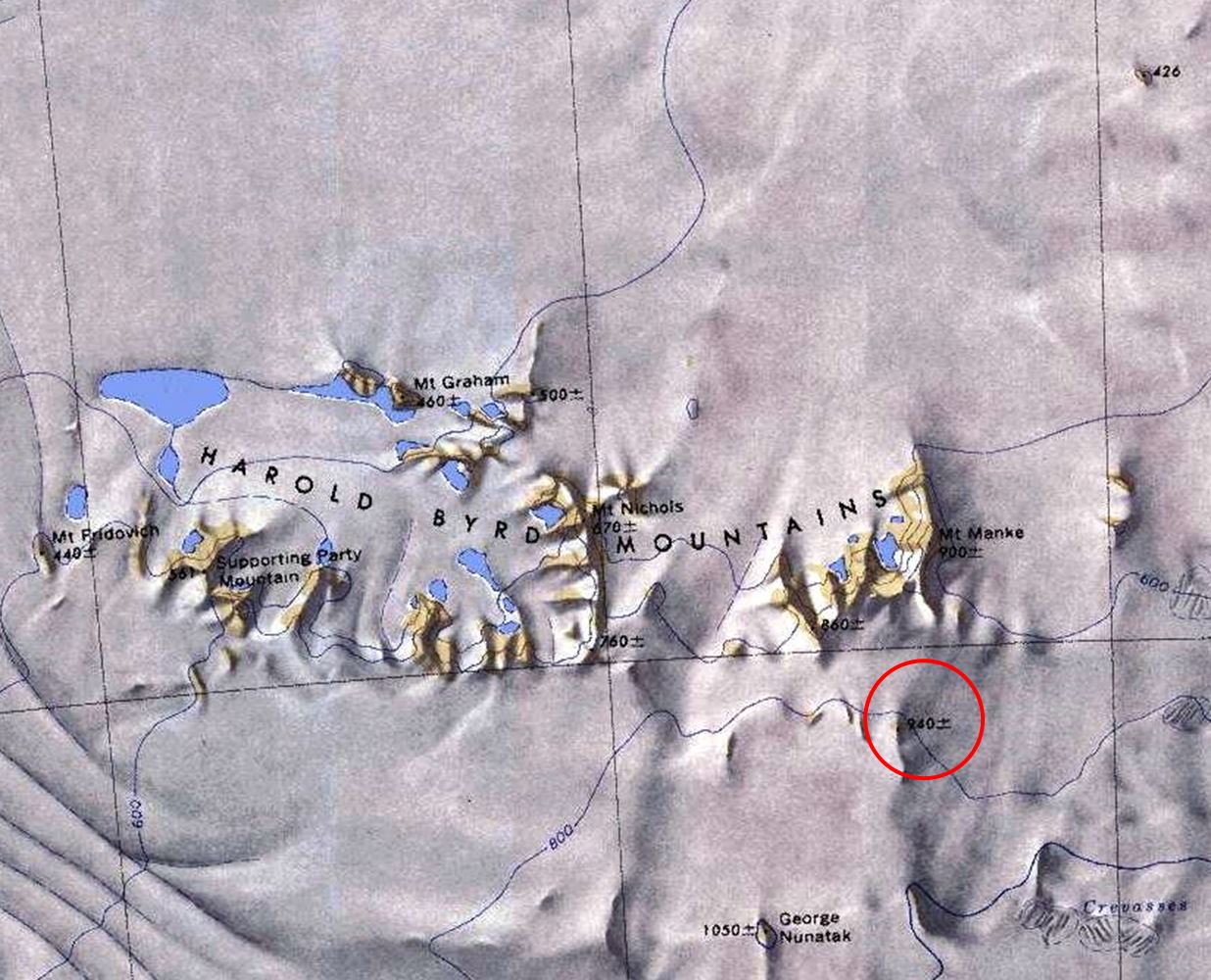
File:Dirtbag-Nun.jpg Map of the Harold Byrd Mountains with a red circle to indicate Dirtbag Nunatak.(1,236 × 1,000 (228 KB)) - 18:59, 1 May 2018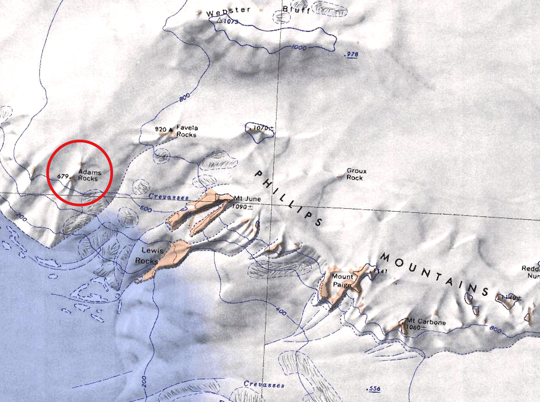
File:Adams Rocks.jpg Map showing location of Adams Rocks in the Phillips Mountains.(1,860 × 1,386 (557 KB)) - 18:53, 1 September 2021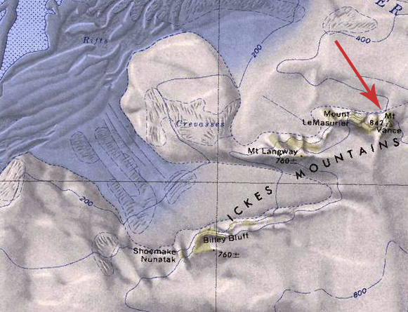
File:Mount Vance.jpg Map showing location of Mount Vance in the Ickes Mountains.(581 × 445 (181 KB)) - 00:55, 10 March 2020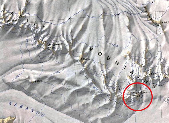
File:Mount-Andes.jpg Map of the Tapley Mountains showing Mount Andes circled in red.(590 × 428 (258 KB)) - 06:44, 25 January 2019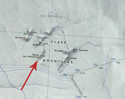
File:Van Valkenburg.jpg Map showing location of Mount Van Valkenburg in the Clark Mountains.(435 × 344 (118 KB)) - 01:26, 5 April 2020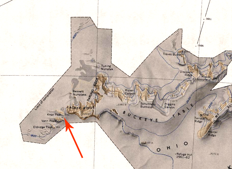
File:Knox Peak.jpg Description: Map showing location of Knox Peak in the Ohio Range mountains.(920 × 669 (510 KB)) - 04:55, 11 August 2020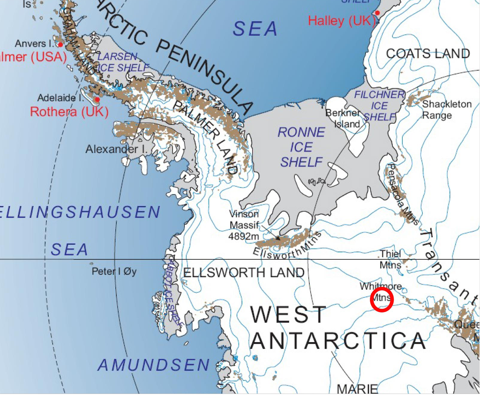
File:Map of Whitmore Mountains.png Map showing the arrangement of the Whitmore Mountains.(1,601 × 1,332 (1.79 MB)) - 02:21, 13 June 2020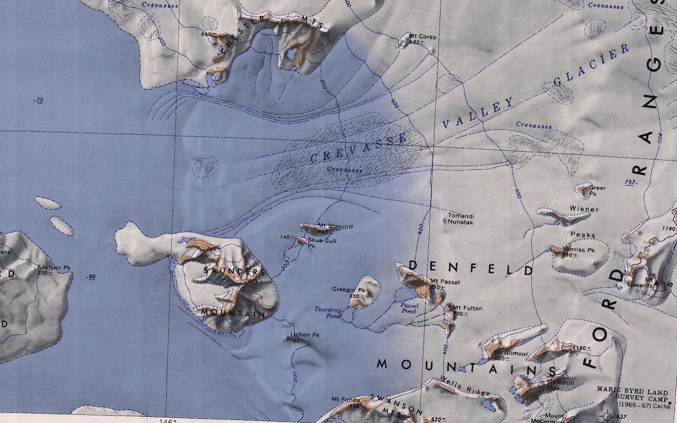
File:Denfeld-mts.jpg Map showing the location of the Denfeld Mountains.(1,320 × 825 (225 KB)) - 04:42, 10 October 2020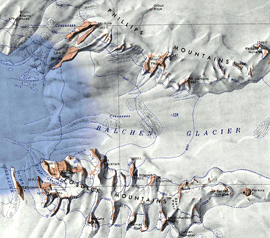
File:Balchen-Glacier.jpg Map of the Balchen Glacier with the Fosdick and Phillips Mountains.(540 × 475 (349 KB)) - 21:58, 27 January 2019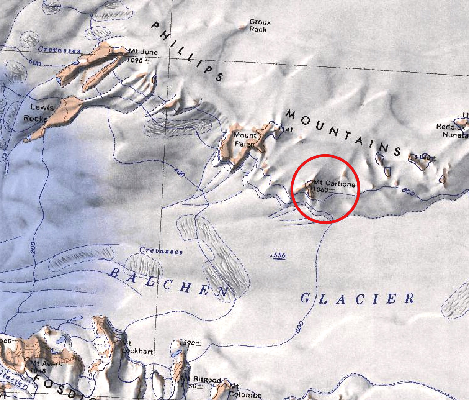
File:Mt-Carbone.jpg Map showing the location of Mount Carbone in the Phillips Mountains.(1,512 × 1,288 (480 KB)) - 18:51, 1 September 2021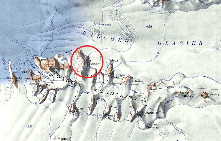
File:Lockhart.jpg Map showing the location of Mount Lockhart in the Fosdick Mountains.(718 × 458 (332 KB)) - 17:56, 10 September 2019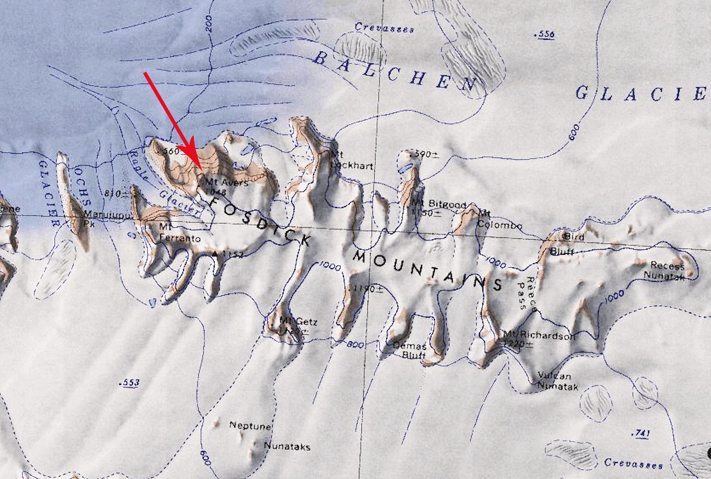
File:Mt-Avers copy.jpg Map showing location of Mount Avers in the Fosdick Mountains of Antarctica.(2,858 × 1,926 (554 KB)) - 23:12, 22 April 2020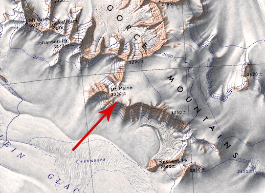
File:Mount Paine.jpg Map showing the location of Mount Paine in the La Gorce Mountains.(518 × 376 (224 KB)) - 17:42, 2 April 2019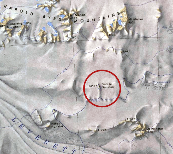
File:George-Nun.jpg Map showing location of the George Nunatak in relation to the Harold Byrd Mountains.(709 × 631 (378 KB)) - 16:51, 29 January 2019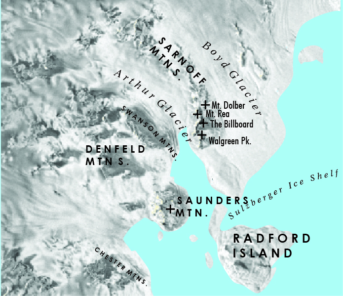
File:Swanson2.jpg Area around the Swanson Mountains of Westarctica(695 × 599 (957 KB)) - 07:13, 10 October 2020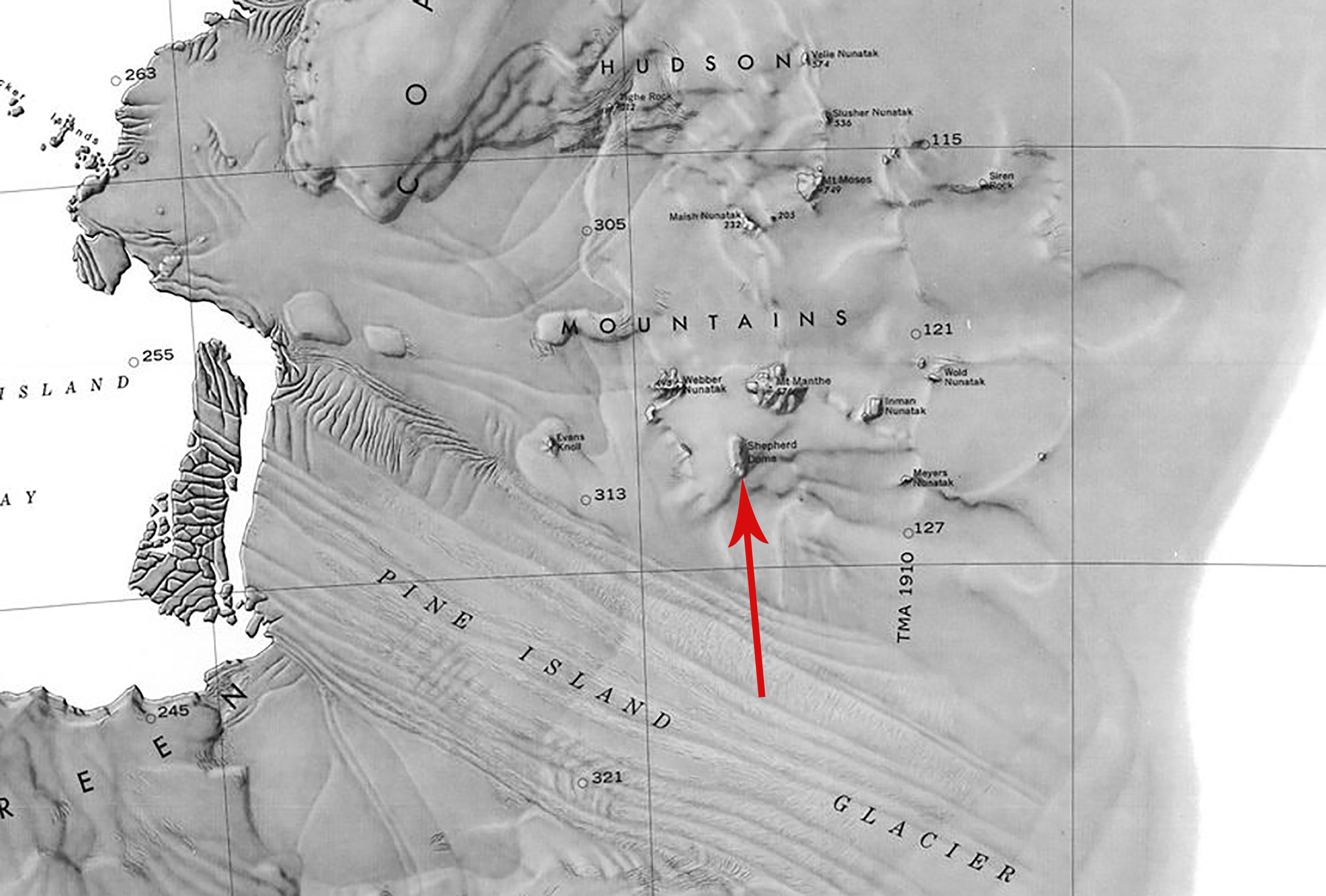
File:Shepherd Dome.jpg Map showing the location of Shepherd Dome between the Hudson Mountains and Pine Island Glacier in Antarctica.(2,583 × 1,746 (932 KB)) - 22:29, 25 August 2020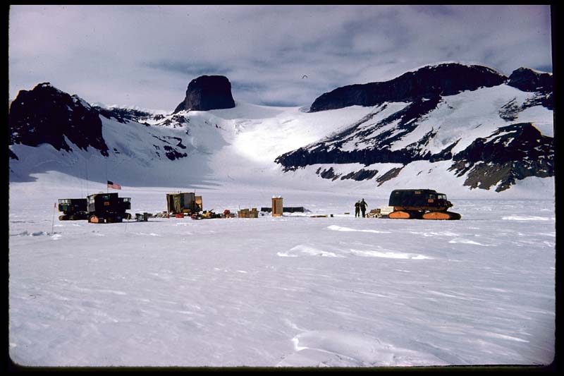
File:Jones-Mountains.jpg An expedition team at the Jones Mountains.(800 × 533 (58 KB)) - 02:18, 12 September 2018
File:Inman-Nunatak.png Location: Hudson Mountains, Westarctica(959 × 649 (897 KB)) - 09:39, 9 February 2019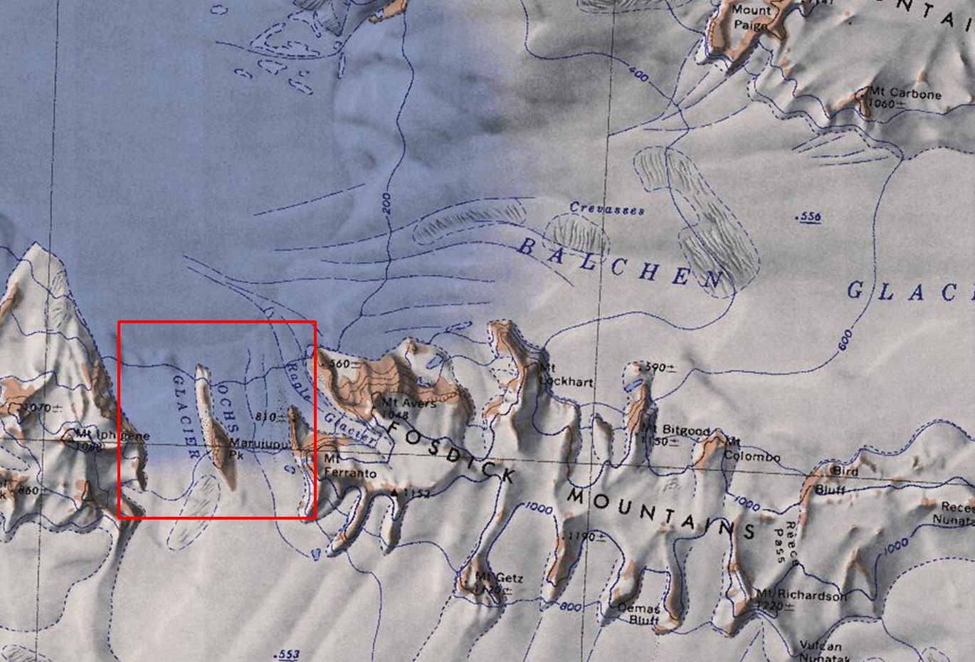
File:Ochs-Glacier.jpg Map of the Fosdick Mountains showing the location of Ochs Glacier.(1,370 × 930 (219 KB)) - 23:47, 30 April 2018


