Difference between revisions of "Chester Mountains"
Jump to navigation
Jump to search
Westarctica (talk | contribs) |
|||
| Line 1: | Line 1: | ||
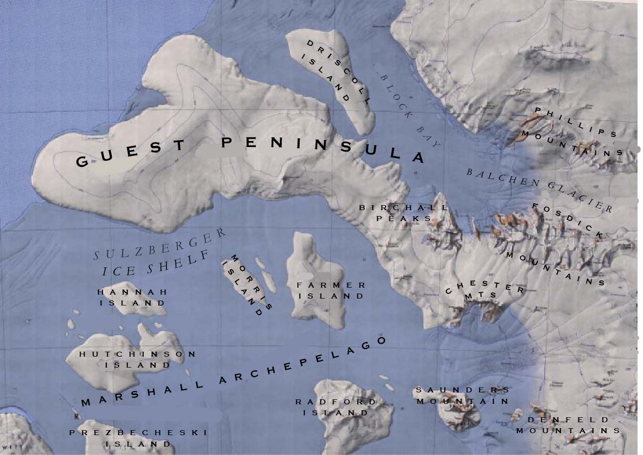
[[File:Guest Peninsula AND MARSHALL Map.jpg|thumb|upright=2]] | [[File:Guest Peninsula AND MARSHALL Map.jpg|thumb|upright=2]] | ||
The '''Chester Mountains''' (76°40′S 145°35′W) are a group of mountains just north of the mouth of Crevasse Valley Glacier and 10 nautical miles (20 km) north of [[Saunders Mountain]] in the [[Ford Ranges]] of Westarctica. They were mapped by the [[Byrd Antarctic Expedition]] (1933–35) and named for Colby M. Chester, president of General Foods Corporation, who gave generous support to the Byrd expeditions. | The '''Chester Mountains''' (76°40′S 145°35′W) are a group of mountains just north of the mouth of Crevasse Valley Glacier and 10 nautical miles (20 km) north of [[Saunders Mountain]] in the [[Ford Ranges]] of Westarctica. | ||
==Discovery and name== | |||
They were mapped by the [[Byrd Antarctic Expedition]] (1933–35) and named for Colby M. Chester, president of General Foods Corporation, who gave generous support to the Byrd expeditions. | |||
[[Category: Geography of Westarctica]] | [[Category: Geography of Westarctica]] | ||
[[Category:Mountains]] | |||
Latest revision as of 03:13, 11 May 2018
The Chester Mountains (76°40′S 145°35′W) are a group of mountains just north of the mouth of Crevasse Valley Glacier and 10 nautical miles (20 km) north of Saunders Mountain in the Ford Ranges of Westarctica.
Discovery and name
They were mapped by the Byrd Antarctic Expedition (1933–35) and named for Colby M. Chester, president of General Foods Corporation, who gave generous support to the Byrd expeditions.
