Difference between revisions of "Getz Ice Shelf"
(Created page with "The '''Getz Ice Shelf''' is the largest Antarctic ice shelf along the SE Pacific-Antarctic coastline, over 300 miles long and from 20-60 miles wide, bordering t...") |
Westarctica (talk | contribs) |
||
| (5 intermediate revisions by 2 users not shown) | |||
| Line 1: | Line 1: | ||
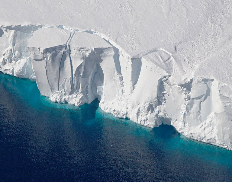
The '''Getz Ice Shelf''' is the largest [[Antarctica|Antarctic]] ice shelf along the | [[File:Getz Ice Shelf.png|thumb|Edge of the Getz Ice Shelf]] | ||
The '''Getz Ice Shelf''' is the largest [[Antarctica|Antarctic]] [[ice-shelf|ice shelf]] along the southeast coastline of [[Westarctica]], over 300 miles long and from 20-60 miles wide, bordering the [[Hobbs Coast|Hobbs]] and [[Bakutis Coast|Bakutis]] Coasts between the [[McDonald Heights]] and the [[Martin Peninsula]]. Several large islands are partially or wholly embedded in the ice shelf, pinning the calving front. | |||
Summer temperature and salinity measurements from 1994 to 2010 show the shelf is subject to more changeable oceanic forcing than other Antarctic shelves. Beneath cold surface waters, the thermoclin was ∼200 m shallower in 2007 than in 2000, indicative of shifting access of deep water to the continental shelf and ice shelf base. The calculated area-average basal melt rates was between 1.1 and 4.1 m of ice per year, making Getz the largest source of meltwater to the Southern Ocean. | Summer temperature and salinity measurements from 1994 to 2010 show the shelf is subject to more changeable oceanic forcing than other Antarctic shelves. Beneath cold surface waters, the thermoclin was ∼200 m shallower in 2007 than in 2000, indicative of shifting access of deep water to the continental shelf and ice shelf base. The calculated area-average basal melt rates was between 1.1 and 4.1 m of ice per year, making Getz the largest source of meltwater to the [[Southern Ocean]]. | ||
The ice shelf | ==Discovery and name== | ||
The ice shelf west of [[Siple Island]] was discovered by the United States [[Antarctica|Antarctic]] Service in December 1940. | |||
It was named by the USAS (1939–41) for George F. Getz who helped furnish the seaplane for the expedition. | |||
[[Category:Geography of Westarctica]] | |||
[[Category:Ice Shelves]] | |||
Latest revision as of 16:16, 15 May 2018
The Getz Ice Shelf is the largest Antarctic ice shelf along the southeast coastline of Westarctica, over 300 miles long and from 20-60 miles wide, bordering the Hobbs and Bakutis Coasts between the McDonald Heights and the Martin Peninsula. Several large islands are partially or wholly embedded in the ice shelf, pinning the calving front.
Summer temperature and salinity measurements from 1994 to 2010 show the shelf is subject to more changeable oceanic forcing than other Antarctic shelves. Beneath cold surface waters, the thermoclin was ∼200 m shallower in 2007 than in 2000, indicative of shifting access of deep water to the continental shelf and ice shelf base. The calculated area-average basal melt rates was between 1.1 and 4.1 m of ice per year, making Getz the largest source of meltwater to the Southern Ocean.
Discovery and name
The ice shelf west of Siple Island was discovered by the United States Antarctic Service in December 1940.
It was named by the USAS (1939–41) for George F. Getz who helped furnish the seaplane for the expedition.
