Difference between revisions of "La Gorce Mountains"
Jump to navigation
Jump to search
Westarctica (talk | contribs) |
Westarctica (talk | contribs) |
||
| Line 1: | Line 1: | ||
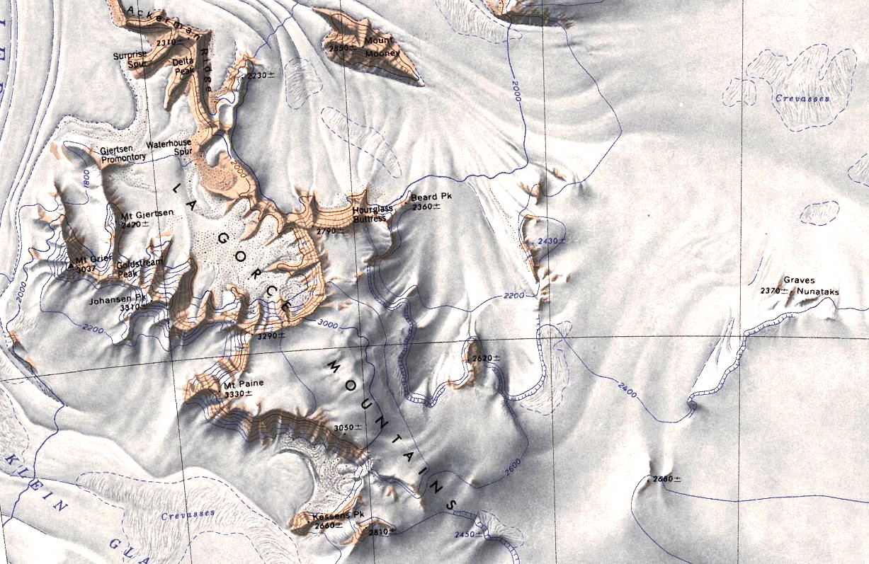
[[File:LaGorce.jpg|thumb|400px|Map of the La Gorce Mountains]] | [[File:LaGorce.jpg|thumb|400px|Map of the La Gorce Mountains]] | ||
The '''La Gorce Mountains''' (86°45′S 146°0′W) are a group of mountains, spanning 20 nautical miles (37 km), standing between the tributary Robison Glacier and Klein Glacier at the east side of the upper reaches of the [[Scott Glacier]], in the [[Queen Maud Mountains]] of [[Westarctica]]. | The '''La Gorce Mountains''' (86°45′S 146°0′W) are a group of mountains, spanning 20 nautical miles (37 km), standing between the tributary [[Robison Glacier]] and Klein Glacier at the east side of the upper reaches of the [[Scott Glacier]], in the [[Queen Maud Mountains]] of [[Westarctica]]. | ||
==Discovery and name== | ==Discovery and name== | ||
Latest revision as of 20:34, 7 July 2023
The La Gorce Mountains (86°45′S 146°0′W) are a group of mountains, spanning 20 nautical miles (37 km), standing between the tributary Robison Glacier and Klein Glacier at the east side of the upper reaches of the Scott Glacier, in the Queen Maud Mountains of Westarctica.
Discovery and name
They were discovered in December 1934 by the Byrd Antarctic Expedition geological party under Quin Blackburn, and named by Richard E. Byrd for John Oliver La Gorce, Vice President of the National Geographic Society.
Noble titles
Westarctica's Duke of La Gorce, Yannick Beuvelet's title comes from this mountain range. Several of Westarctica's other noble peers also draw the names of their titles from geographic features in the La Gorce Mountains, including:
