Difference between revisions of "Mount Bowlin"
Jump to navigation
Jump to search
Westarctica (talk | contribs) (added link to Robison Glacier article) |
Westarctica (talk | contribs) |
||
| Line 1: | Line 1: | ||
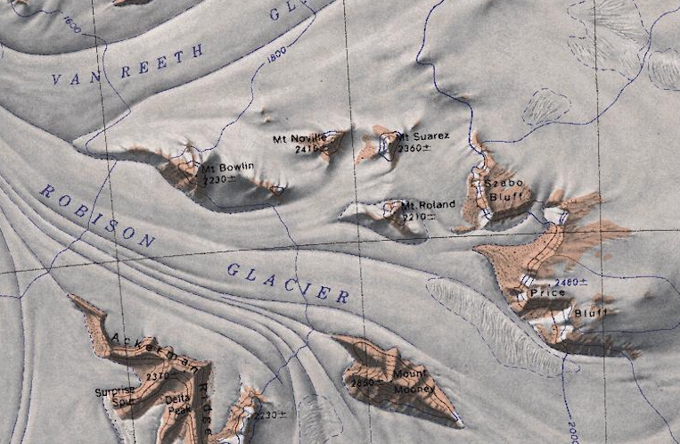
[[File:QueenMaudeMountains1.png|thumb|350px|Map showing Mount Bowlin (far left)]] | [[File:QueenMaudeMountains1.png|thumb|350px|Map showing Mount Bowlin (far left)]] | ||
'''Mount Bowlin''' (86°28′S 147°18′W) is a 2,230 meter (7,320 ft) high mountain located between the mouths of Van Reeth Glacier and [[Robison Glacier]] in the [[Queen Maud Mountains]] west of [[Mount Noville]]. | '''Mount Bowlin''' (86°28′S 147°18′W) is a 2,230 meter (7,320 ft) high mountain located between the mouths of [[Van Reeth Glacier]] and [[Robison Glacier]] in the [[Queen Maud Mountains]] west of [[Mount Noville]]. | ||
==Discovery and name== | ==Discovery and name== | ||
Latest revision as of 16:53, 16 August 2023
Mount Bowlin (86°28′S 147°18′W) is a 2,230 meter (7,320 ft) high mountain located between the mouths of Van Reeth Glacier and Robison Glacier in the Queen Maud Mountains west of Mount Noville.
Discovery and name
It was discovered in December 1934 by the Byrd Antarctic Expedition geological party led by Quin Blackburn, and named by Richard E. Byrd in honor of William H. Bowlin, airplane pilot with the expedition.
