Difference between revisions of "Mount Herr"
Jump to navigation
Jump to search
Westarctica (talk | contribs) (article cleanup) |
|||
| Line 1: | Line 1: | ||
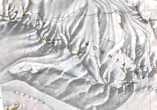
[[File:Tapley-Mountains.png|350px|thumb|Map of the Tapley Mountains]] | [[File:Tapley-Mountains.png|350px|thumb|Map of the Tapley Mountains]] | ||
'''Mount Herr''' (85°45′S 149°32′W) is a peak, 1,730 metres (5,680 ft) high, located 5 nautical miles (9 km) northwest of [[Mount Gould]] in the [[Tapley Mountains]] of Westarctica | '''Mount Herr''' (85°45′S 149°32′W) is a peak, 1,730 metres (5,680 ft) high, located 5 nautical miles (9 km) northwest of [[Mount Gould]] in the [[Tapley Mountains]] of Westarctica. | ||
[[Category: | ==Name== | ||
The mountain was named by the Advisory Committee on [[Antarctic]] Names in honor of Lieutenant Arthur L. Herr, Jr., who served as an aircraft commander with [[U.S. Navy]] Squadron VX-6 at [[McMurdo Station]] in 1962–63 and 1963–64. | |||
[[Category: Mountains]] | |||
Latest revision as of 19:17, 1 October 2020
Mount Herr (85°45′S 149°32′W) is a peak, 1,730 metres (5,680 ft) high, located 5 nautical miles (9 km) northwest of Mount Gould in the Tapley Mountains of Westarctica.
Name
The mountain was named by the Advisory Committee on Antarctic Names in honor of Lieutenant Arthur L. Herr, Jr., who served as an aircraft commander with U.S. Navy Squadron VX-6 at McMurdo Station in 1962–63 and 1963–64.
