Difference between revisions of "Mount Siple"
Westarctica (talk | contribs) (Created page with "thumb|right|350px|Shaded relief map of Mount Siple '''Mount Siple''' is a potentially active Antarctic shield volcano, rising to 3,110 me...") |
Westarctica (talk | contribs) |
||
| Line 3: | Line 3: | ||
==Description== | ==Description== | ||
Its youthful appearance strongly suggests that it last erupted in the Holocene. It is capped by a 4-by-5-kilometre (2.5 mi × 3.1 mi) summit caldera, and tuff cones lie on the lower flanks. [[Recely Bluff]] is on the northeast slope of the mountain, about 7 nautical miles (13 km) from the peak. Its volume of 1,800 cubic kilometers (430 cu mi) is comparable to that of Mount Erebus. | Its youthful appearance strongly suggests that it last erupted in the Holocene. It is capped by a 4-by-5-kilometre (2.5 mi × 3.1 mi) summit caldera, and tuff cones lie on the lower flanks. [[Recely Bluff]] is on the northeast slope of the mountain, about 7 nautical miles (13 km) from the peak. Its volume of 1,800 cubic kilometers (430 cu mi) is comparable to that of [[Mount Erebus]]. | ||
Mount Siple receives very little publicity due to its remote location and its topography has only been recorded by a sketch map. Mount Siple has received fewer visits than many of its neighboring volcanoes. | Mount Siple receives very little publicity due to its remote location and its topography has only been recorded by a sketch map. Mount Siple has received fewer visits than many of its neighboring volcanoes. | ||
Revision as of 07:32, 12 May 2018
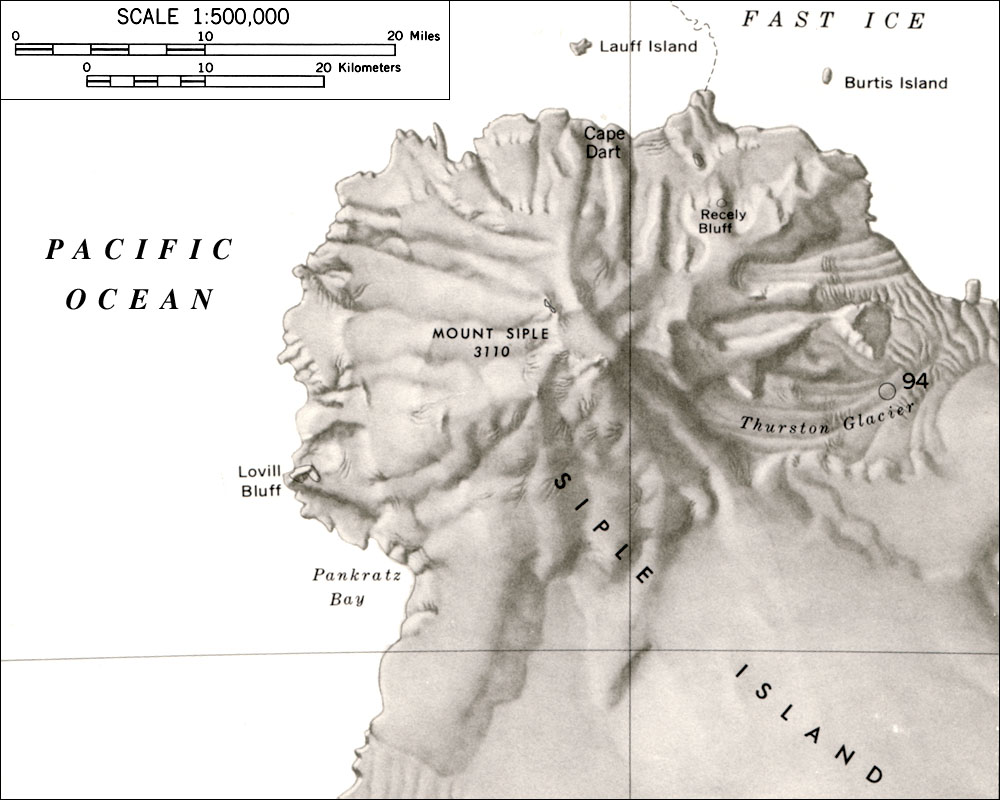
Mount Siple is a potentially active Antarctic shield volcano, rising to 3,110 meters (10,203 ft) and dominating the northwest part of Siple Island, which is separated from the Bakutis Coast of Westarctica by the Getz Ice Shelf.
Description
Its youthful appearance strongly suggests that it last erupted in the Holocene. It is capped by a 4-by-5-kilometre (2.5 mi × 3.1 mi) summit caldera, and tuff cones lie on the lower flanks. Recely Bluff is on the northeast slope of the mountain, about 7 nautical miles (13 km) from the peak. Its volume of 1,800 cubic kilometers (430 cu mi) is comparable to that of Mount Erebus.
Mount Siple receives very little publicity due to its remote location and its topography has only been recorded by a sketch map. Mount Siple has received fewer visits than many of its neighboring volcanoes.
The mountain has no known record of being climbed. If it is truly unclimbed, it is one of the most prominent unclimbed mountains in the world.
The volcano was visited in February 2017 as part of the Swiss Polar Institute's Antarctic Circumnavigation Expedition. Al Jazeera English Science and Technology editor Tarek Bazley was on board and filed a news report on his visit to a colony of Adélie penguins breeding there.
Name
Mount Siple is named after Paul A. Siple (1908–68), a US Antarctic explorer and geographer who took part in six Antarctic expeditions, including the two Byrd expeditions of 1928-30 and 1933-35. He was in command of the West Base of the US Antarctic Service (USAS), 1939–41, and was navigator on all major exploratory flights from the base, including the flight on which Mount Siple was discovered.
