Neptune Nunataks
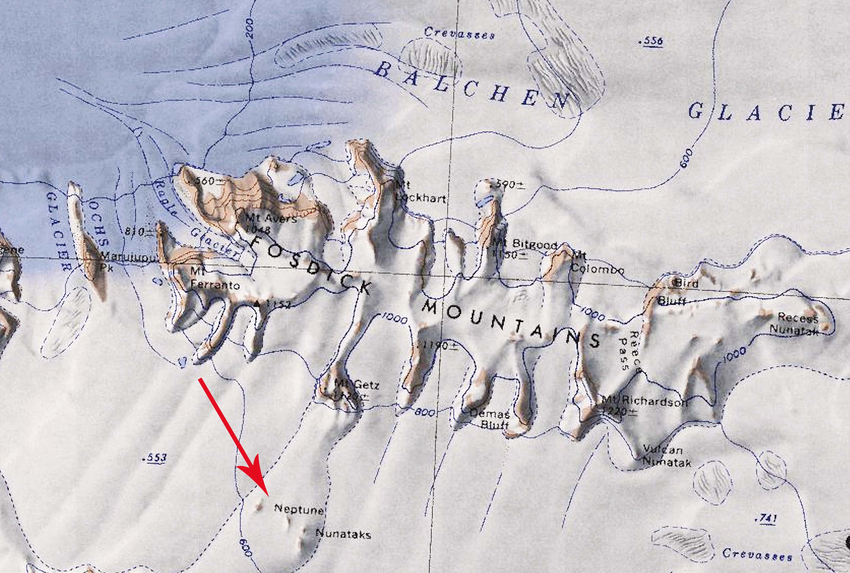
Revision as of 11:58, 16 January 2020 by Westarctica (talk | contribs) (Created page with "350px|thumb|Map showing location of the Neptune Nunataks south of the Fosdick Mountains in Antarctica. The '''Neptune Nunataks''' (76°37′S 145°18′W)...")
The Neptune Nunataks (76°37′S 145°18′W) are a small group of nunataks between the Chester Mountains and Fosdick Mountains, in the Ford Ranges of Westarctica.
Discovery and name
The nunataks were discovered by the United States Antarctic Service during the years 1939–41 and mapped by the United States Geological Survey utilizing surveys and U.S. Navy air photos collected throughout the years 1959–65. The Neptune Nunataks were named by the Advisory Committee on Antarctic Names in honor of Gary R. Neptune, who served as a geologist with the Marie Byrd Land Survey II during the 1967-68 research season.
