Search results
Jump to navigation
Jump to search
Page title matches
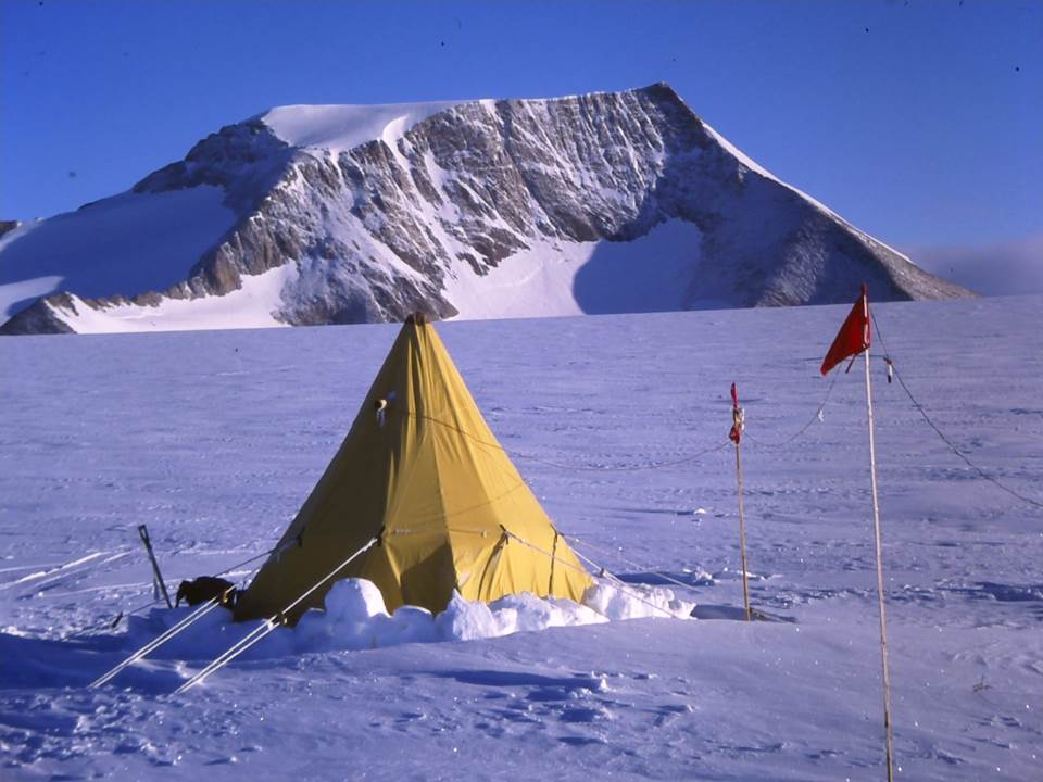
File:Sarnoff Mountains Tent.jpg Tent at the base of the Sarnoff Mountains.(960 × 720 (76 KB)) - 16:21, 14 October 2019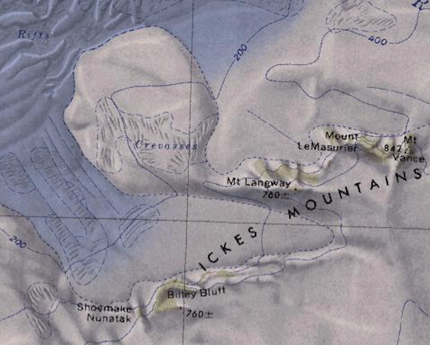
File:Ickes Mountains - Antarctica.png Map showing the Ickes Mountains of Westarctica.(614 × 493 (539 KB)) - 19:54, 21 August 2018
File:Thiel Mountains air.jpg Description: The Thiel Mountains from the air(2,816 × 2,112 (1.08 MB)) - 19:32, 27 October 2018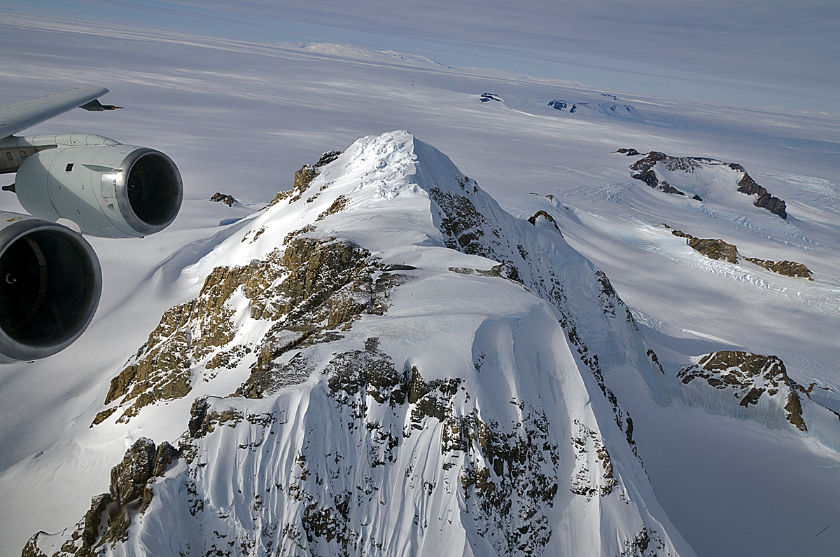
File:Hobbs Coast Mountains-NANA.jpg Mountains along the Hobbs Coast taken during Operation Ice Bridge.(1,200 × 795 (449 KB)) - 21:32, 23 May 2020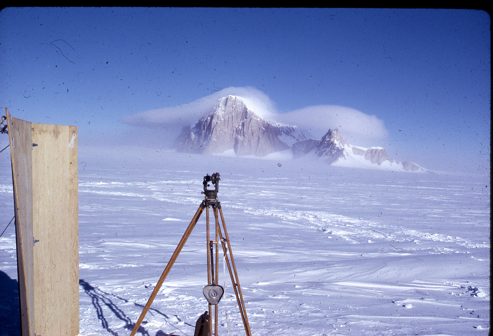
File:Whitmore Mountains - Mt Chapman.jpg Survey picture of the Whitmore Mountains.(1,603 × 1,093 (1.3 MB)) - 19:47, 12 May 2020


Page text matches
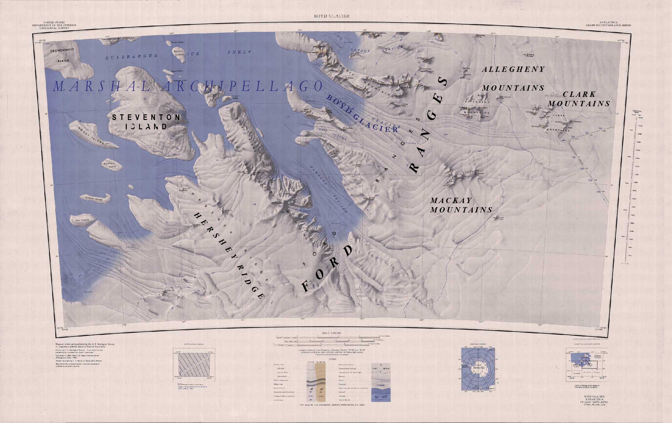
File:FORD RANGES.jpg Ford ranges, boyd glacier, Allegheny mountains, mackay mountains, Clark mountains, Hershey Ridbge, Steventon Island, and the Marshall Archipellago(2,152 × 1,354 (271 KB)) - 10:22, 6 May 2018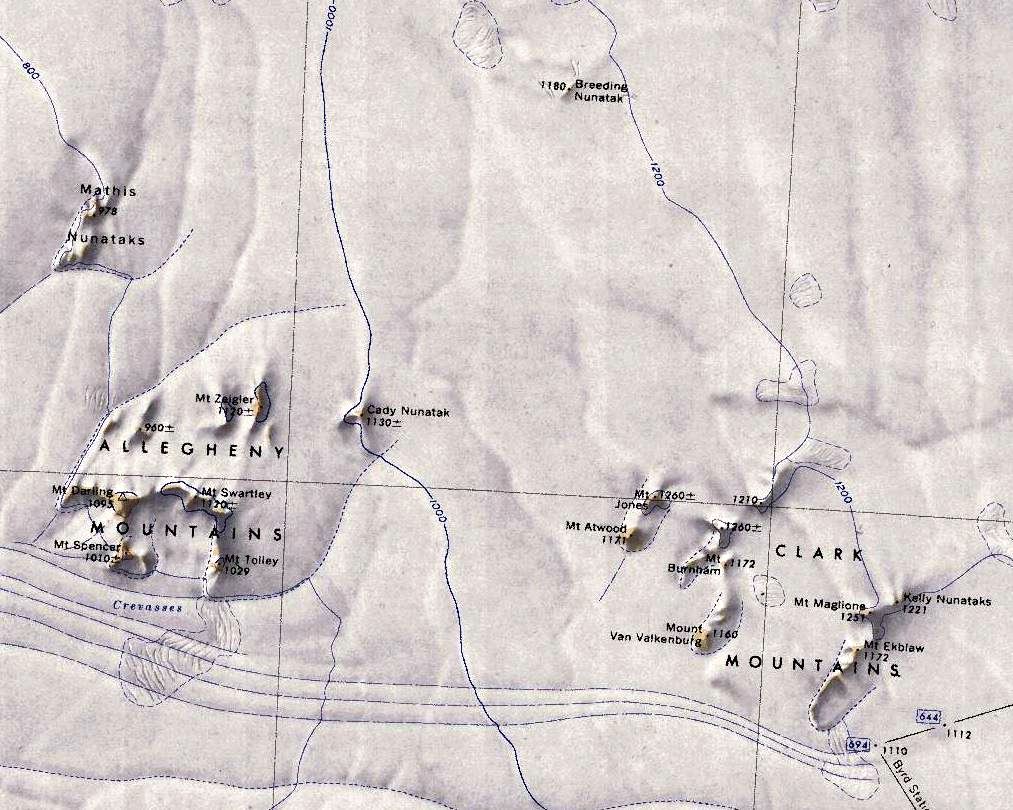
File:Allegheny-Clark-Mts.jpg Map showing the location of the Allegheny Mountains (left) and Clark Mountains (right) in relation to each other.(1,013 × 810 (179 KB)) - 22:44, 20 April 2018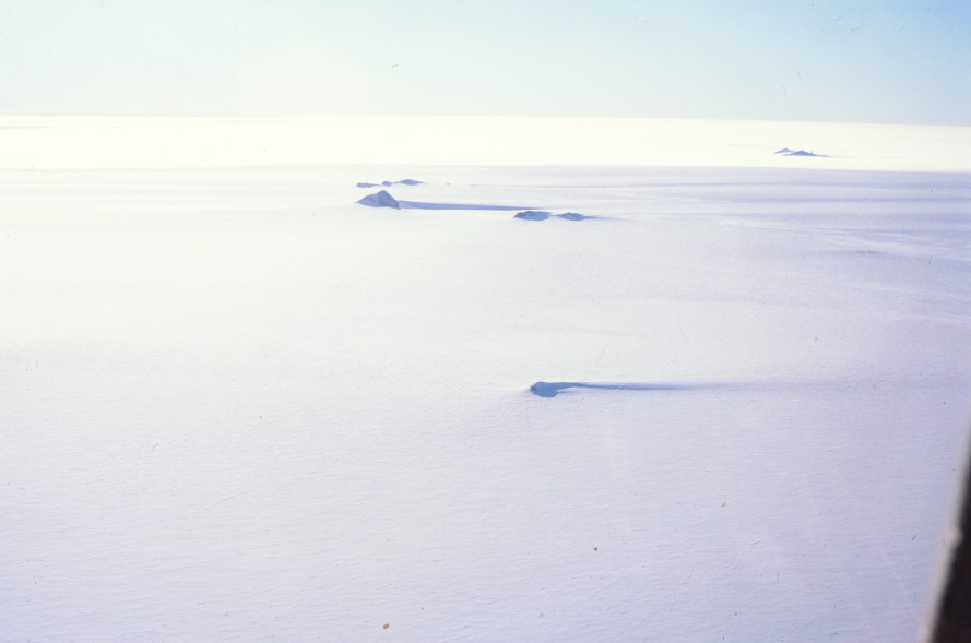
File:Rockefeller-Mts.jpg Description: Rockefeller Mountains Location: Rockefeller Mountains(889 × 589 (53 KB)) - 19:46, 20 November 2018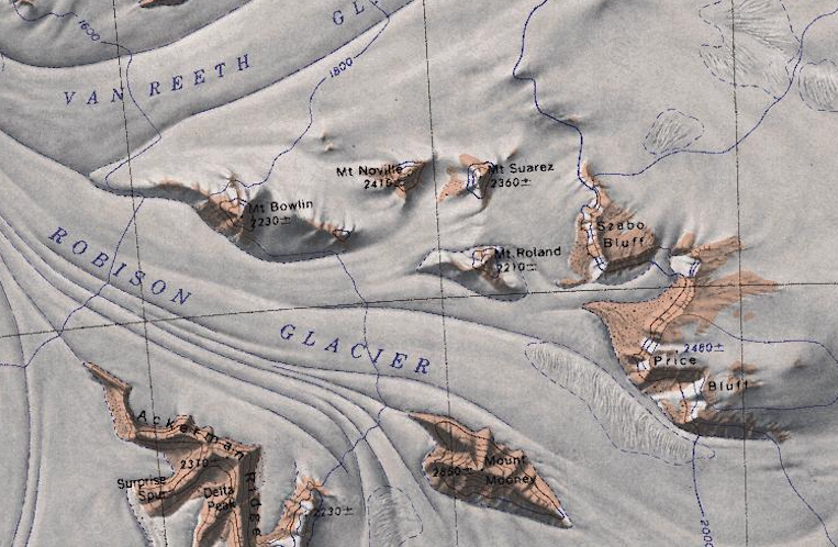
File:QueenMaudeMountains1.png Map showing a cluster of mountains nestled in the Queen Maude Mountains between the Robison and Van Reeth Glaciers.(763 × 498 (754 KB)) - 08:41, 17 January 2019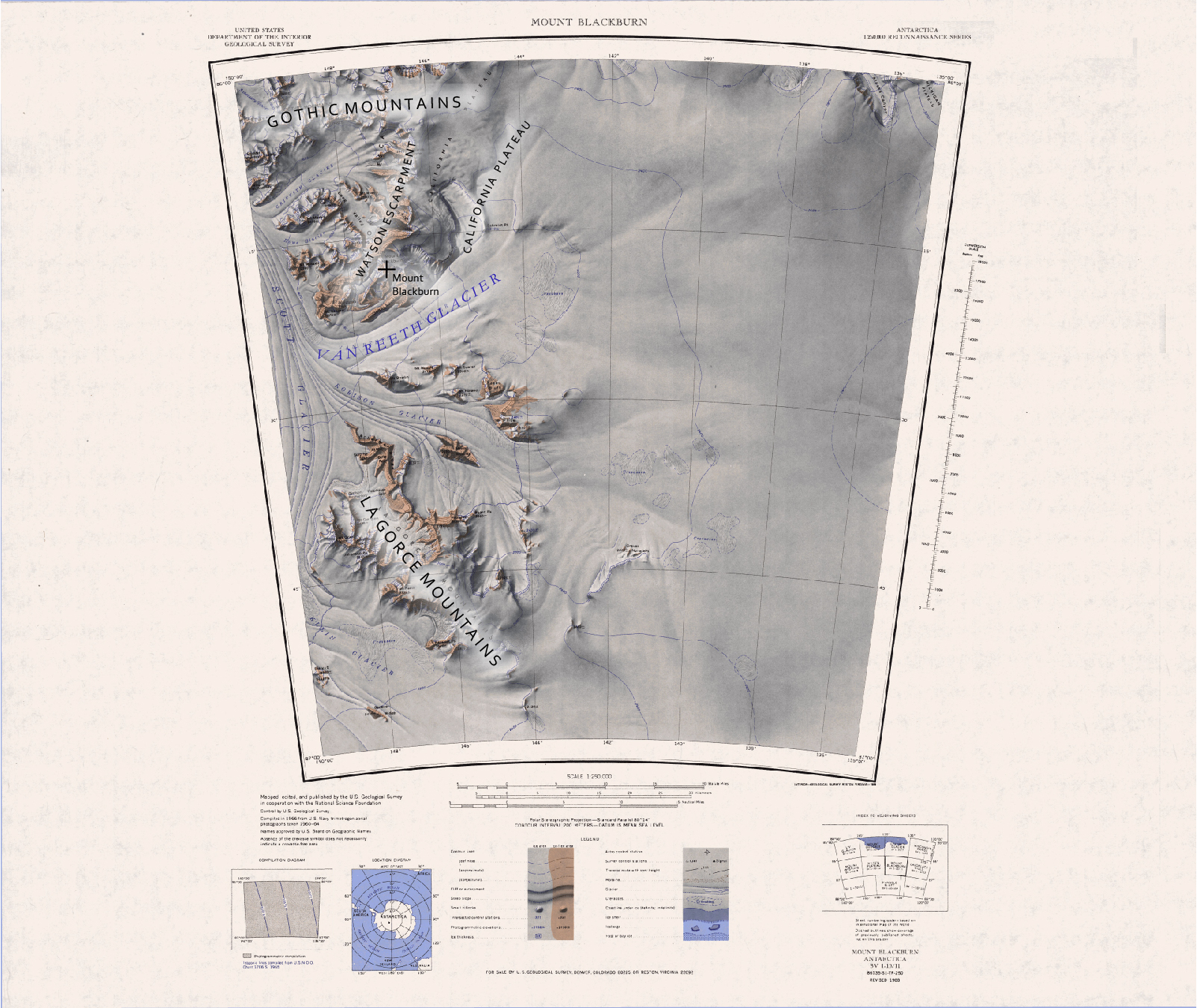
File:C86135s1 Ant.Map Mount Blackburn.jpg Van Reeth Glacier, Mt. Blackburn, Gothic Mountains, La Gorce Mountains, California Plateau, Watson Escarpment(1,603 × 1,350 (1.44 MB)) - 04:57, 7 May 2020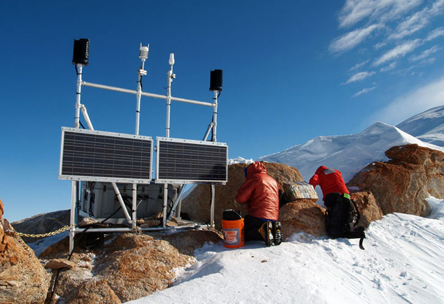
File:Whitmore GPS install.jpg Survey team working at the Whitmore Mountains. Location: Mount Chapman, Whitmore Mountains, Westarctica(640 × 439 (69 KB)) - 03:41, 2 January 2019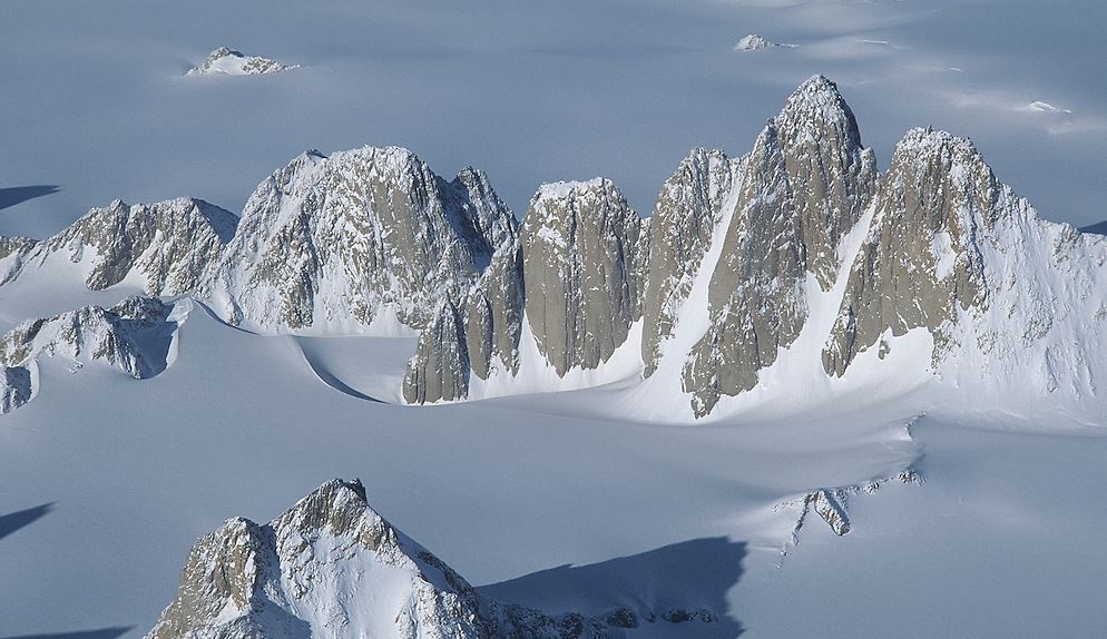
File:Gothic-Mountains.jpg Description: The "Organ Pipes" in the Gothic Mountains of the Queen Maud Mountains.(994 × 574 (118 KB)) - 21:35, 22 June 2023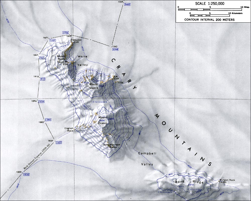
File:CraryMtnsMap.jpg Map of the Crary Mountains.(1,000 × 800 (145 KB)) - 17:24, 9 May 2018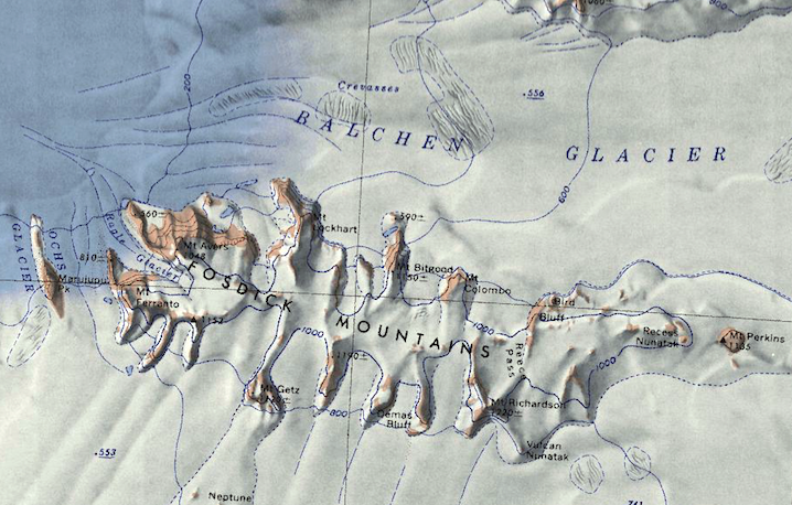
File:Fosdick Mts.png Map of the Fosdick Mountains.(718 × 458 (657 KB)) - 18:21, 16 September 2018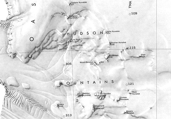
File:Hudson-Mountains.jpg Map of the Hudson Mountains.(584 × 406 (168 KB)) - 09:28, 9 February 2019
File:Horlick Mountains.jpg Picture of the Horlick Mountains(600 × 450 (58 KB)) - 05:24, 11 April 2018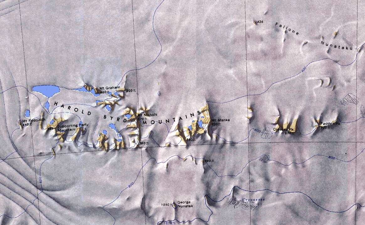
File:Harold-Mountains.jpg Map of the Harold Byrd Mountains.(1,164 × 718 (186 KB)) - 19:02, 1 May 2018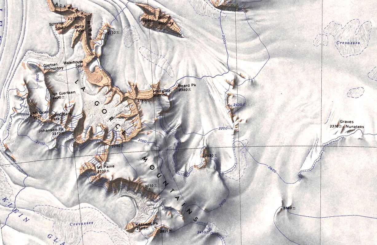
File:LaGorce.jpg Map of the La Gorce Mountains.(1,227 × 797 (228 KB)) - 22:09, 7 May 2018File:Ickes Mountains - Antarctica.png Map showing the Ickes Mountains of Westarctica.(614 × 493 (539 KB)) - 19:54, 21 August 2018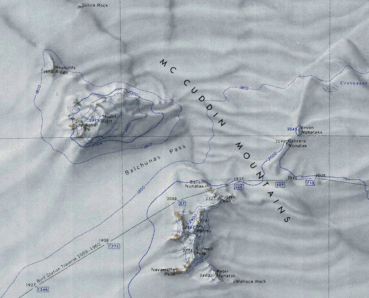
File:McCuddin Mountains.png Map showing the McCuddin Mountains and associated features.(755 × 610 (901 KB)) - 20:26, 14 September 2018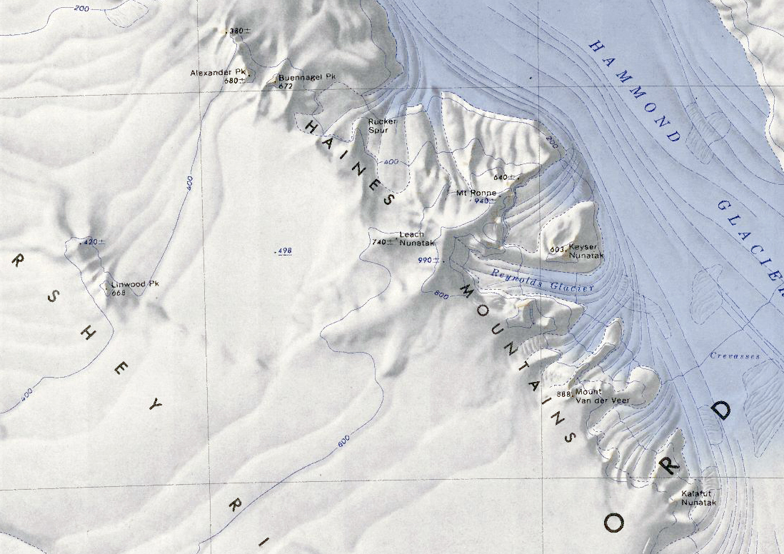
File:Haines Mountains.jpg Map of the Haines Mountains in Antarctica.(1,098 × 776 (618 KB)) - 05:12, 29 December 2021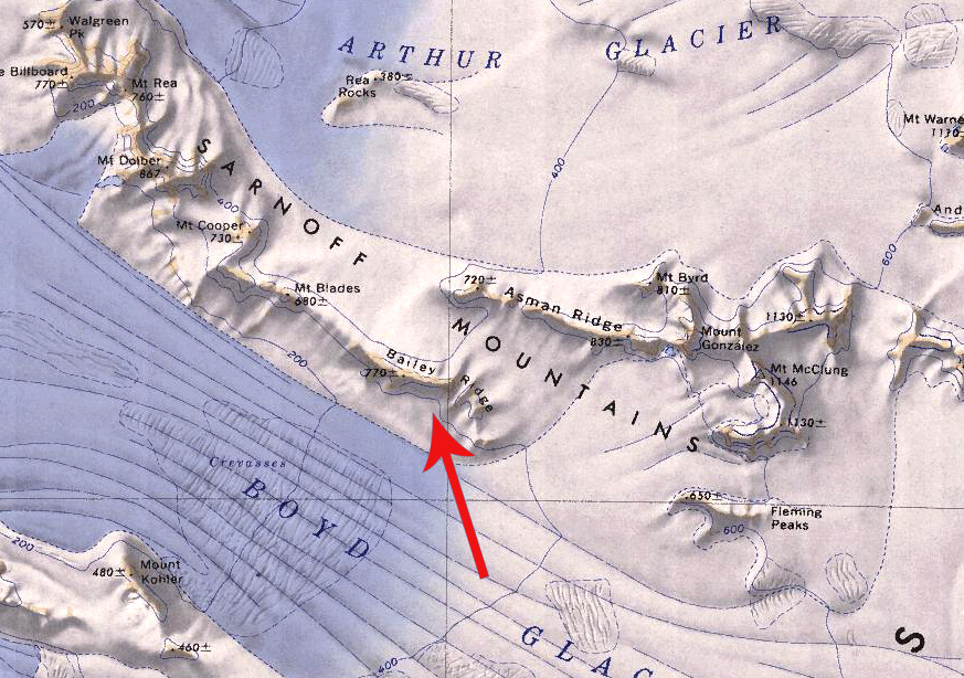
File:Bailey Ridge.jpg Map showing Bailey Ridge in the Sarnoff Mountains.(873 × 614 (289 KB)) - 16:19, 2 September 2021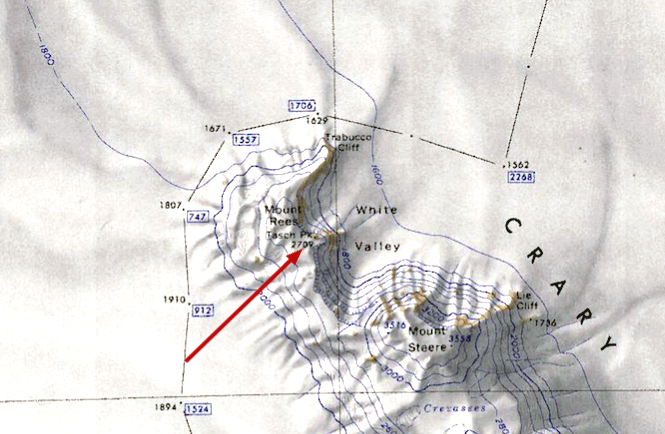
File:Tasch Peak.jpg Map showing Tasch Peak in the Crary Mountains.(665 × 434 (258 KB)) - 18:44, 5 February 2019
File:Cady nunatak alleghney.jpg Picture of Cady Nunatak in the Allegheny Mountains.(756 × 504 (65 KB)) - 08:38, 9 February 2019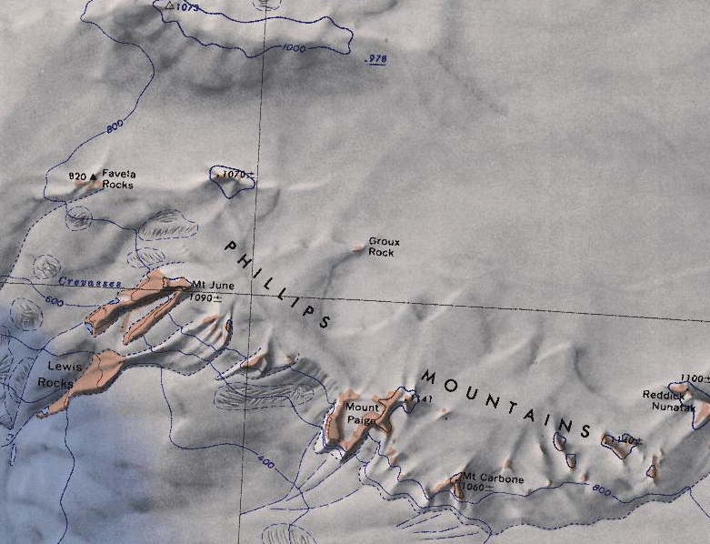
File:Phillips-Mountains.png Map showing the Philips Mountains and various surrounding geographic features.(781 × 598 (693 KB)) - 06:51, 29 September 2018


