Search results
Jump to navigation
Jump to search
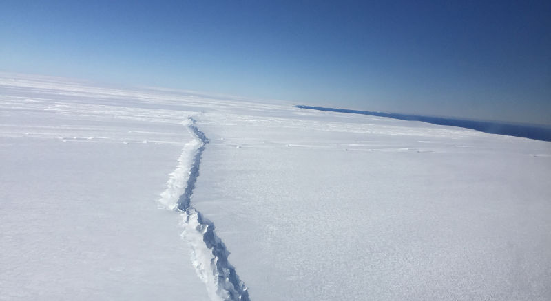
File:Pine Island - rift.jpg A new rift in West Antarctica’s Pine Island Glacier, photographed during a NASA Operation IceBridge flyover on November 4th, 2016. Image: NASA/Nathan Kurtz(800 × 438 (34 KB)) - 21:26, 20 April 2018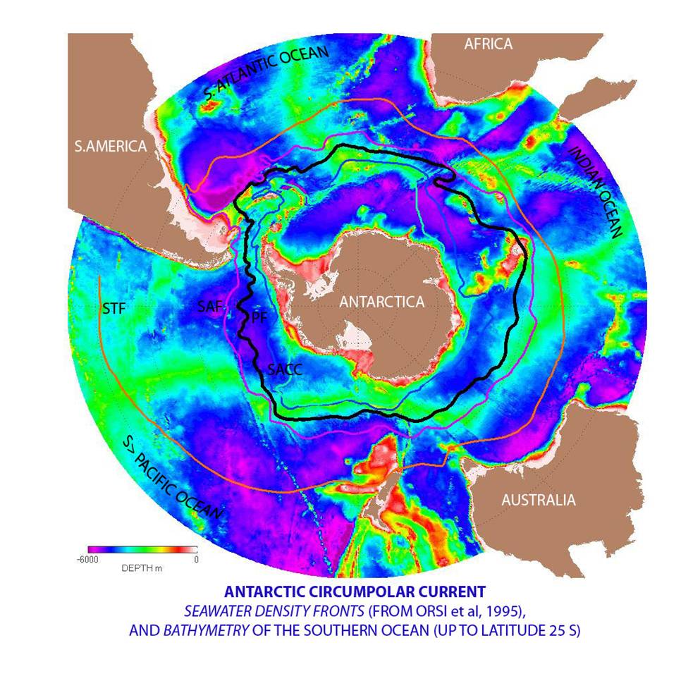
File:Circumpolar.jpg English: Antarctic Circumpolar Current image from Grace Mission. Courtesy NASA/JPL-Caltech. Source: http://www.nasa.gov/vision/earth/lookingatearth/grace-images-20051220.html(966 × 966 (144 KB)) - 23:21, 25 March 2018
File:Hull Glacier.jpg ...seen during Operation IceBridge's "Hull-Land 1" mission on Oct. 28, 2016. (NASA/John Sonntag). Author NASA ICE(2,000 × 1,123 (915 KB)) - 21:09, 4 May 2018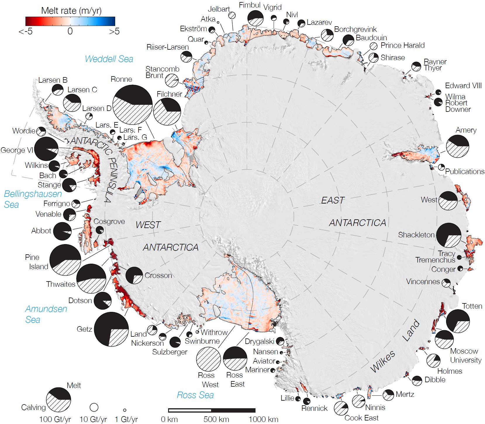
File:Ice-Shelf Melting.jpg ...'s Moderate Resolution Imaging Spectroradiometer (MODIS) instrument aboard NASA's Terra and Aqua spacecraft. Red shades denote melt rates of less than 5 me Source: NASA / JPL(1,659 × 1,452 (350 KB)) - 22:50, 10 April 2018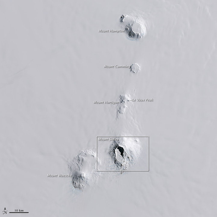
File:ECRange.jpg NASA Landsat Image showing the Executive Committee Range with Mt. Sidley highlig ''Editor's note'': Despite being an official NASA graphic, there is an error on this image. The arrow indicating Le Vaux Peak(720 × 720 (103 KB)) - 16:43, 29 January 2019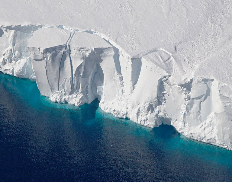
File:Getz Ice Shelf.png Credit: NASA/Jeremy Harback.(768 × 603 (813 KB)) - 02:16, 12 September 2018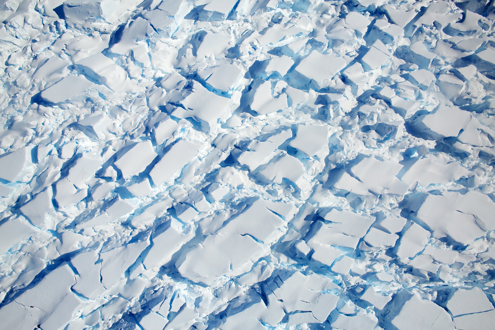
File:Crevassed-Glacier.jpg A heavily crevassed glacier flows west from the Dyer Plateau. Credit: NASA/Digital Mapping System(2,000 × 1,333 (1,012 KB)) - 03:03, 4 April 2018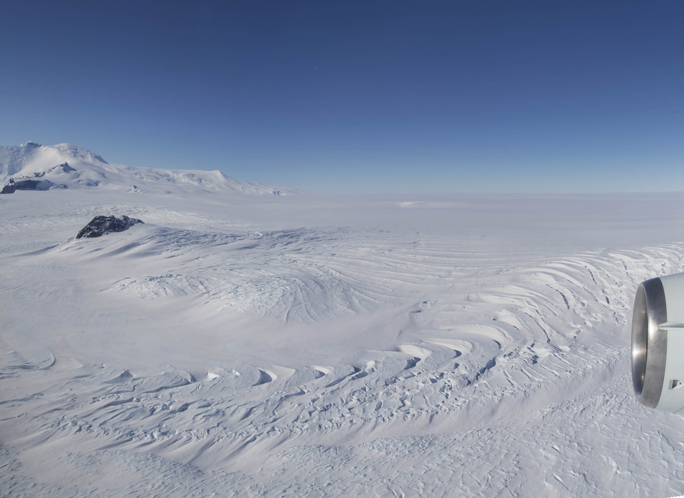
File:Pope Glacier.jpg Photo: NASA/Jeremy Harbeck(2,618 × 1,909 (333 KB)) - 19:54, 1 October 2018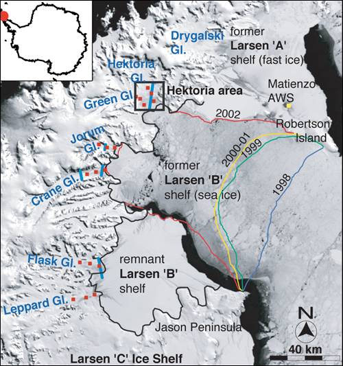
File:Larsen B collapse.jpg Source NASA(500 × 533 (57 KB)) - 20:33, 15 May 2018
File:Sea Ice - Amundsen Sea.jpg Source: http://www.nasa.gov/multimedia/imagegallery/image_feature_1507.html Photo Credit: NASA(1,346 × 894 (187 KB)) - 02:19, 13 February 2019
File:Dotson edge.jpg Description: Edge of the Dotson Ice Shelf (NASA/Jeremy Harbeck)(1,899 × 2,631 (258 KB)) - 16:07, 17 May 2018
File:Thwaites Glacier.jpg Source: http://www.jpl.nasa.gov/news/news.php?release=2014-148 (JPL) Photo Credit: NASA(1,024 × 575 (80 KB)) - 15:57, 2 September 2021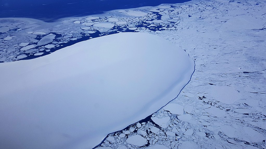
File:Burke Island Ice.jpg Burke Island on approach to the data line. (NASA/Brooke Medley)(1,023 × 576 (135 KB)) - 21:26, 20 April 2018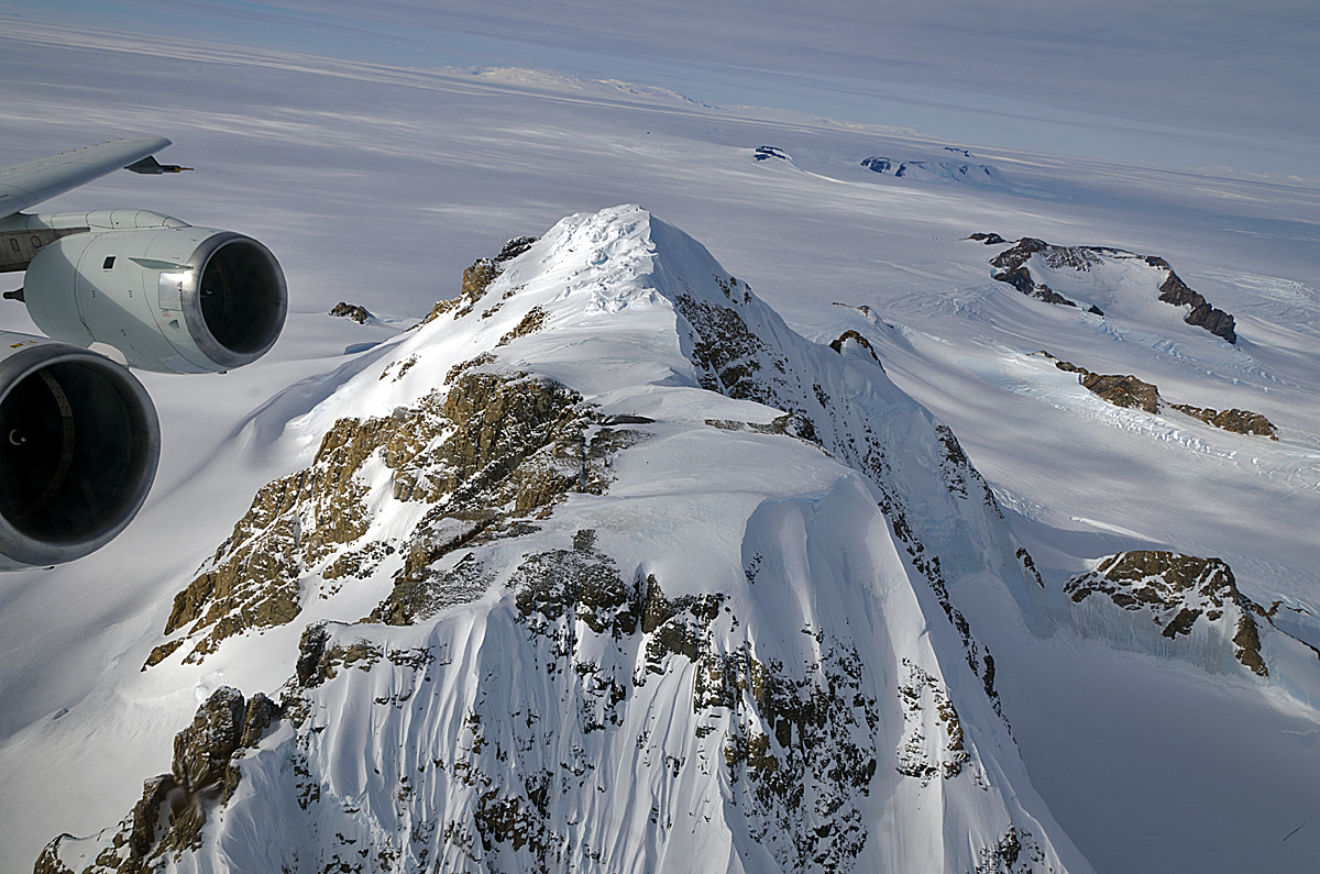
File:Hobbs Coast Mountains-NANA.jpg Credit: NASA(1,200 × 795 (449 KB)) - 21:32, 23 May 2020
File:Abbott Ice Shelf shadow crevasses.jpg Photo Credit: NASA(3,024 × 3,024 (1.57 MB)) - 19:50, 4 September 2021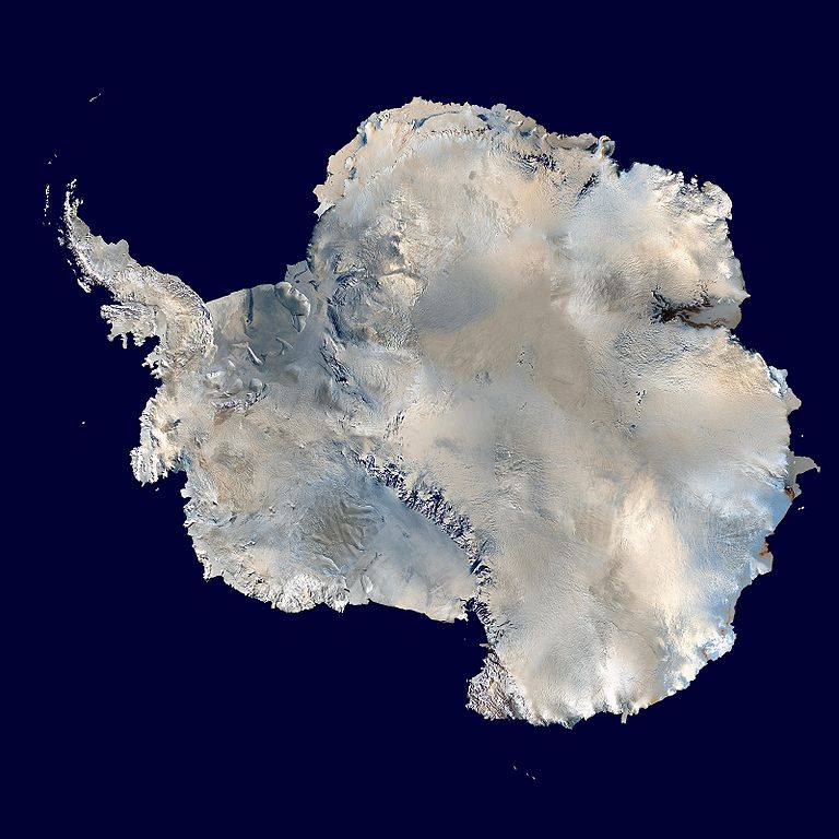
File:Antarctica 6400px from Blue Marble.jpg English: Antarctica. An orthographic projection of NASA's Blue Marble data set (1 km resolution global satellite composite). "MODIS ...ogonal creada a partir del conjunto de datos satelitales Blue Marble de la NASA con una resolución de un kilómetro.(768 × 768 (87 KB)) - 19:46, 30 March 2018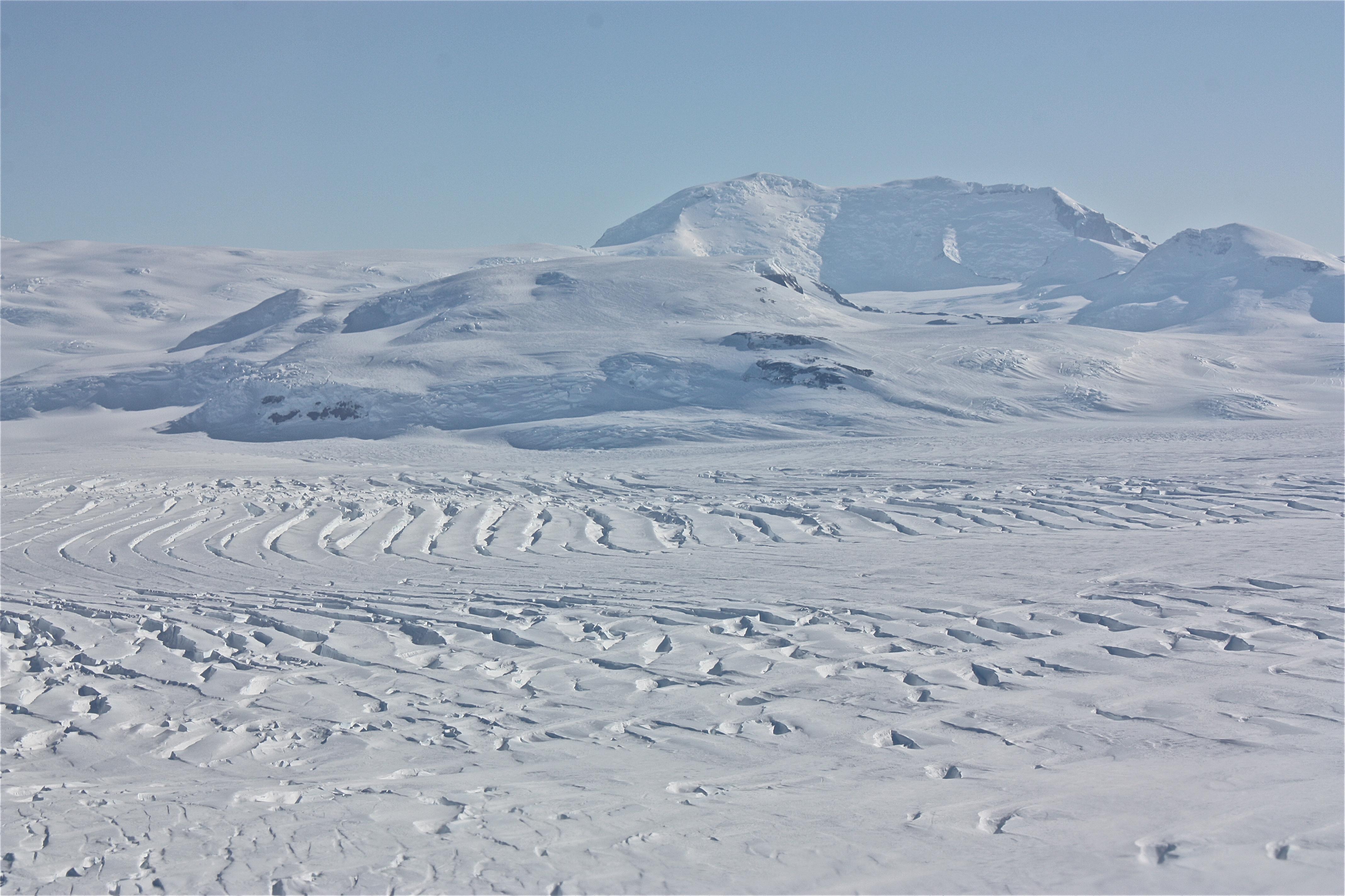
File:Mt Murphy-Antarctica.jpg Photo Credit: NASA/Kathryn Hansen Source: http://www.nasa.gov/mission_pages/icebridge/multimedia/fall10/IMG_0975.html(4,272 × 2,848 (1.24 MB)) - 19:54, 18 October 2020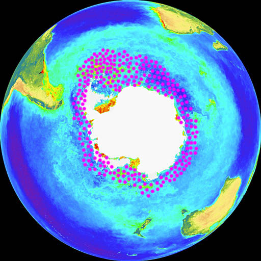
File:Krilldistribution.jpg distribution of krill on NASA image composed by Uwe Kils.(512 × 512 (78 KB)) - 18:11, 27 March 2018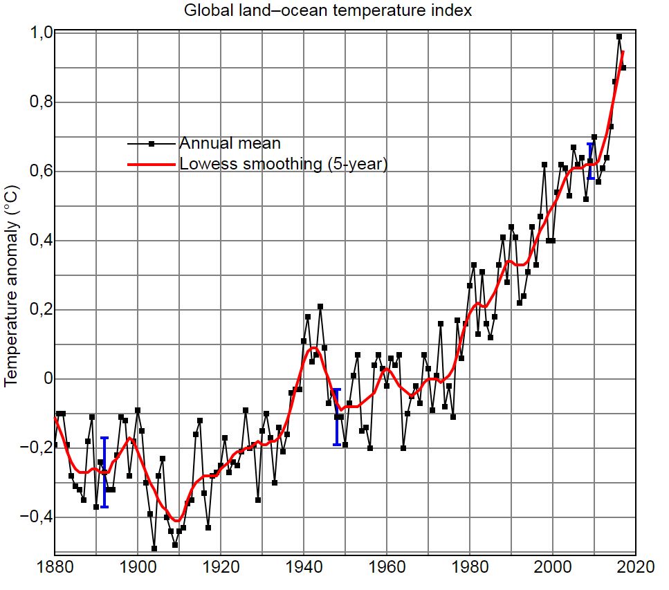
File:Global-Temperature-Rise.jpg Source http://data.giss.nasa.gov/gistemp/graphs/ Author NASA Goddard Institute for Space Studies(967 × 853 (123 KB)) - 16:32, 11 May 2018


