Difference between revisions of "Template:POTD protected"
Westarctica (talk | contribs) |
Westarctica (talk | contribs) |
||
| Line 1: | Line 1: | ||
{| role="presentation" style="margin:0 3px 3px; width:100%; text-align:left; background-color:transparent; border-collapse: collapse; " | {| role="presentation" style="margin:0 3px 3px; width:100%; text-align:left; background-color:transparent; border-collapse: collapse; " | ||
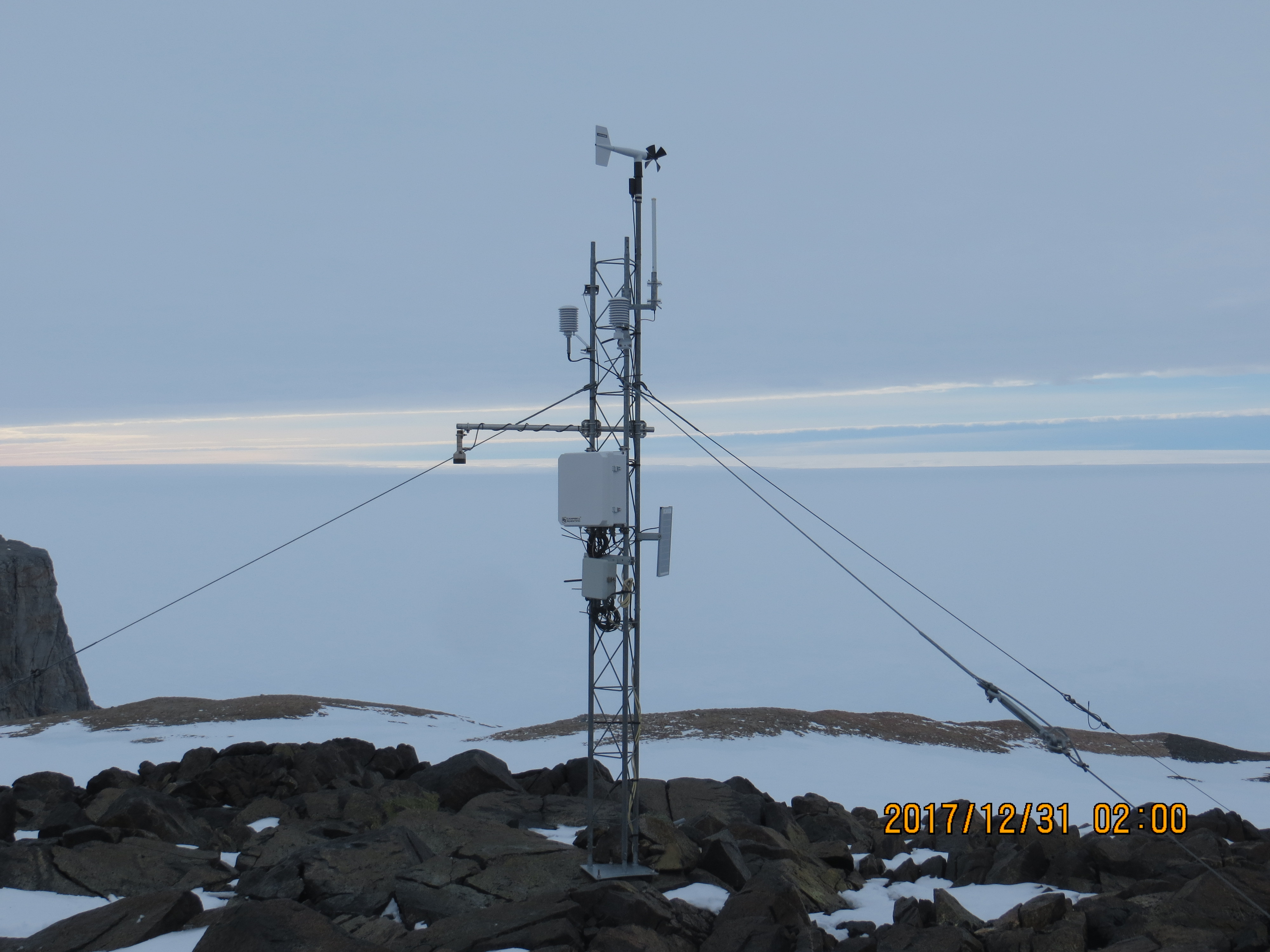
|style="padding:0 0.9em 0 0;" | [[File: | |style="padding:0 0.9em 0 0;" | [[File:Bear Peninsula - AWS 31dec2017.jpg|300px]] | ||
|style="padding:0 6px 0 0"| | |style="padding:0 6px 0 0"| | ||
The '''[[ | The '''[[Bear Peninsula]]''' (74°35′S 111°00′W) is a peninsula about 80 km (50 mi) long and 40 km (25 mi) wide which is [[ice]] covered except for several isolated rock bluffs and outcrops along its margins, lying 48 km 30 mi) east of [[Martin Peninsula]] on the [[Walgreen Coast]] of [[Westarctica]]. | ||
The peninsula was first delineated from aerial photographs taken by [[U.S. Navy]] Operation Highjump in January 1947, and was named after the ice-ship USS ''Bear'', flagship of the U.S. [[Antarctica|Antarctic]] Service, from which three reconnaissance flights were made in late February 1940, resulting in the discovery of the [[Walgreen Coast]] (with probable sighting of this feature) and the [[Thurston Island]] area. | |||
This ship, under the name ''Bear of Oakland'', also served as flagship of Admiral [[Richard E. Byrd]] from 1933-35. | |||
<p><small>Photo: | <p><small>Photo Courtesy: University of Wisconsin-Madison</small></p> | ||
[[:Category:Images|'''(More Featured Images)''']] | [[:Category:Images|'''(More Featured Images)''']] | ||
<div class="potd-recent" style="text-align:right;"> | <div class="potd-recent" style="text-align:right;"> | ||
Revision as of 17:49, 16 September 2018

|
The Bear Peninsula (74°35′S 111°00′W) is a peninsula about 80 km (50 mi) long and 40 km (25 mi) wide which is ice covered except for several isolated rock bluffs and outcrops along its margins, lying 48 km 30 mi) east of Martin Peninsula on the Walgreen Coast of Westarctica. The peninsula was first delineated from aerial photographs taken by U.S. Navy Operation Highjump in January 1947, and was named after the ice-ship USS Bear, flagship of the U.S. Antarctic Service, from which three reconnaissance flights were made in late February 1940, resulting in the discovery of the Walgreen Coast (with probable sighting of this feature) and the Thurston Island area. This ship, under the name Bear of Oakland, also served as flagship of Admiral Richard E. Byrd from 1933-35. Photo Courtesy: University of Wisconsin-Madison |