Difference between revisions of "Template:POTD protected"
Westarctica (talk | contribs) |
Westarctica (talk | contribs) |
||
| Line 1: | Line 1: | ||
{| role="presentation" style="margin:0 3px 3px; width:100%; text-align:left; background-color:transparent; border-collapse: collapse; " | {| role="presentation" style="margin:0 3px 3px; width:100%; text-align:left; background-color:transparent; border-collapse: collapse; " | ||
|style="padding:0 0.9em 0 0;" | [[File: | |style="padding:0 0.9em 0 0;" | [[File:Thiel Mountains air.jpg|300px]] | ||
|style="padding:0 6px 0 0"| | |style="padding:0 6px 0 0"| | ||
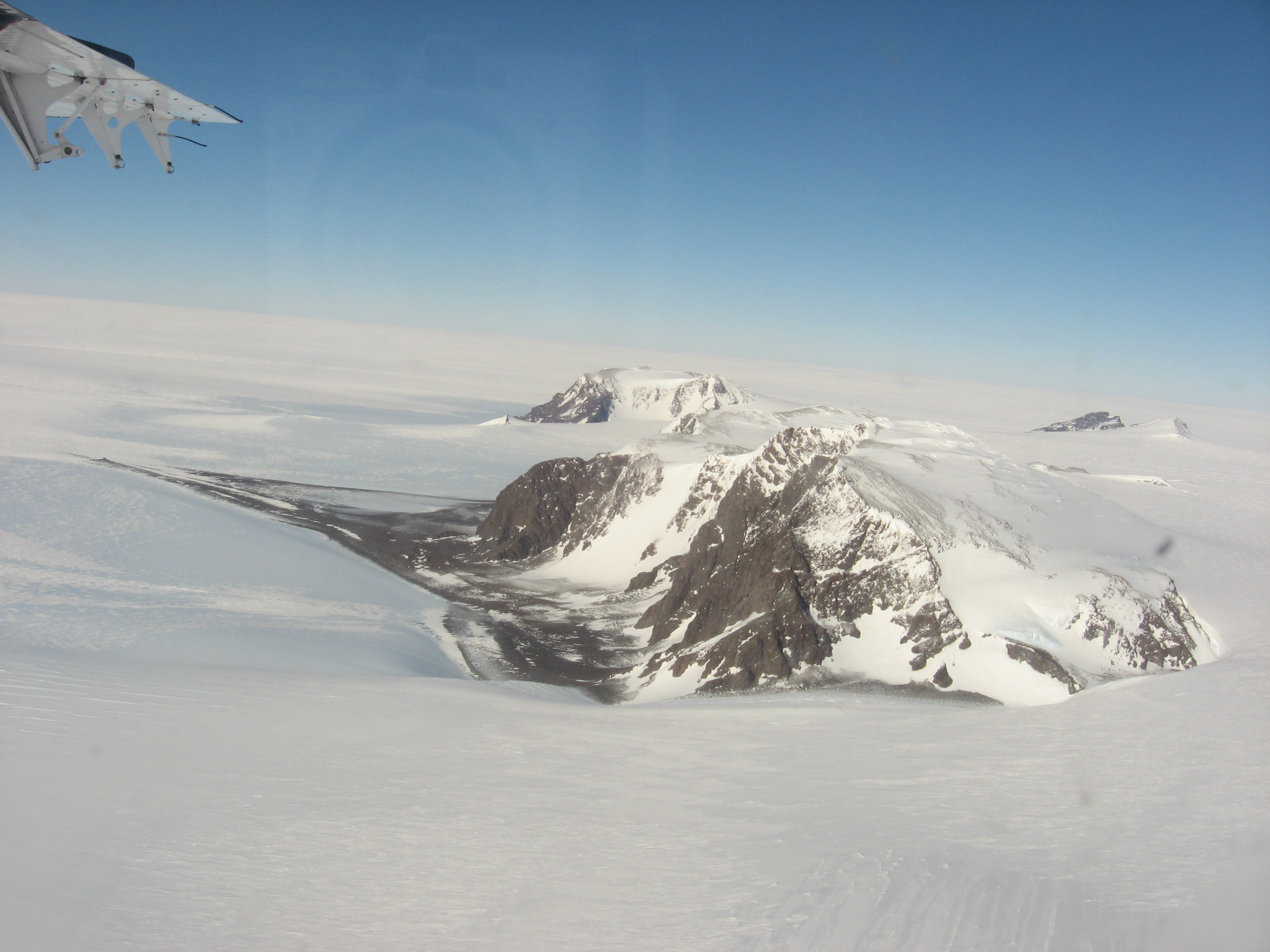
The '''[[ | The '''[[Thiel Mountains]]''' are an isolated, mainly [[snow]]-capped mountain range of the [[Transantarctic Mountains]], located in the [[Ellsworth Land]] region of [[Westarctica]]. | ||
The mountain range is 72 km (45 mi) long, and is located roughly between the [[Horlick Mountains]] and the Pensacola Mountains, and extends from [[Moulton Escarpment]] on the west to Nolan Pillar on the east. Major components include [[Ford Massif]] (2,810 m), Bermel Escarpment and a group of eastern peaks near Nolan Pillar. | |||
<p><small>Photographer: | The mountains were observed and first positioned by the USARP Horlick Mountains Traverse Party, 1958-59. The mountains were surveyed by the USGS Thiel Mountains parties of 1960-61 and 1961-62. An aircraft fuel cache (85°12′S 087°53′W) is located near the Thiel Mountains for planes traveling between the Union Glacier Camp and the [[Amundsen–Scott South Pole Station]]. | ||
<p><small>Photographer: Richard Laronde</small></p> | |||
[[:Category:Images|'''(More Featured Images)''']] | [[:Category:Images|'''(More Featured Images)''']] | ||
<div class="potd-recent" style="text-align:right;"> | <div class="potd-recent" style="text-align:right;"> | ||
Revision as of 19:33, 27 October 2018

|
The Thiel Mountains are an isolated, mainly snow-capped mountain range of the Transantarctic Mountains, located in the Ellsworth Land region of Westarctica. The mountain range is 72 km (45 mi) long, and is located roughly between the Horlick Mountains and the Pensacola Mountains, and extends from Moulton Escarpment on the west to Nolan Pillar on the east. Major components include Ford Massif (2,810 m), Bermel Escarpment and a group of eastern peaks near Nolan Pillar. The mountains were observed and first positioned by the USARP Horlick Mountains Traverse Party, 1958-59. The mountains were surveyed by the USGS Thiel Mountains parties of 1960-61 and 1961-62. An aircraft fuel cache (85°12′S 087°53′W) is located near the Thiel Mountains for planes traveling between the Union Glacier Camp and the Amundsen–Scott South Pole Station. Photographer: Richard Laronde |