Difference between revisions of "Template:POTD protected"
Westarctica (talk | contribs) |
Westarctica (talk | contribs) |
||
| Line 1: | Line 1: | ||
{| role="presentation" style="margin:0 3px 3px; width:100%; text-align:left; background-color:transparent; border-collapse: collapse; " | {| role="presentation" style="margin:0 3px 3px; width:100%; text-align:left; background-color:transparent; border-collapse: collapse; " | ||
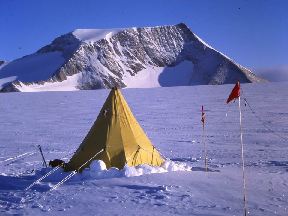
|style="padding:0 0.9em 0 0;" | [[File: | |style="padding:0 0.9em 0 0;" | [[File:Sarnoff Mountains Tent.jpg|300px]] | ||
|style="padding:0 6px 0 0"| | |style="padding:0 6px 0 0"| | ||
The '''[[ | The '''[[Sarnoff Mountains]]''' (77°10′S 145°0′W) are a range of mountains, 25 nautical miles (46 km) long and 4 to 8 nautical miles (15 km) wide separating the west-flowing [[Boyd Glacier|Boyd]] and [[Arthur Glacier]]s in the [[Ford Ranges]] of [[Westarctica]]. [[The Billboard]] is a prominent rock feature on the far western tip of the mountain range. | ||
The | The west end of the range was discovered and roughly plotted from photos taken by Byrd [[Antarctica|Antarctic]] Expedition (1928–30) on the flight of 5 December 1929. The range was mapped in greater detail by the Byrd Antarctic Expedition (1933–35) and United States Antarctic Service (USAS) (1939–41), all expeditions led by Admiral [[Richard E. Byrd]]. On 1 February 2015, Westarctica's [[Minister of Technology]], [[Prince-Consort Dinny|Dinny Pulipati]] was given the title Marquis of Sarnoff and made a royal prince in the [[Hereditary Nobility of Westarctica]]. | ||
<p><small>Photographer: | <p><small>Photographer: David Sugden </small></p> | ||
[[:Category:Images|'''(More Featured Images)''']] | [[:Category:Images|'''(More Featured Images)''']] | ||
<div class="potd-recent" style="text-align:right;"> | <div class="potd-recent" style="text-align:right;"> | ||
Revision as of 16:23, 14 October 2019

|
The Sarnoff Mountains (77°10′S 145°0′W) are a range of mountains, 25 nautical miles (46 km) long and 4 to 8 nautical miles (15 km) wide separating the west-flowing Boyd and Arthur Glaciers in the Ford Ranges of Westarctica. The Billboard is a prominent rock feature on the far western tip of the mountain range. The west end of the range was discovered and roughly plotted from photos taken by Byrd Antarctic Expedition (1928–30) on the flight of 5 December 1929. The range was mapped in greater detail by the Byrd Antarctic Expedition (1933–35) and United States Antarctic Service (USAS) (1939–41), all expeditions led by Admiral Richard E. Byrd. On 1 February 2015, Westarctica's Minister of Technology, Dinny Pulipati was given the title Marquis of Sarnoff and made a royal prince in the Hereditary Nobility of Westarctica.
Photographer: David Sugden |