Difference between revisions of "Template:POTD protected"
Westarctica (talk | contribs) |
Westarctica (talk | contribs) |
||
| Line 1: | Line 1: | ||
{| role="presentation" style="margin:0 3px 3px; width:100%; text-align:left; background-color:transparent; border-collapse: collapse; " | {| role="presentation" style="margin:0 3px 3px; width:100%; text-align:left; background-color:transparent; border-collapse: collapse; " | ||
|style="padding:0 0.9em 0 0;" | [[File: | |style="padding:0 0.9em 0 0;" | [[File:Mount Erebus craters.jpg|300px]] | ||
|style="padding:0 6px 0 0"| | |style="padding:0 6px 0 0"| | ||
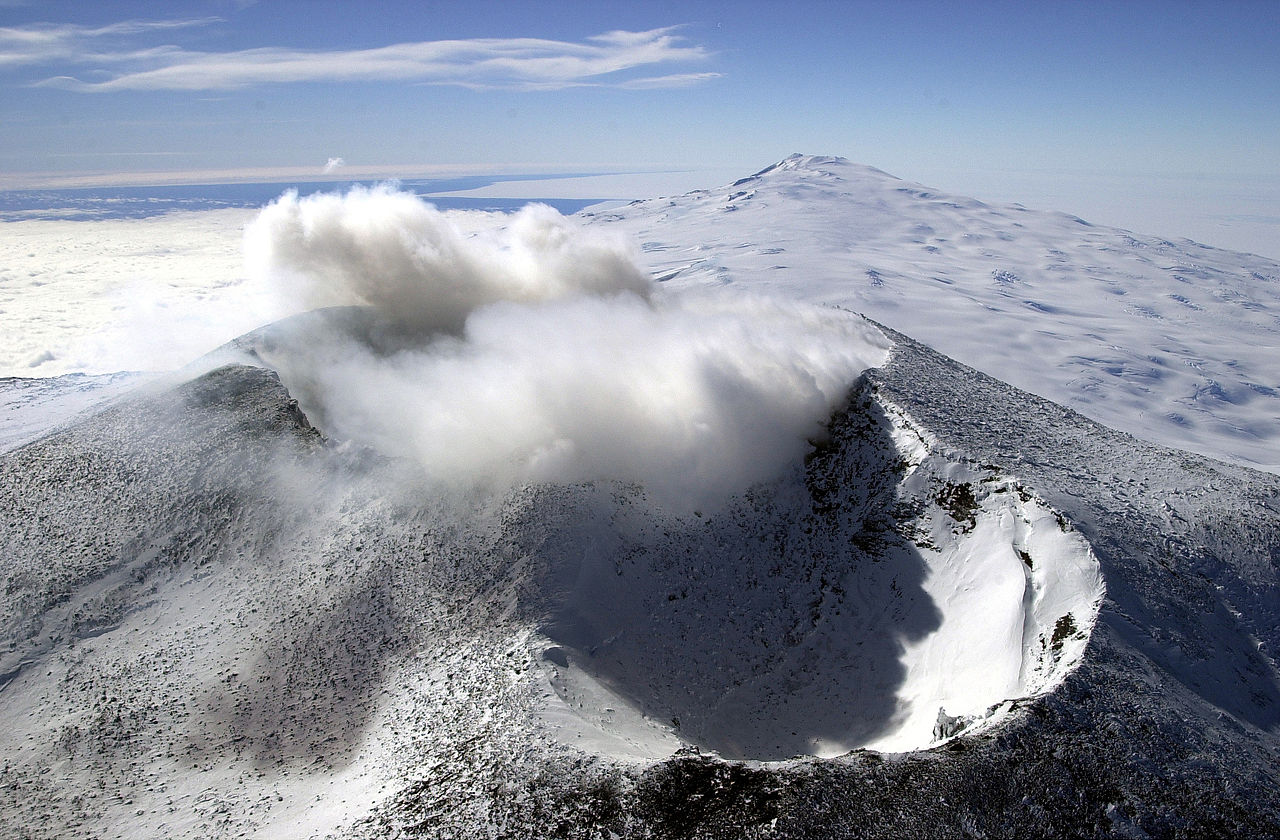
'''[[ | '''[[Mount Erebus]]''' is the second-highest volcano in [[Antarctica]] (after [[Mount Sidley]]) and the southernmost active volcano on Earth. With a summit elevation of 3,794 meters (12,448 ft), it is located on [[Ross Island]], which is also home to three inactive volcanoes: Mount Terror, Mount Bird, and Mount Terra Nova. The volcano has been active since about 1.3 million years ago and is the site of the Mount Erebus Volcano Observatory run by the New Mexico Institute of Mining and Technology. A volcanic rock from Mount Erebus known as the "Erebus Rock" is included as a part of the [[Crown Jewels of Westarctica]]. | ||
Mount Erebus' summit crater rim was first achieved by members of Sir [[Ernest Shackleton]]'s party; Professor Edgeworth David, Sir [[Douglas Mawson]], Dr Alister Mackay, Jameson Adams, Dr Eric Marshall and Phillip Brocklehurst (who did not reach the summit), in 1908. | |||
<p><small> | <p><small>Photographer: Josh Landis </small></p> | ||
[[:Category:Images|'''(More Featured Images)''']] | [[:Category:Images|'''(More Featured Images)''']] | ||
<div class="potd-recent" style="text-align:right;"> | <div class="potd-recent" style="text-align:right;"> | ||
Revision as of 01:07, 8 December 2019

|
Mount Erebus is the second-highest volcano in Antarctica (after Mount Sidley) and the southernmost active volcano on Earth. With a summit elevation of 3,794 meters (12,448 ft), it is located on Ross Island, which is also home to three inactive volcanoes: Mount Terror, Mount Bird, and Mount Terra Nova. The volcano has been active since about 1.3 million years ago and is the site of the Mount Erebus Volcano Observatory run by the New Mexico Institute of Mining and Technology. A volcanic rock from Mount Erebus known as the "Erebus Rock" is included as a part of the Crown Jewels of Westarctica. Mount Erebus' summit crater rim was first achieved by members of Sir Ernest Shackleton's party; Professor Edgeworth David, Sir Douglas Mawson, Dr Alister Mackay, Jameson Adams, Dr Eric Marshall and Phillip Brocklehurst (who did not reach the summit), in 1908.
Photographer: Josh Landis |