Difference between revisions of "Template:Westarctica.wiki:Today's featured article"
Westarctica (talk | contribs) |
Westarctica (talk | contribs) |
||
| Line 1: | Line 1: | ||
[[File: | [[File:AmundsenSea-map.jpg|thumb|300px|left]] | ||
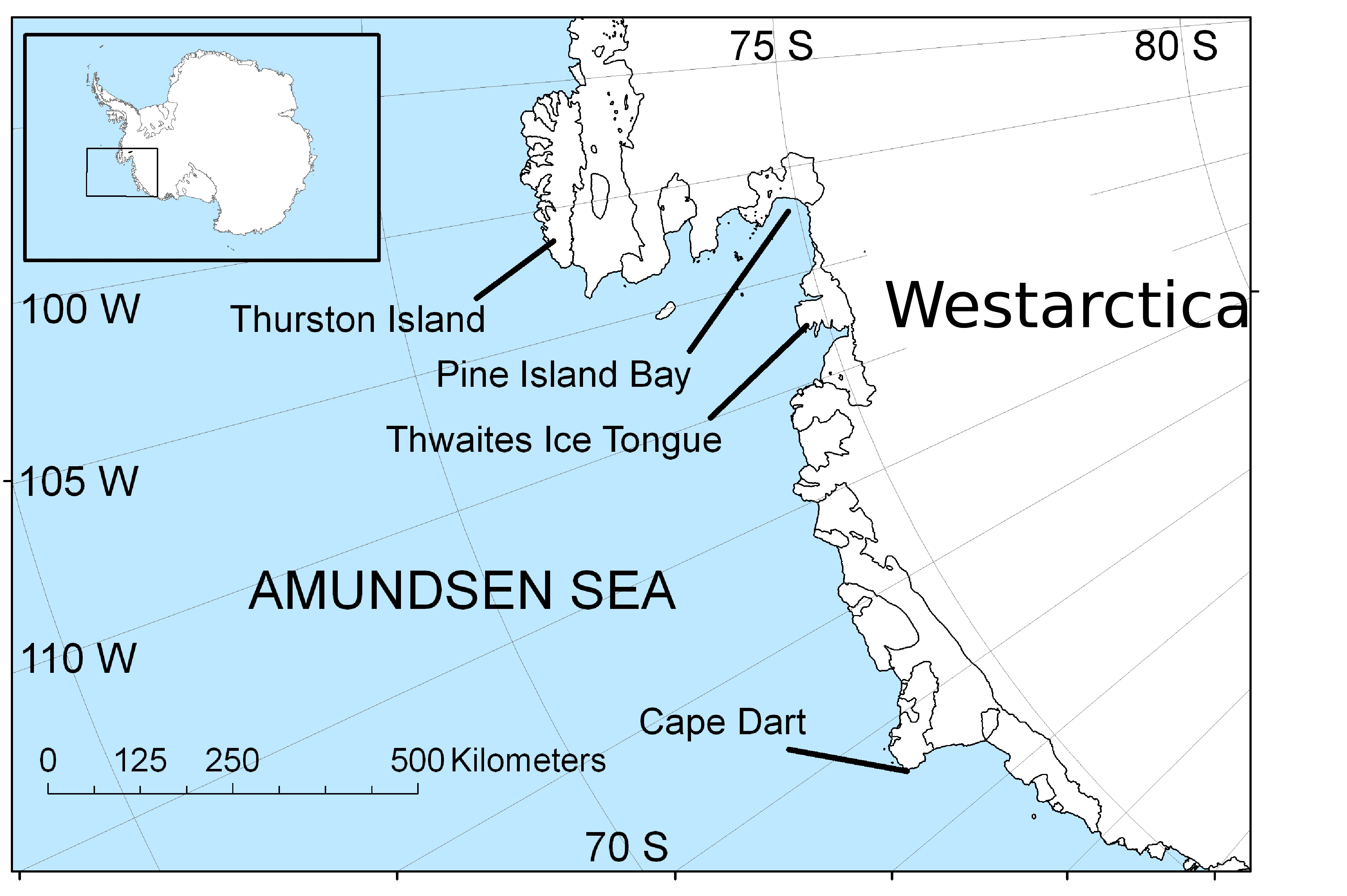
''' | The '''Amundsen Sea''', an arm of the [[Southern Ocean]] off of [[Westarctica]] in western [[Antarctica]], lies between [[Cape Flying Fish]] (the northwestern tip of [[Thurston Island]]) to the east and [[Cape Dart]] on [[Siple Island]] to the west. Cape Flying Fish marks the boundary between the Amundsen Sea and the [[Bellingshausen Sea]]. West of Cape Dart there is an unnamed "marginal sea" of the Southern Ocean between the Amundsen and [[Ross Sea]]s. The Norwegian expedition of 1928–1929 under Captain Nils Larsen named the body of water for the Norwegian polar explorer [[Roald Amundsen]] while exploring this area in February 1929. | ||
The sea is mostly ice-covered, and the [[Thwaites Ice Tongue]] protrudes into it. The [[ice sheet]] which drains into the Amundsen Sea averages about 3 km (1.9 mi) in thickness; roughly the size of the state of Texas, this area is known as the Amundsen Sea Embayment (ASE); it forms one of the three major ice-drainage basins of the [[West Antarctic Ice Sheet]]. | |||
It is Westarctica's largest sea. '''([[Amundsen Sea|Full Article...]])''' | |||
Revision as of 00:45, 6 August 2018
The Amundsen Sea, an arm of the Southern Ocean off of Westarctica in western Antarctica, lies between Cape Flying Fish (the northwestern tip of Thurston Island) to the east and Cape Dart on Siple Island to the west. Cape Flying Fish marks the boundary between the Amundsen Sea and the Bellingshausen Sea. West of Cape Dart there is an unnamed "marginal sea" of the Southern Ocean between the Amundsen and Ross Seas. The Norwegian expedition of 1928–1929 under Captain Nils Larsen named the body of water for the Norwegian polar explorer Roald Amundsen while exploring this area in February 1929.
The sea is mostly ice-covered, and the Thwaites Ice Tongue protrudes into it. The ice sheet which drains into the Amundsen Sea averages about 3 km (1.9 mi) in thickness; roughly the size of the state of Texas, this area is known as the Amundsen Sea Embayment (ASE); it forms one of the three major ice-drainage basins of the West Antarctic Ice Sheet.
It is Westarctica's largest sea. (Full Article...)
