Difference between revisions of "Template:Westarctica.wiki:Today's featured article"
Jump to navigation
Jump to search
Westarctica (talk | contribs) |
Westarctica (talk | contribs) |
||
| Line 1: | Line 1: | ||
[[File: | [[File:Whitmore Mountains - Mt Chapman.jpg|thumb|300px|left]] | ||
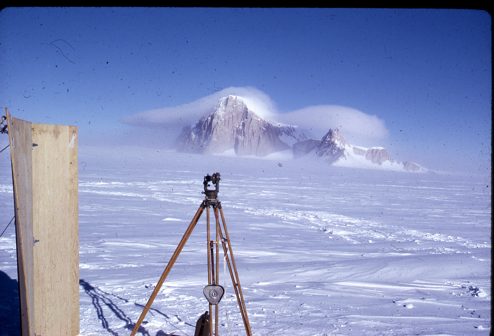
The '''[[ | The '''[[Whitmore Mountains]]''' are an isolated mountain range of the Transantarctic Mountains System, located in the [[Marie Byrd Land]] region of [[Westarctica]]. They consist of three small mountains and a cluster of [[nunatak]]s arranged in a semicircular pattern extending over 15 miles. The group was visited and surveyed on January 2, 1959, by William H. Chapman, cartographer with the [[Horlick Mountains]] Traverse Party. | ||
The mountains were named by Chapman for George D. Whitmore, Chief Topographic Engineer of the United States Geological Survey (USGS), who was a member of the Working Group on Cartography of the Scientific Committee on [[Antarctic]] Research. | |||
'''([[ | The title [[Viscount of Whitmore]] was the first title created in the [[Peerage of Westarctica]] in 2001. | ||
'''([[Whitmore Mountains|Full Article...]])''' | |||
Revision as of 06:03, 1 October 2018
The Whitmore Mountains are an isolated mountain range of the Transantarctic Mountains System, located in the Marie Byrd Land region of Westarctica. They consist of three small mountains and a cluster of nunataks arranged in a semicircular pattern extending over 15 miles. The group was visited and surveyed on January 2, 1959, by William H. Chapman, cartographer with the Horlick Mountains Traverse Party.
The mountains were named by Chapman for George D. Whitmore, Chief Topographic Engineer of the United States Geological Survey (USGS), who was a member of the Working Group on Cartography of the Scientific Committee on Antarctic Research.
The title Viscount of Whitmore was the first title created in the Peerage of Westarctica in 2001.
