Difference between revisions of "Thwaites Glacier"
Westarctica (talk | contribs) (added picture and cleaned up article) |
|||
| Line 1: | Line 1: | ||
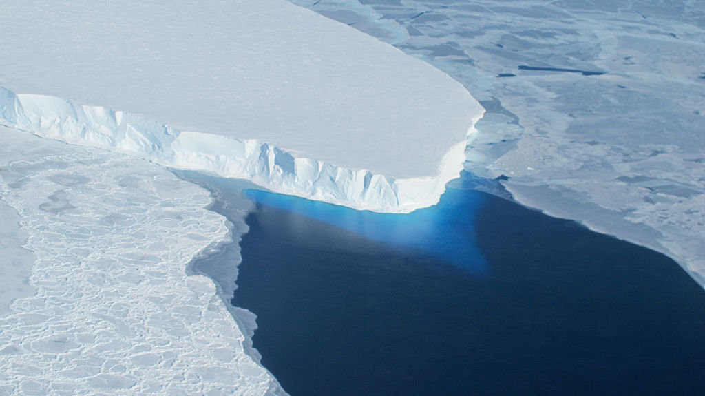
'''Thwaites Glacier''' (75°30′S 106°45′W), including the '''Thwaites Ice Tongue''', is an unusually broad and fast Antarctic glacier flowing into [[Pine Island Bay]], part of the [[Amundsen Sea]], east of [[Mount Murphy]], on the [[Walgreen Coast]] of [[Westarctica]] | [[File:Thwaites Glacier.jpg|400px|thumb|Thwaites Ice Tongue]] | ||
'''Thwaites Glacier''' (75°30′S 106°45′W), including the '''Thwaites Ice Tongue''', is an unusually broad and fast Antarctic [[glacier]] flowing into [[Pine Island Bay]], part of the [[Amundsen Sea]], east of [[Mount Murphy]], on the [[Walgreen Coast]] of [[Westarctica]]. | |||
Its surface speeds exceed 2 km/yr near its grounding line, and its fastest flowing grounded ice is centered between 50 and 100 km east of [[Mount Murphy]]. | |||
==Name== | |||
It was named after Fredrik T. Thwaites, a glacial geologist, geomorphologist and professor emeritus at the University of Wisconsin–Madison. | |||
[[Category: Geography of Westarctica]] | ==Significance of rising sea levels== | ||
Thwaites Glacier drains into Westarctica’s Amundsen Sea and is closely watched for its potential to raise sea levels. | |||
Along with the [[Pine Island Glacier]], the Thwaites Ice Tongue has been described as part of the "weak underbelly" of the [[West Antarctic Ice Sheet]], due to its apparent vulnerability to significant retreat. This hypothesis is based on both theoretical studies of the stability of marine ice sheets and recent observations of large changes on both of these glaciers. In recent years, the flow of both of these glaciers have accelerated, their surfaces lowered, and the grounding lines retreated. | |||
[[Category:Glaciers]] | |||
[[Category:Geography of Westarctica]] | |||
Revision as of 22:54, 8 May 2018
Thwaites Glacier (75°30′S 106°45′W), including the Thwaites Ice Tongue, is an unusually broad and fast Antarctic glacier flowing into Pine Island Bay, part of the Amundsen Sea, east of Mount Murphy, on the Walgreen Coast of Westarctica.
Its surface speeds exceed 2 km/yr near its grounding line, and its fastest flowing grounded ice is centered between 50 and 100 km east of Mount Murphy.
Name
It was named after Fredrik T. Thwaites, a glacial geologist, geomorphologist and professor emeritus at the University of Wisconsin–Madison.
Significance of rising sea levels
Thwaites Glacier drains into Westarctica’s Amundsen Sea and is closely watched for its potential to raise sea levels.
Along with the Pine Island Glacier, the Thwaites Ice Tongue has been described as part of the "weak underbelly" of the West Antarctic Ice Sheet, due to its apparent vulnerability to significant retreat. This hypothesis is based on both theoretical studies of the stability of marine ice sheets and recent observations of large changes on both of these glaciers. In recent years, the flow of both of these glaciers have accelerated, their surfaces lowered, and the grounding lines retreated.
