File:Map-AWS from UW.png
Jump to navigation
Jump to search
No higher resolution available.
Map-AWS_from_UW.png (800 × 600 pixels, file size: 116 KB, MIME type: image/png)
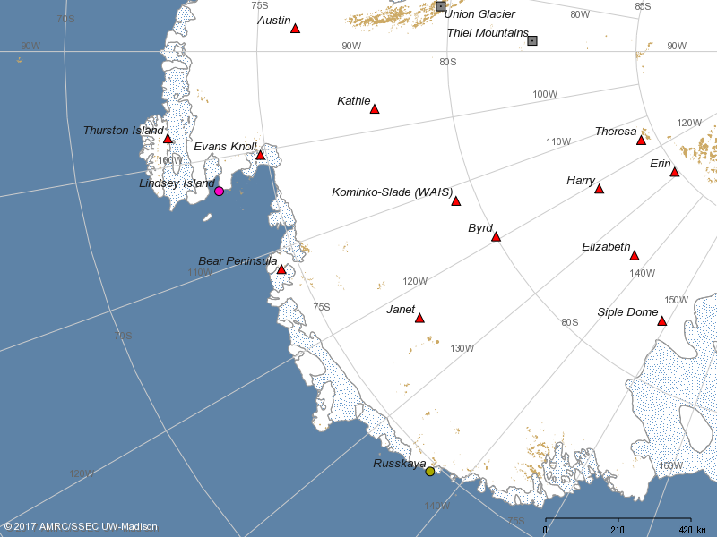
Map showing currently operating Automatic Weather Stations in and around Westarctica.
Source: University of Wisconsin-Madison https://amrc.ssec.wisc.edu/aws/temp/aws_inter153098975720863.png
File history
Click on a date/time to view the file as it appeared at that time.
| Date/Time | Thumbnail | Dimensions | User | Comment | |
|---|---|---|---|---|---|
| current | 18:57, 7 July 2018 | | 800 × 600 (116 KB) | Westarctica (talk | contribs) |
You cannot overwrite this file.
File usage
The following page uses this file: