Search results
Jump to navigation
Jump to search
Page title matches
File:Backer Islands GPS.jpg GPS monitoring station located on the Backer Islands. View is looking toward Cranston Bay.(1,024 × 577 (137 KB)) - 05:51, 1 April 2019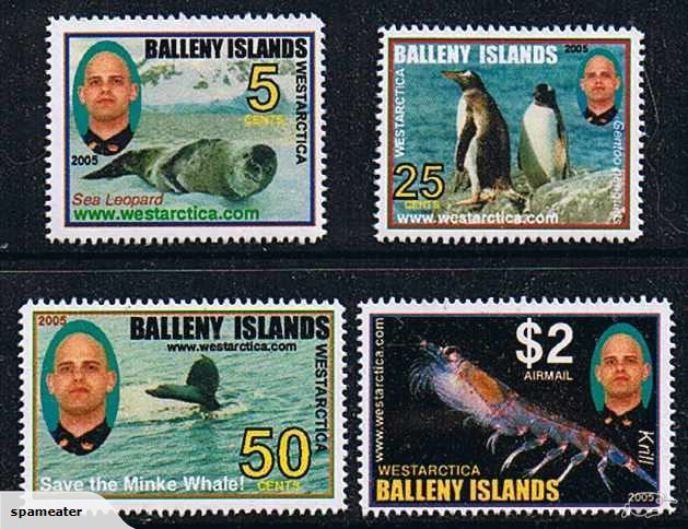
File:Balleny Islands - Krill.jpg Semi-unauthorized stamps of the Balleny Islands.(629 × 484 (103 KB)) - 06:29, 27 March 2018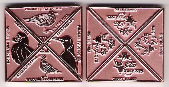
File:Coin-Islands SET 2008.jpg (592 × 307 (58 KB)) - 19:18, 21 March 2018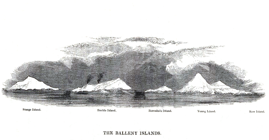
File:Balleny Islands - 1839 Enderby copy.jpg 1839 etching of the Balleny Islands by C. Enderby.(934 × 489 (308 KB)) - 22:05, 8 April 2018


Page text matches
File:Young Island-Balleny Islands.jpg Description Balleny Islands: Young Island Location Balleny Islands(808 × 648 (115 KB)) - 06:41, 26 March 2018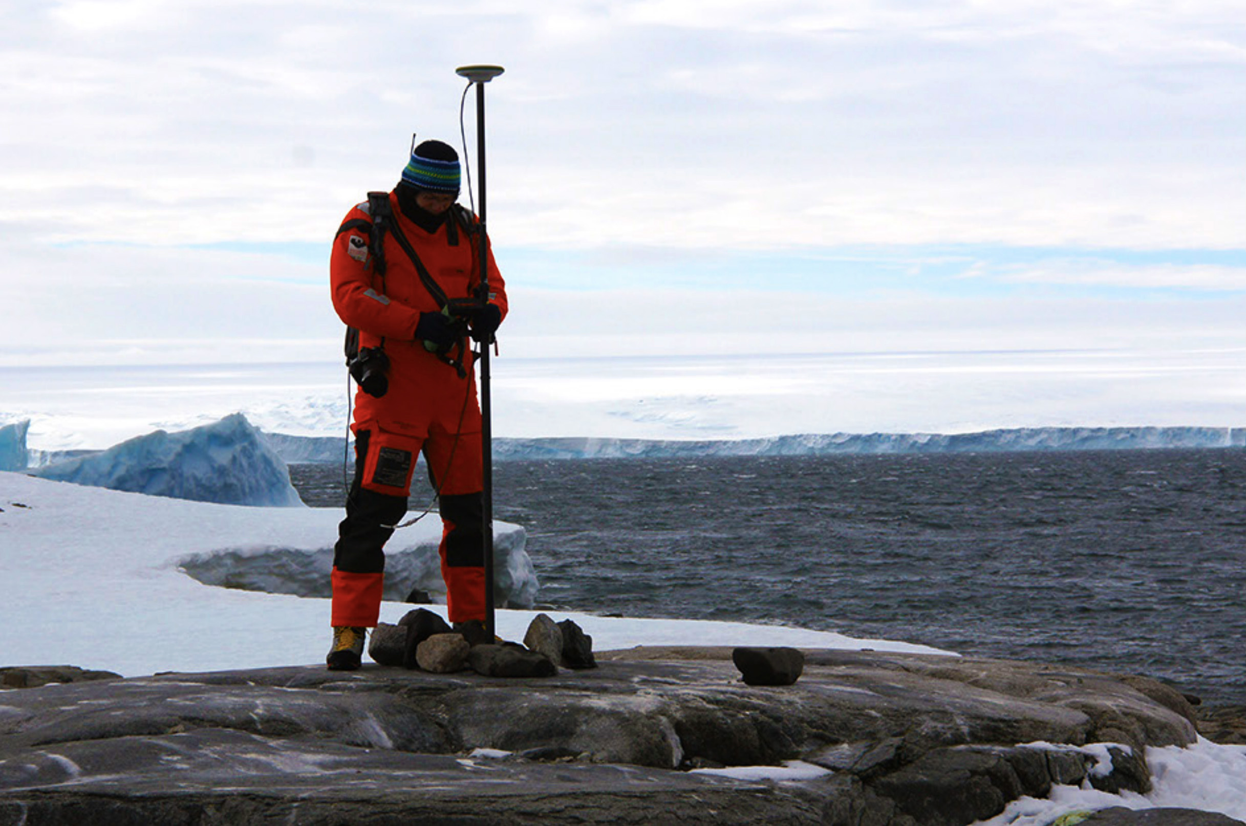
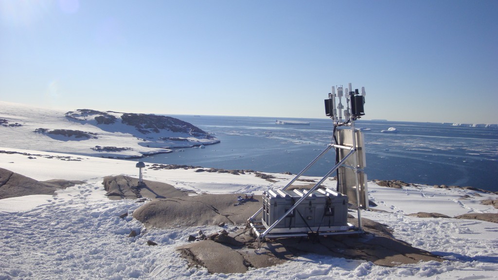
File:Suchland Islands.jpg Scientist at the Suchland Islands taking a GPS reading. Location: Suchland Islands, Antarctica(2,434 × 1,614 (649 KB)) - 22:26, 26 June 2020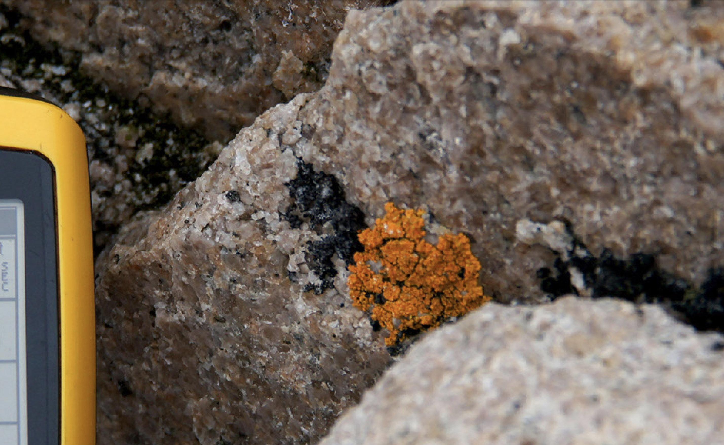
File:Brownson Island Lichens.jpg Description: Black and yellow lichens on a granite boulder in the Brownson Islands. Location: Brownson Islands, Antarctica(2,858 × 1,758 (819 KB)) - 22:49, 26 June 2020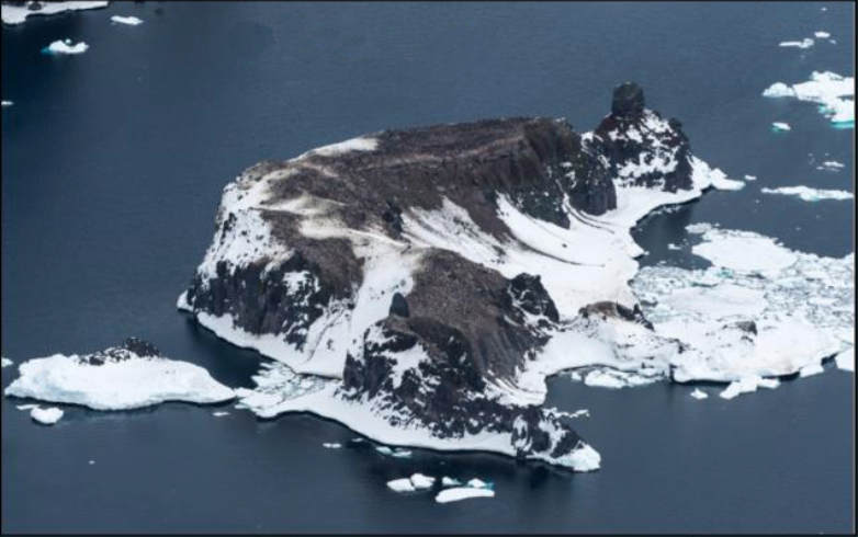
File:Chinstrap Island Picture.png Oblique aerial picture of Chinstrap Island, in the Balleny Islands. Location: Chinstrap Island, Balleny Islands(782 × 490 (501 KB)) - 21:58, 13 January 2019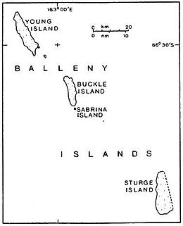
File:Balleny Map.jpg Map of the Balleny Islands.(260 × 321 (12 KB)) - 22:44, 16 March 2018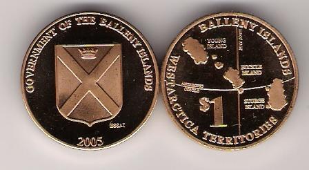
File:Coin-Balleny Island 1 2005 Bronze.jpg $1 coin of the Balleny Islands.(448 × 246 (24 KB)) - 19:25, 21 March 2018File:Balleny Islands - Krill.jpg Semi-unauthorized stamps of the Balleny Islands.(629 × 484 (103 KB)) - 06:29, 27 March 2018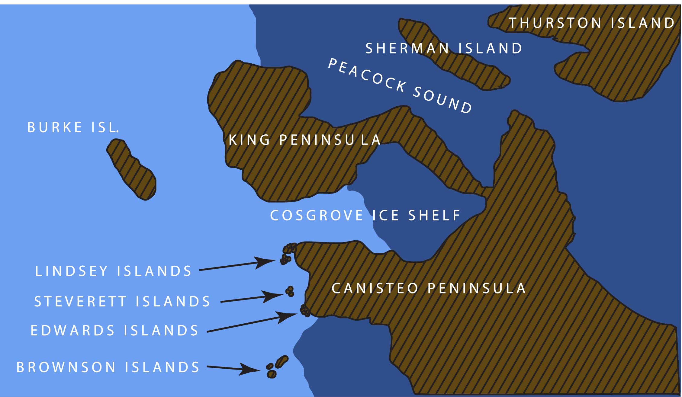
File:LINDSEY.jpg Steverett, Lindsey, Brownson, and Edwards Islands, Westarctica(2,258 × 1,315 (227 KB)) - 09:21, 9 July 2018File:Balleny Islands - 1839 Enderby copy.jpg 1839 etching of the Balleny Islands by C. Enderby.(934 × 489 (308 KB)) - 22:05, 8 April 2018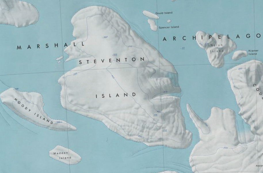
File:Steventon-Island-Map.png Map showing Steventon Island and surrounding islands in the Marshall Archipelago.(914 × 602 (773 KB)) - 19:24, 8 November 2019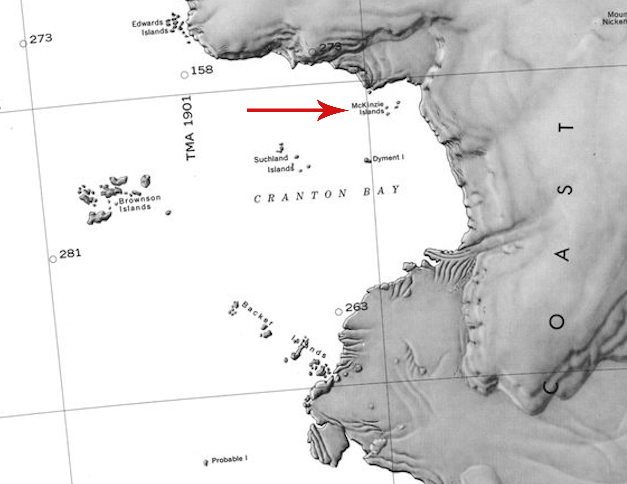
File:McKinzie Islands.jpg Description: Map showing the location of the McKinzie Islands in Antarctica.(2,170 × 1,674 (673 KB)) - 22:40, 26 June 2020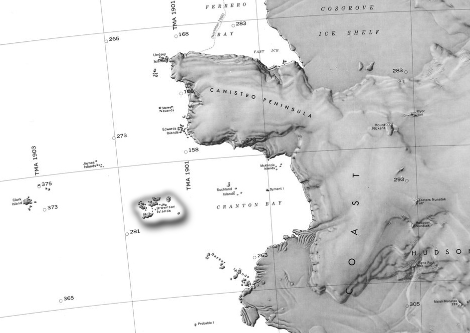
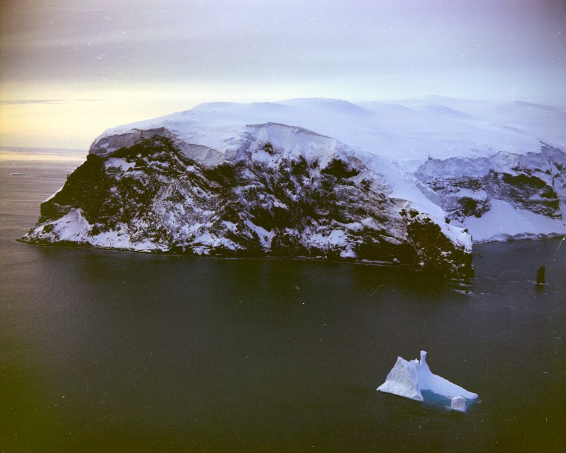
File:Barony Brownson.jpg Map of Cranton Bay and the Canisteo Peninsula showing the Brownson Islands.(942 × 668 (231 KB)) - 17:14, 4 February 2019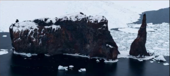
File:The Monolith.jpg Picture of The Monolith in the Balleny Islands.(576 × 258 (103 KB)) - 08:49, 7 February 2019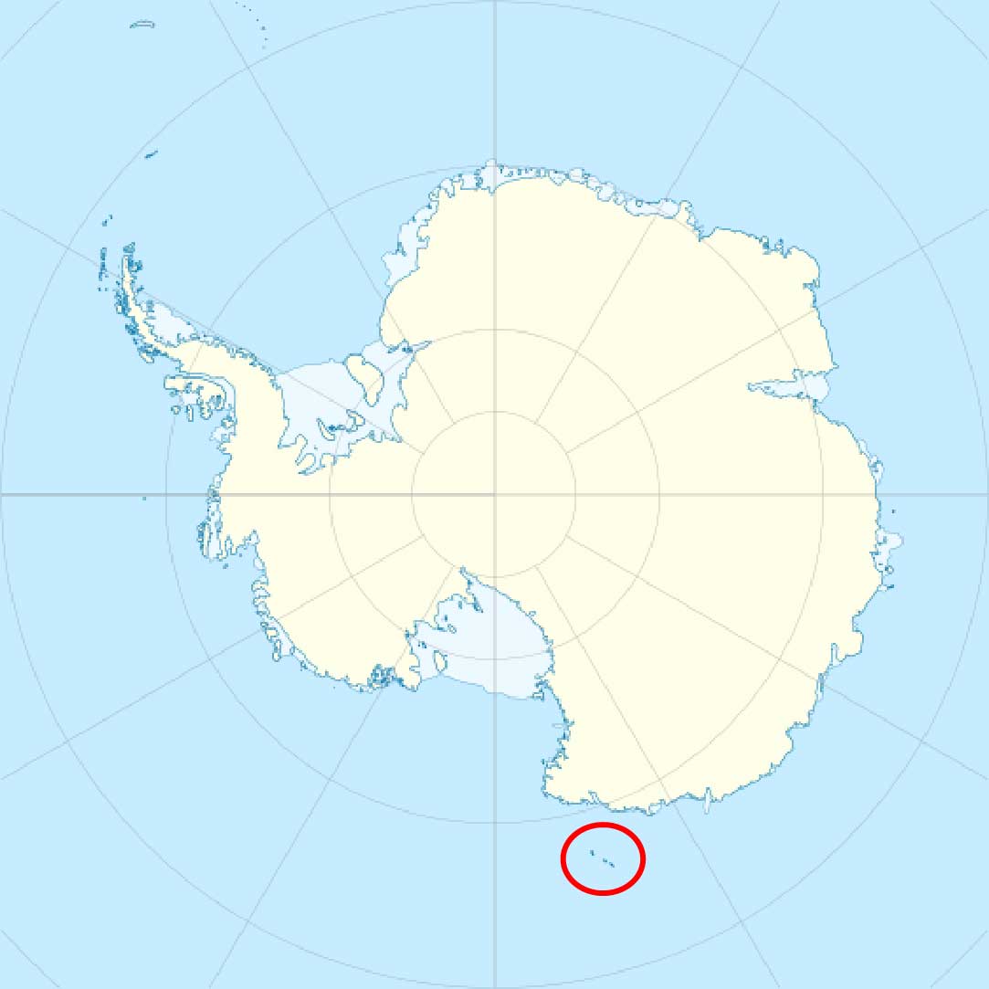
File:Balleny islands.jpg Balleny Islands in relation to Antarctica(1,083 × 1,083 (64 KB)) - 01:05, 23 November 2018
File:SturgeIsland-Balleny.jpg Description: Balleny Islands: Sturge Island(724 × 724 (143 KB)) - 19:59, 1 October 2018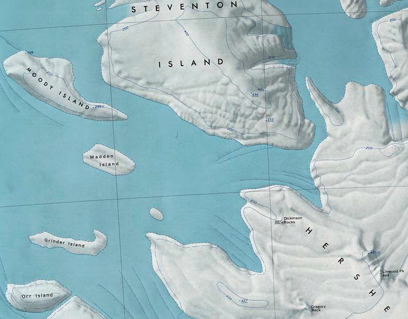
File:Marshall-Islands.png Map showing location of several small islands in the southwest portion of the [[Marshall Archipelago]].(814 × 638 (971 KB)) - 16:24, 18 December 2019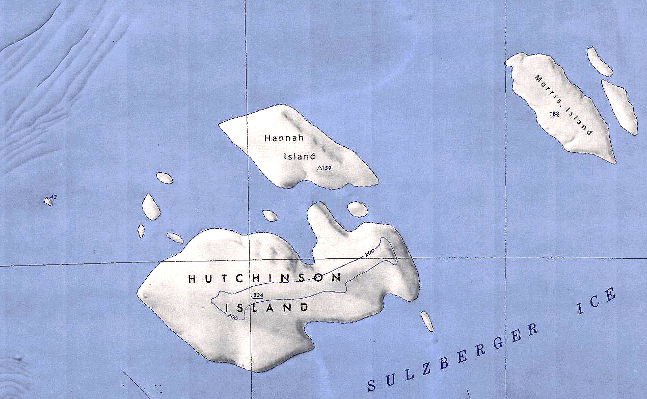
File:Hannah-Hutchinson.jpg Map showing the location of Hannah and Hutchinson Islands off the coast of Antarctica.(1,270 × 783 (1,015 KB)) - 21:03, 31 December 2019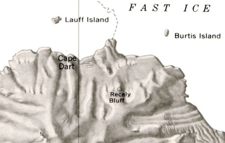
File:Lauff-Burtis Islands.png Map showing the location of Lauff and Burtis Islands off the coast of Siple Island.(783 × 500 (431 KB)) - 02:02, 25 November 2019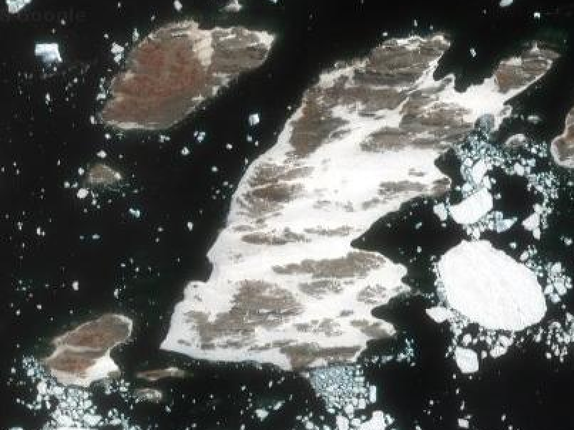
File:Lindsey Islands.png Satellite view showing the western group of the Lindsey Islands. Not pictured is the largest island just slightly to the east.(806 × 604 (225 KB)) - 19:41, 7 July 2018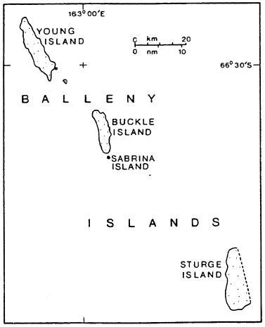
File:Balleny Map1.jpg English: Map of the Balleny Islands in the Southern Ocean(377 × 465 (17 KB)) - 23:41, 26 March 2018


