Difference between revisions of "File:Wrigley-Gulf-Map.png"
Jump to navigation
Jump to search
Westarctica (talk | contribs) |
(No difference)
|
Latest revision as of 08:25, 23 April 2018
Map showing the location of Wrigley Gulf in relation to surrounding features.
Wrigley Gulf is in the center of the image.
File history
Click on a date/time to view the file as it appeared at that time.
| Date/Time | Thumbnail | Dimensions | User | Comment | |
|---|---|---|---|---|---|
| current | 08:25, 23 April 2018 | 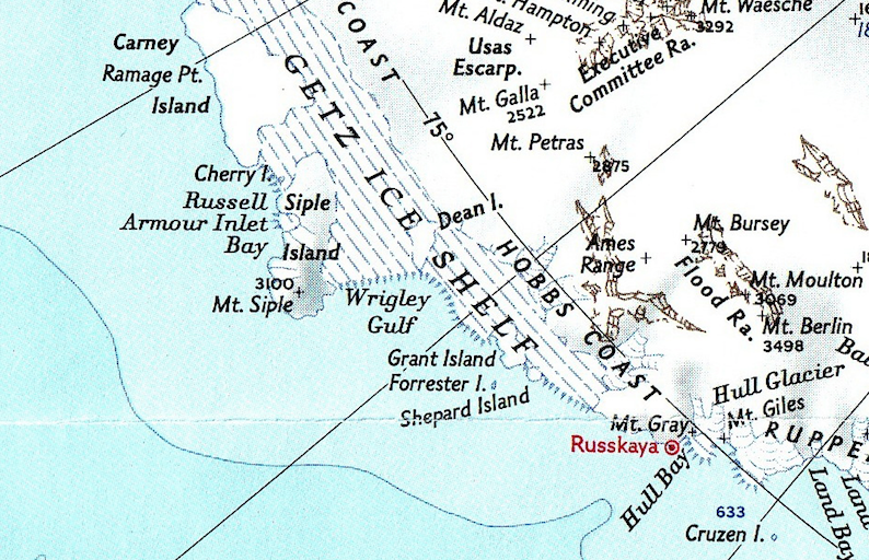 | 794 × 512 (925 KB) | Westarctica (talk | contribs) |
You cannot overwrite this file.
File usage
The following page uses this file: