Search results
Jump to navigation
Jump to search
Page title matches
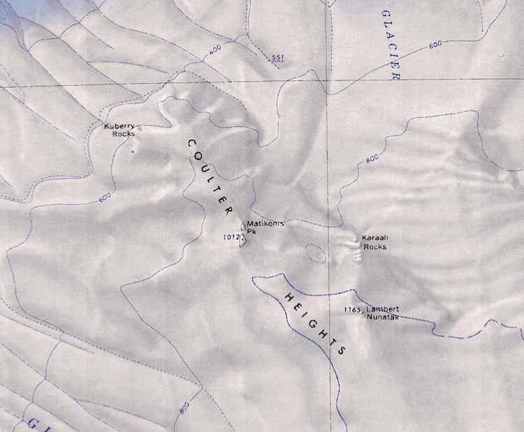
File:Coulter Heights.png Map of the Coulter Heights showing several notable geographic features.(750 × 619 (809 KB)) - 01:45, 17 August 2018

Page text matches
- [[File:Coulter Heights.png|thumb|350px|Map of the Coulter Heights]] The '''Coulter Heights''' (75°21′S 138°15′W) are [[snow]]-covered heights that rise1 KB (175 words) - 13:46, 4 September 2023
- [[File:Coulter Heights.png|thumb|350px|Map of the Coulter Heights showing location of Kuberry Rocks]] ...°17′S 138°31′W) are a small area of exposed rock at the north end of the [[Coulter Heights]]. The rocks are 6 nautical miles (11 km) northwest of [[Matikonis868 bytes (122 words) - 20:17, 22 August 2023
- [[File:Coulter Heights.png|thumb|Map of the Coulter Heights showing the Karaali rocks to the east of the Heights.]] ...small group of rocks along the east side of the mainly [[snow]]-covered [[Coulter Heights]], 5 nautical miles (9 km) east of [[Matikonis Peak]] in [[Westarct887 bytes (130 words) - 20:17, 22 August 2023