File:Discovery Expedition field of work.png
Original file (890 × 598 pixels, file size: 60 KB, MIME type: image/png)
Description
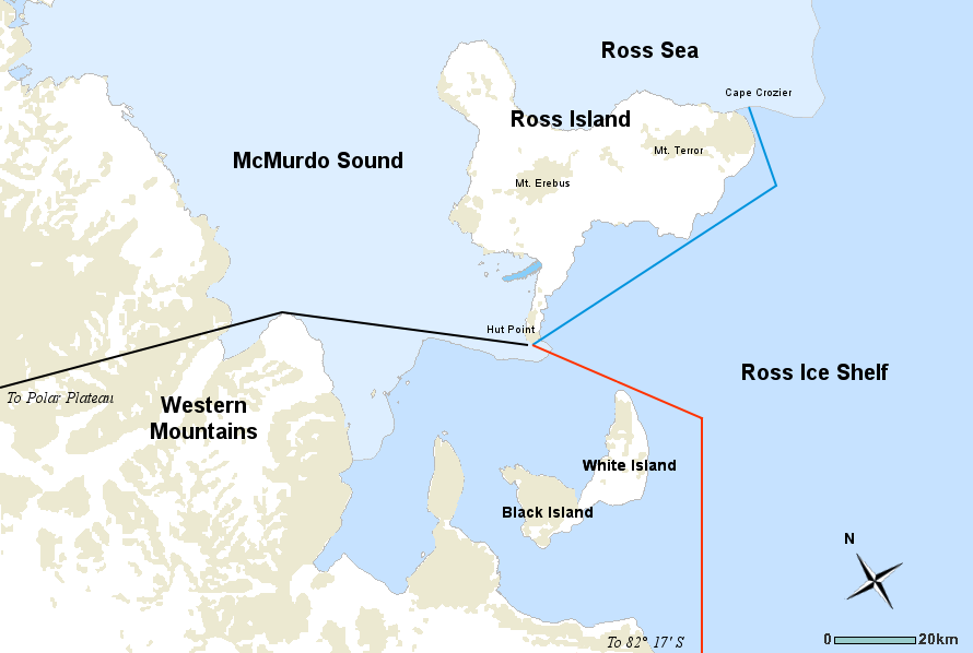
Map of the Discovery Expedition field of work, including three routes of explorations undertaken by members of the British National Antarctic Expedition of 1901-04 led by Robert Falcon Scott. RED line; Southern journey to Furthest South, November 1902 to February 1903. BLACK line; Western journey through Western Mountains to Polar Plateau, October–December 1903. BLUE line; Journeys to message point and Emperor Penguin colony at Cape Crozier, October 1902, September and October 1903. Date 2 May 2008 Source Underlying map from the Atlas of Antarctic Research by the United States Geological Survey (a public domain work). Includes Image:Simple compass rose.svg. Author Map by USGS, additional modifications by Howcheng
Source: Wikimedia Commons
File history
Click on a date/time to view the file as it appeared at that time.
| Date/Time | Thumbnail | Dimensions | User | Comment | |
|---|---|---|---|---|---|
| current | 05:02, 24 April 2018 | | 890 × 598 (60 KB) | Westarctica (talk | contribs) |
You cannot overwrite this file.
File usage
The following page uses this file: