File:Old Antarctica map.jpg
Size of this preview: 686 × 599 pixels. Other resolution: 879 × 768 pixels.
Original file (879 × 768 pixels, file size: 268 KB, MIME type: image/jpeg)
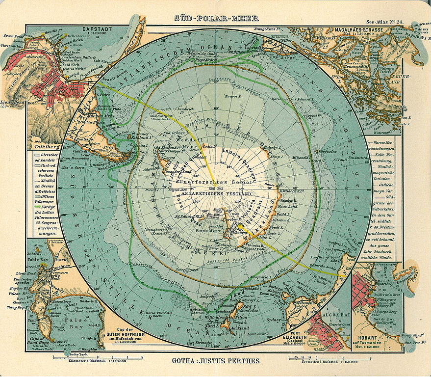
Publisher Justus Perthes Year of publication 1906 Place of publication Gotha Description Deutsch: Blatt 24, Süd-Polar-Meer English: Page 24, Antarctica, Inset maps of Cape town, Cape of good hope, Magalhaes strait, Hobart, Port Elizabeth
Pulled from Wikimedia Commons
File history
Click on a date/time to view the file as it appeared at that time.
| Date/Time | Thumbnail | Dimensions | User | Comment | |
|---|---|---|---|---|---|
| current | 23:16, 25 March 2018 | | 879 × 768 (268 KB) | Westarctica (talk | contribs) |
You cannot overwrite this file.
File usage
The following page uses this file: