File:Antarctic expedition map.png
Revision as of 00:15, 20 April 2018 by Westarctica (talk | contribs)
Size of this preview: 637 × 600 pixels. Other resolution: 1,446 × 1,361 pixels.
Original file (1,446 × 1,361 pixels, file size: 361 KB, MIME type: image/png)
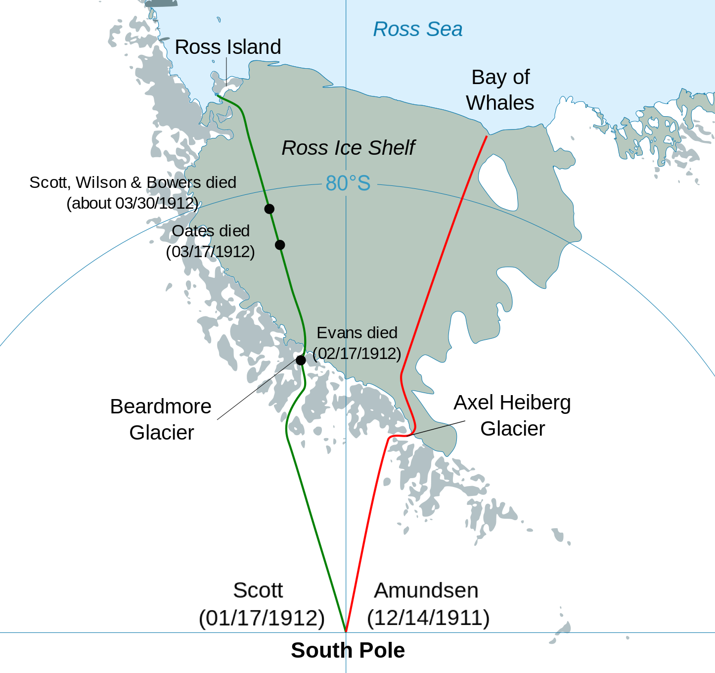
Description English: Comparison og Amundsen and Scott antartic expedition 1911 Cropped version of File:Antarctic expedition map (Amundsen - Scott)-en.svg Date 14 December 2016 Source Own work Author Soerfm
File history
Click on a date/time to view the file as it appeared at that time.
| Date/Time | Thumbnail | Dimensions | User | Comment | |
|---|---|---|---|---|---|
| current | 00:15, 20 April 2018 | | 1,446 × 1,361 (361 KB) | Westarctica (talk | contribs) |
You cannot overwrite this file.
File usage
The following 2 pages use this file: