File:Drake passage en.png
Jump to navigation
Jump to search
Size of this preview: 658 × 600 pixels. Other resolution: 928 × 846 pixels.
Original file (928 × 846 pixels, file size: 237 KB, MIME type: image/png)
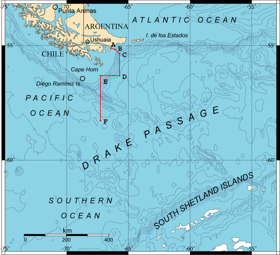
Description Drake Passage Map showing de boundary through points A, B, C, D, E and F accorded between Chile and Argentina by the Tratado de Paz y Amistad of 1984.
Date 19 November 2006 Source GMT (OMC) base map modified by Giovanni Fattori points according Tratado de Paz y Amistad of 1984. Author GMT (OMC) base map modified by Giovanni Fattori Permission (Reusing this file) free license
File history
Click on a date/time to view the file as it appeared at that time.
| Date/Time | Thumbnail | Dimensions | User | Comment | |
|---|---|---|---|---|---|
| current | 17:02, 15 May 2018 | | 928 × 846 (237 KB) | Westarctica (talk | contribs) |
You cannot overwrite this file.
File usage
The following page uses this file: