File:Sherman Island Satellite Image.png
Jump to navigation
Jump to search
Size of this preview: 800 × 499 pixels. Other resolution: 986 × 615 pixels.
Original file (986 × 615 pixels, file size: 582 KB, MIME type: image/png)
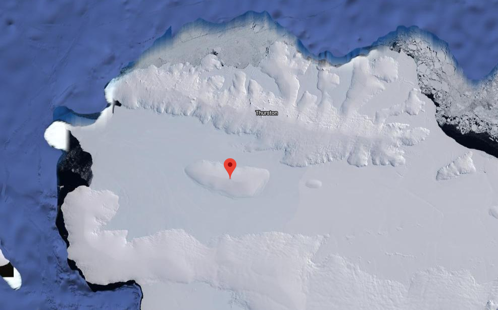
Satellite image showing the location of Sherman Island in relation to Thurston Island.
File history
Click on a date/time to view the file as it appeared at that time.
| Date/Time | Thumbnail | Dimensions | User | Comment | |
|---|---|---|---|---|---|
| current | 04:25, 30 March 2018 | | 986 × 615 (582 KB) | Westarctica (talk | contribs) |
You cannot overwrite this file.
File usage
The following page uses this file: