File:Map 13 Marie Byrd Land Ed 3.jpg
Size of this preview: 418 × 599 pixels. Other resolutions: 1,429 × 2,048 pixels | 2,880 × 4,128 pixels.
Original file (2,880 × 4,128 pixels, file size: 1.02 MB, MIME type: image/jpeg)
Summary
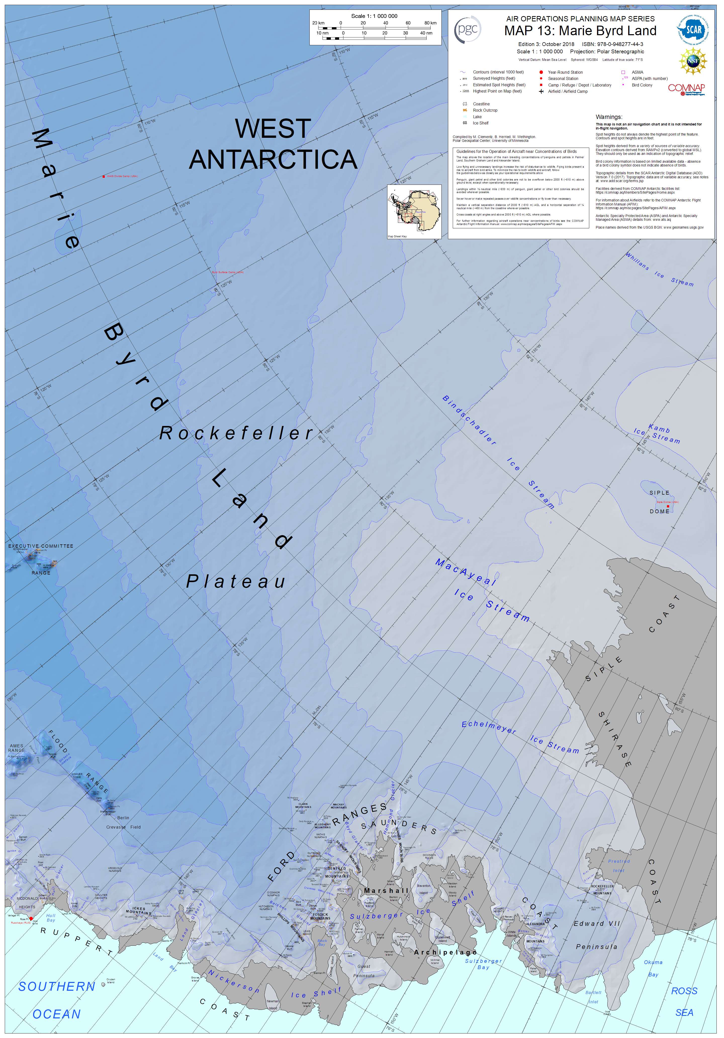
Eastern Mary Byrd Land
The copyright holder of this file, the Polar Geospatial Center, allows anyone to use it for any purpose, provided that the copyright holder is properly attributed. Redistribution, derivative work, commercial use, and all other use is permitted.
Attribution: Polar Geospatial Center, 2018, PGC Map Catalog, https://doi.org/10.7910/DVN/6R8F7U, Harvard Dataverse, V1, Map 13, 29 July 2019]
Licensing

|
File history
Click on a date/time to view the file as it appeared at that time.
| Date/Time | Thumbnail | Dimensions | User | Comment | |
|---|---|---|---|---|---|
| current | 10:42, 30 July 2019 | | 2,880 × 4,128 (1.02 MB) | Baron of Bastanchury (talk | contribs) | Eastern Mary Byrd Land The copyright holder of this file, the Polar Geospatial Center, allows anyone to use it for any purpose, provided that the copyright holder is properly attributed. Redistribution, derivative work, commercial use, and all other... |
You cannot overwrite this file.
File usage
There are no pages that use this file.