Difference between revisions of "File:Coyer-Point.jpg"
Jump to navigation
Jump to search
Westarctica (talk | contribs) |
(No difference)
|
Latest revision as of 06:37, 25 January 2019
Map of the southeastern edge of the Martin Peninsula showing Coyer Point circled in red.
File history
Click on a date/time to view the file as it appeared at that time.
| Date/Time | Thumbnail | Dimensions | User | Comment | |
|---|---|---|---|---|---|
| current | 06:37, 25 January 2019 | 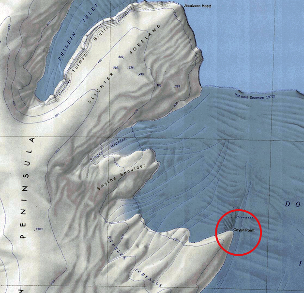 | 628 × 605 (369 KB) | Westarctica (talk | contribs) |
You cannot overwrite this file.
File usage
The following page uses this file: