Difference between revisions of "Mount Rubin de la Borbolla"
Westarctica (talk | contribs) (Created page with "'''Mount Rubin de la Borbolla''' (75°02′S 135°03′W) is an ice-covered mountain in the southeast extremity of the McDonald Heights, overlooking Johnson Glacier fr...") |
Westarctica (talk | contribs) (added map) |
||
| Line 1: | Line 1: | ||
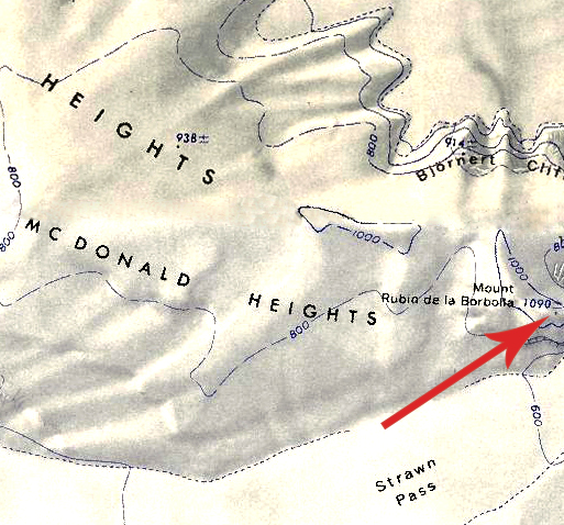
[[File:MountRubin.jpg|400px|thumb|Map showing the location of Mount Rubin de la Borbolla]] | |||
'''Mount Rubin de la Borbolla''' (75°02′S 135°03′W) is an [[ice]]-covered mountain in the southeast extremity of the [[McDonald Heights]], overlooking Johnson Glacier from the west. It is 1,090 meters (3,580 ft) high. | '''Mount Rubin de la Borbolla''' (75°02′S 135°03′W) is an [[ice]]-covered mountain in the southeast extremity of the [[McDonald Heights]], overlooking Johnson Glacier from the west. It is 1,090 meters (3,580 ft) high. | ||
Latest revision as of 07:17, 7 July 2025
Mount Rubin de la Borbolla (75°02′S 135°03′W) is an ice-covered mountain in the southeast extremity of the McDonald Heights, overlooking Johnson Glacier from the west. It is 1,090 meters (3,580 ft) high.
Discovery and name
The mountain was mapped by USGS from surveys and United States Navy air photos collected during the years 1959-65. Mount Rubin de la Borbolla was named by US-ACAN in honor of Mexican scientist George S. Rubin de la Borbolla, who worked as a meteorologist for Michigan Technological University at Plateau Station in 1968. His primary duty was to act as an observer for the micrometeorological program, which was heralded as the "largest and most exciting one" ever established in the polar regions; however, the station was closed soon after as a result of infighting between the scientists and U.S. Navy personnel. Rubin de la Borbolla later testified at a National Science Foundation hearing that he believed the U.S. Navy was deliberately sabotaging civilian efforts at the station and throughout Antarctica.
