Difference between revisions of "File:Koloc-Point.png"
Jump to navigation
Jump to search
Westarctica (talk | contribs) |
Westarctica (talk | contribs) |
||
| Line 1: | Line 1: | ||
Map of the Bear Peninsula showing Koloc Point and Moore Dome. | Map of the Bear Peninsula showing Koloc Point and Moore Dome. | ||
Map Credit: U.S. Geological Survye | |||
Date of Creation: 1978 | |||
Featured Image: 9 June 2019 | |||
[[Category: Featured Images]] | |||
[[Category: Maps]] | [[Category: Maps]] | ||
Latest revision as of 17:55, 10 June 2019
Map of the Bear Peninsula showing Koloc Point and Moore Dome.
Map Credit: U.S. Geological Survye
Date of Creation: 1978
Featured Image: 9 June 2019
File history
Click on a date/time to view the file as it appeared at that time.
| Date/Time | Thumbnail | Dimensions | User | Comment | |
|---|---|---|---|---|---|
| current | 16:35, 4 February 2019 | 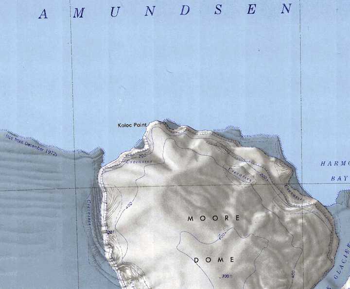 | 720 × 595 (713 KB) | Westarctica (talk | contribs) |
You cannot overwrite this file.
File usage
The following 2 pages use this file: