Difference between revisions of "File:Boudette Peaks.jpg"
Jump to navigation
Jump to search
Westarctica (talk | contribs) |
(license) |
||
| Line 1: | Line 1: | ||
Map showing the location of the Boudette Peaks in relation to Mount Hartigan and the Executive Committee Range. | Map showing the location of the Boudette Peaks in relation to Mount Hartigan and the Executive Committee Range. | ||
{{CC-PD}} | |||
[[Category: Maps]] | [[Category: Maps]] | ||
Latest revision as of 04:52, 11 August 2020
Map showing the location of the Boudette Peaks in relation to Mount Hartigan and the Executive Committee Range.

|
File history
Click on a date/time to view the file as it appeared at that time.
| Date/Time | Thumbnail | Dimensions | User | Comment | |
|---|---|---|---|---|---|
| current | 11:57, 6 August 2020 | 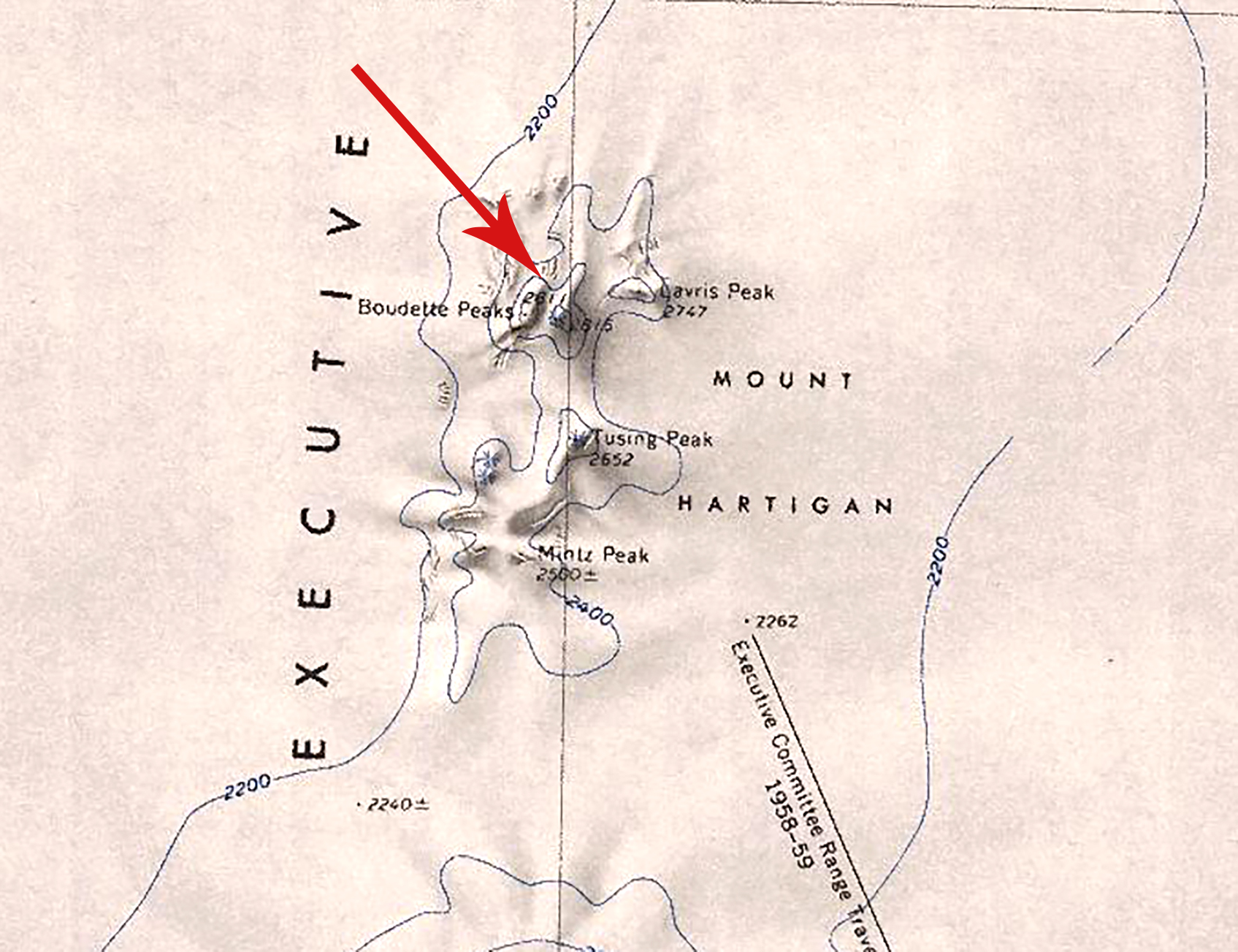 | 1,695 × 1,303 (973 KB) | Westarctica (talk | contribs) |
You cannot overwrite this file.
File usage
The following page uses this file: