File:Cronenwett-Island.jpg
Size of this preview: 800 × 553 pixels. Other resolution: 999 × 691 pixels.
Original file (999 × 691 pixels, file size: 533 KB, MIME type: image/jpeg)
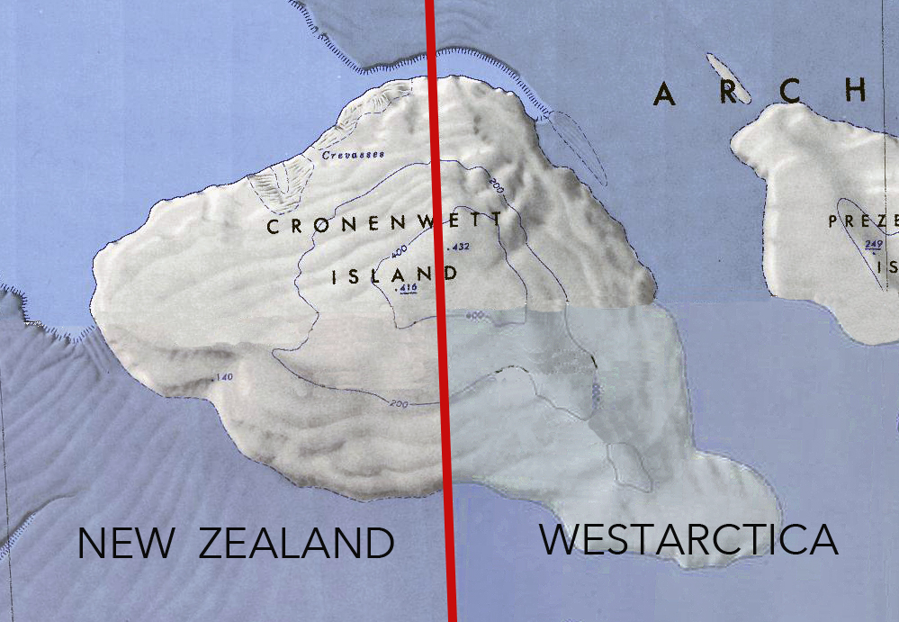
Composite map showing the 150 degree line dividing Cronenwett Island between New Zealand (Ross Dependency) and Westarctica.
File history
Click on a date/time to view the file as it appeared at that time.
| Date/Time | Thumbnail | Dimensions | User | Comment | |
|---|---|---|---|---|---|
| current | 03:11, 11 May 2018 | | 999 × 691 (533 KB) | Westarctica (talk | contribs) |
You cannot overwrite this file.
File usage
The following page uses this file: