File:Raymond Ice Rise.jpg
Size of this preview: 576 × 599 pixels. Other resolution: 750 × 780 pixels.
Original file (750 × 780 pixels, file size: 147 KB, MIME type: image/jpeg)
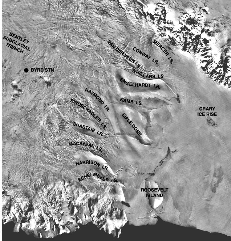
Map showing general location of the various ice rises, ridges, and streams surrounding the vicinity of the Siple Dome along the Siple Coast.
Source: http://www.waisworkshop.org/sites/waisworkshop.org/files/images/ismap2.jpg
Authors: S. Shabtaie and C.R. Bentley
File history
Click on a date/time to view the file as it appeared at that time.
| Date/Time | Thumbnail | Dimensions | User | Comment | |
|---|---|---|---|---|---|
| current | 08:20, 1 April 2019 | | 750 × 780 (147 KB) | Westarctica (talk | contribs) |
You cannot overwrite this file.
File usage
The following page uses this file: