File:Allegheny-Clark-Mts.jpg
Revision as of 22:44, 20 April 2018 by Westarctica (talk | contribs)
Size of this preview: 750 × 600 pixels. Other resolution: 1,013 × 810 pixels.
Original file (1,013 × 810 pixels, file size: 179 KB, MIME type: image/jpeg)
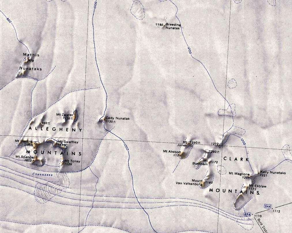
Map showing the location of the Allegheny Mountains (left) and Clark Mountains (right) in relation to each other.
File history
Click on a date/time to view the file as it appeared at that time.
| Date/Time | Thumbnail | Dimensions | User | Comment | |
|---|---|---|---|---|---|
| current | 22:44, 20 April 2018 | | 1,013 × 810 (179 KB) | Westarctica (talk | contribs) |
You cannot overwrite this file.
File usage
The following 2 pages use this file: