File:Mount Takahe Geology.png
Revision as of 02:25, 15 August 2019 by Westarctica (talk | contribs)
Size of this preview: 770 × 600 pixels. Other resolution: 809 × 630 pixels.
Original file (809 × 630 pixels, file size: 138 KB, MIME type: image/png)
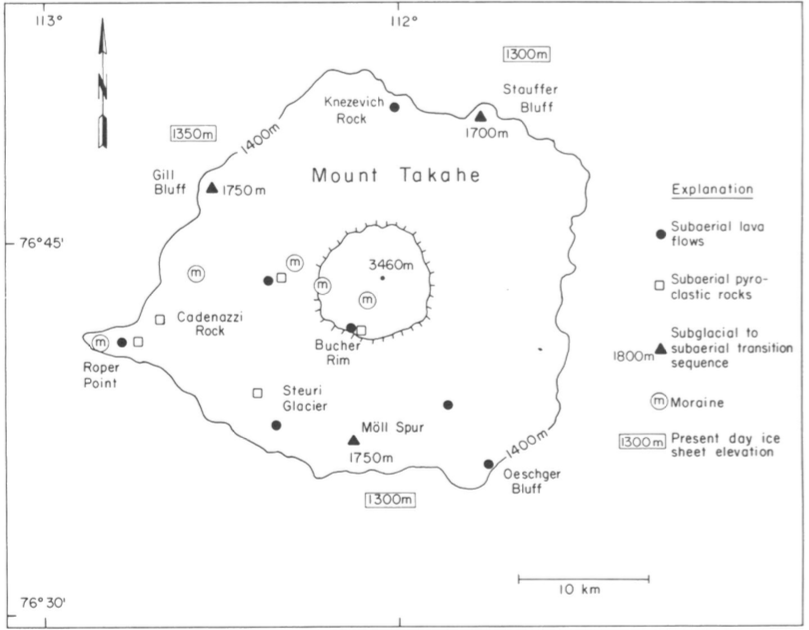
A geologic map of Mount Takahe.
File history
Click on a date/time to view the file as it appeared at that time.
| Date/Time | Thumbnail | Dimensions | User | Comment | |
|---|---|---|---|---|---|
| current | 02:25, 15 August 2019 | | 809 × 630 (138 KB) | Westarctica (talk | contribs) |
You cannot overwrite this file.
File usage
The following page uses this file: