File:Backer Islands GPS.jpg
Jump to navigation
Jump to search
Size of this preview: 800 × 451 pixels. Other resolution: 1,024 × 577 pixels.
Original file (1,024 × 577 pixels, file size: 137 KB, MIME type: image/jpeg)
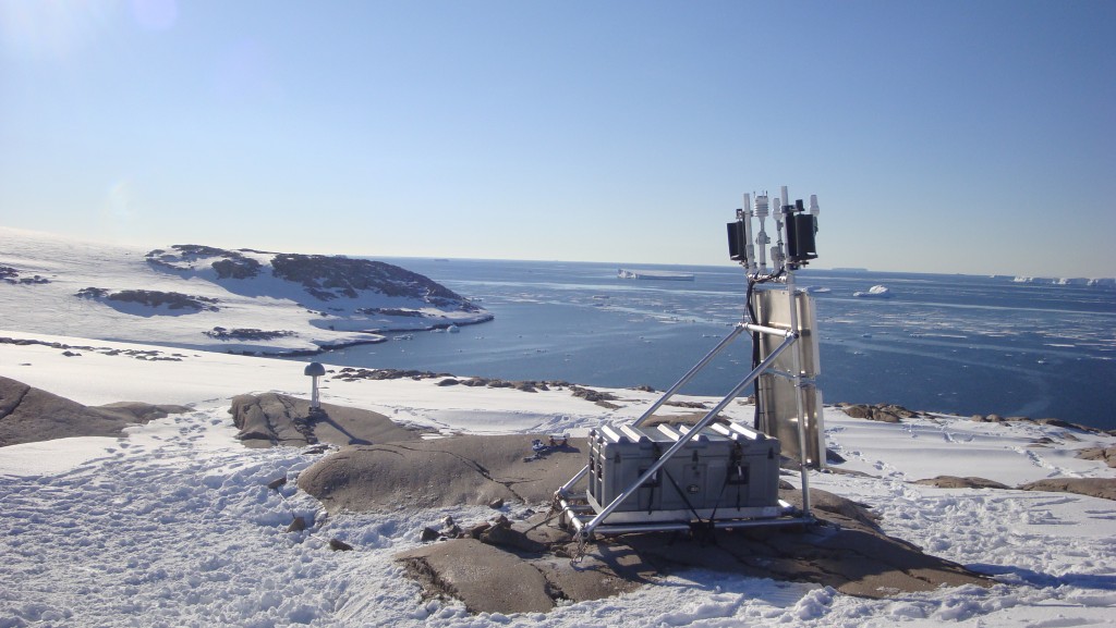
GPS monitoring station located on the Backer Islands. View is looking toward Cranston Bay.
Date: 2011 - 2012 season
Location: S 74.4304, W 102.478
Photographer: Ellie Boyce (UNAVCO)
Source: http://polenet.org/backer-island#prettyPhoto
Featured Image: 31 March 2019
File history
Click on a date/time to view the file as it appeared at that time.
| Date/Time | Thumbnail | Dimensions | User | Comment | |
|---|---|---|---|---|---|
| current | 04:13, 2 January 2019 | | 1,024 × 577 (137 KB) | Westarctica (talk | contribs) |
You cannot overwrite this file.
File usage
The following page uses this file: