File:Boschert Glacier.png
Revision as of 05:57, 9 December 2019 by Westarctica (talk | contribs)
Size of this preview: 800 × 533 pixels. Other resolution: 1,059 × 706 pixels.
Original file (1,059 × 706 pixels, file size: 1.23 MB, MIME type: image/png)
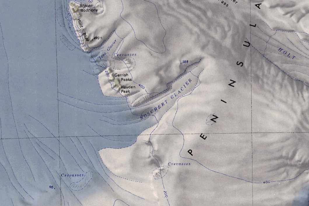
Map of the south-east section of the Bear Peninsula showing the location of Boschert Glacier.
File history
Click on a date/time to view the file as it appeared at that time.
| Date/Time | Thumbnail | Dimensions | User | Comment | |
|---|---|---|---|---|---|
| current | 05:57, 9 December 2019 | | 1,059 × 706 (1.23 MB) | Westarctica (talk | contribs) |
You cannot overwrite this file.
File usage
The following page uses this file: