File:Map Peter I Island.jpg
Size of this preview: 508 × 600 pixels. Other resolution: 509 × 601 pixels.
Original file (509 × 601 pixels, file size: 166 KB, MIME type: image/jpeg)
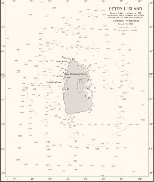
Nautical navigation chart of Peter I Island.
File history
Click on a date/time to view the file as it appeared at that time.
| Date/Time | Thumbnail | Dimensions | User | Comment | |
|---|---|---|---|---|---|
| current | 07:53, 15 March 2018 | | 509 × 601 (166 KB) | Westarctica (talk | contribs) | Nautical navigation chart of Peter I Island. |
You cannot overwrite this file.
File usage
The following page uses this file: