File:Peter I Island Map.jpg
Revision as of 08:09, 1 December 2019 by Westarctica (talk | contribs)
No higher resolution available.
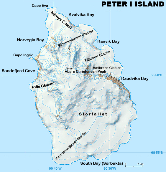
Peter_I_Island_Map.jpg (563 × 584 pixels, file size: 297 KB, MIME type: image/jpeg)
Description: Highly detailed map of Peter I Island.
Author: Map created by Grand Duke Travis with the assistance of the Norway Office of Polar Programs.
Date of Creation: 27 February 2019
Featured Image: 1 December 2019
File history
Click on a date/time to view the file as it appeared at that time.
| Date/Time | Thumbnail | Dimensions | User | Comment | |
|---|---|---|---|---|---|
| current | 06:16, 27 February 2019 | | 563 × 584 (297 KB) | Westarctica (talk | contribs) |
You cannot overwrite this file.
File usage
The following 3 pages use this file: