File:Siple War - Map.png
No higher resolution available.
Siple_War_-_Map.png (537 × 574 pixels, file size: 85 KB, MIME type: image/png)
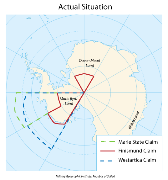
Map showing the overlapping claims that led to the Siple War. The claim of Flandrensis is not shown as it only encompasses Siple Island.
File history
Click on a date/time to view the file as it appeared at that time.
| Date/Time | Thumbnail | Dimensions | User | Comment | |
|---|---|---|---|---|---|
| current | 21:10, 20 April 2018 | | 537 × 574 (85 KB) | Westarctica (talk | contribs) |
You cannot overwrite this file.
File usage
The following page uses this file: