File:Wright-Island.png
Revision as of 20:57, 13 August 2018 by Westarctica (talk | contribs)
No higher resolution available.
Wright-Island.png (478 × 569 pixels, file size: 445 KB, MIME type: image/png)
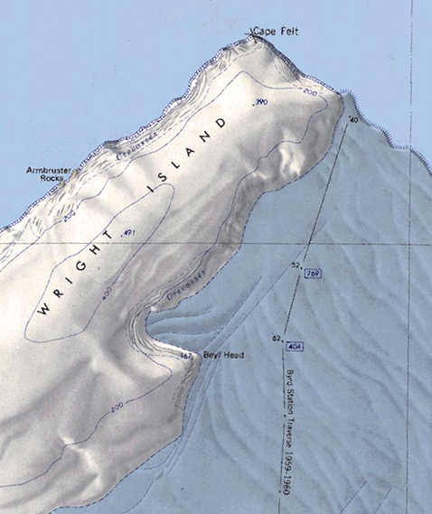
Map showing the northern half of Wright Island with some significant geographic features indicated.
File history
Click on a date/time to view the file as it appeared at that time.
| Date/Time | Thumbnail | Dimensions | User | Comment | |
|---|---|---|---|---|---|
| current | 20:57, 13 August 2018 | | 478 × 569 (445 KB) | Westarctica (talk | contribs) |
You cannot overwrite this file.
File usage
The following page uses this file: