Difference between revisions of "Template:POTD protected"
Jump to navigation
Jump to search
Westarctica (talk | contribs) |
Westarctica (talk | contribs) |
||
| (153 intermediate revisions by the same user not shown) | |||
| Line 1: | Line 1: | ||
{| role="presentation" style="margin:0 3px 3px; width:100%; text-align:left; background-color:transparent; border-collapse: collapse; " | {| role="presentation" style="margin:0 3px 3px; width:100%; text-align:left; background-color:transparent; border-collapse: collapse; " | ||
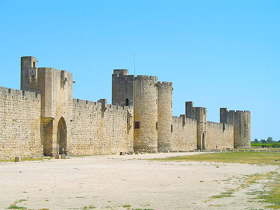
|style="padding:0 0.9em 0 0;" | [[File: | |style="padding:0 0.9em 0 0;" | [[File:Aigues-Mortes Walls.jpg|300px|thumb]] | ||
|style="padding:0 6px 0 0"| | |style="padding:0 6px 0 0"| | ||
'''[[ | The '''[[Principality of Aigues-Mortes]]''' is a [[micronation]] created to promote and support local initiatives of the eponymous city, located in Southern France, 23km east of Montpellier. The Princely Couple (His Serene Highness, Sovereign-Prince Jean-Pierre IV and Her Serene Highness, Princess Olivia-Eugénie) work together with the citizens and the Princely Grand Council, to create and organize events that are both fun and windows of local talents and creativity. | ||
During [[MicroCon 2025]], it was announced that the Principality of Aigues-Mortes would serve as host of [[MicroCon EU 2027]]. | |||
<p><small> | |||
[[:Category:Images|'''(More | |||
<p><small>Photographer: Marc Ryckaert (MJJR)</small></p> | |||
[[:Category:Images|'''(More Images)''']] | |||
<div class="potd-recent" style="text-align:right;"> | <div class="potd-recent" style="text-align:right;"> | ||
Latest revision as of 22:25, 1 January 2026
|
The Principality of Aigues-Mortes is a micronation created to promote and support local initiatives of the eponymous city, located in Southern France, 23km east of Montpellier. The Princely Couple (His Serene Highness, Sovereign-Prince Jean-Pierre IV and Her Serene Highness, Princess Olivia-Eugénie) work together with the citizens and the Princely Grand Council, to create and organize events that are both fun and windows of local talents and creativity. During MicroCon 2025, it was announced that the Principality of Aigues-Mortes would serve as host of MicroCon EU 2027.
Photographer: Marc Ryckaert (MJJR) |
