Difference between revisions of "Template:POTD protected"
Jump to navigation
Jump to search
Westarctica (talk | contribs) |
Westarctica (talk | contribs) |
||
| (142 intermediate revisions by the same user not shown) | |||
| Line 1: | Line 1: | ||
{| role="presentation" style="margin:0 3px 3px; width:100%; text-align:left; background-color:transparent; border-collapse: collapse; " | {| role="presentation" style="margin:0 3px 3px; width:100%; text-align:left; background-color:transparent; border-collapse: collapse; " | ||
|style="padding:0 0.9em 0 0;" | [[File: | |style="padding:0 0.9em 0 0;" | [[File:San-Joaquin-Kit-Fox-Den.jpg|300px|thumb]] | ||
|style="padding:0 6px 0 0"| | |style="padding:0 6px 0 0"| | ||
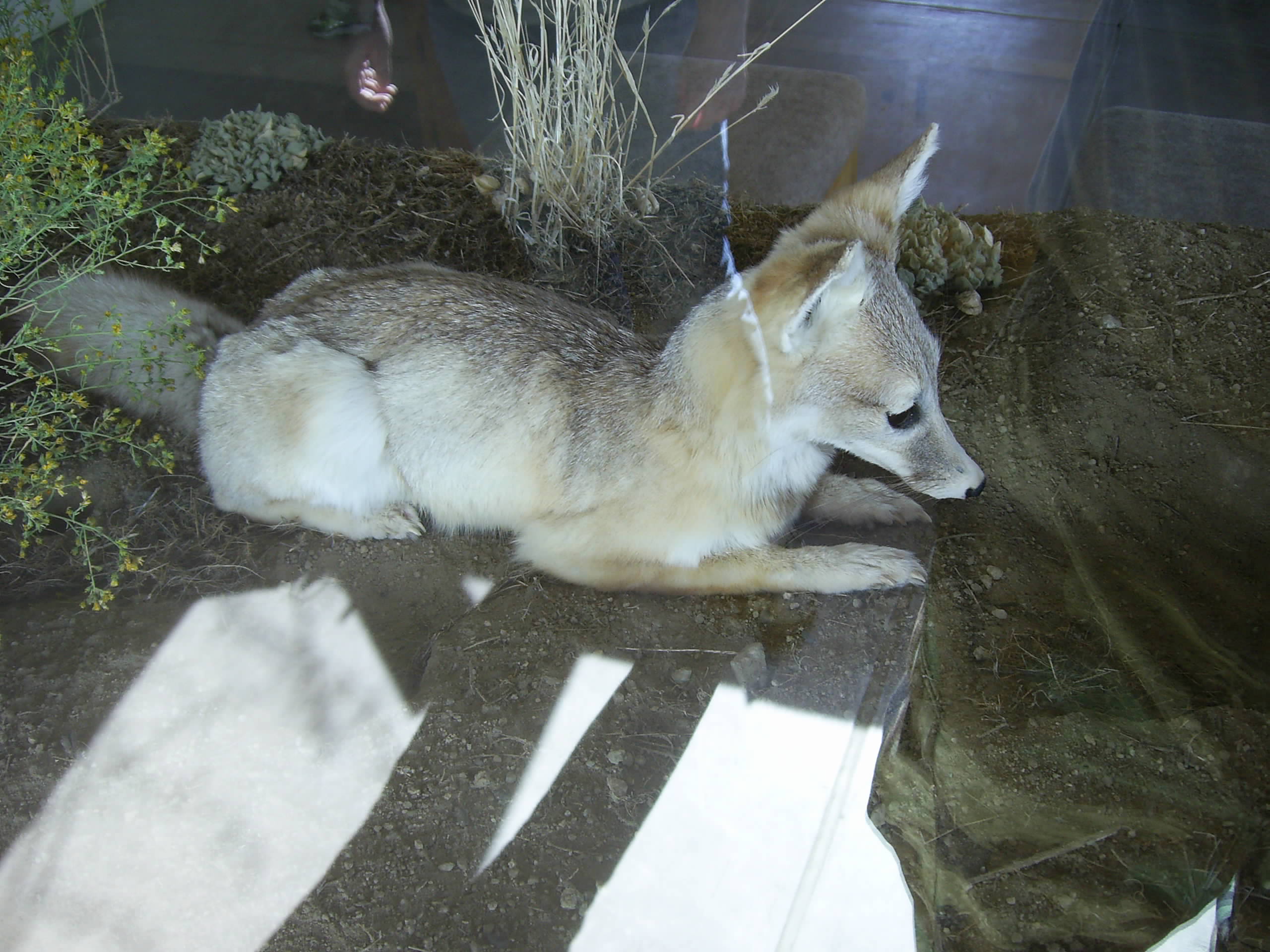
The '''[[ | The '''[[San Joaquin kit fox]]''' is the smallest member of the dog family in North America and one of several endangered species that lives within the borders of the [[Colony of Calsahara]]. In 1990, its population was estimated to be 7,000. This subspecies is still endangered, after nearly 50 years of being on the Endangered Species List. Today, much of the kit fox's remaining habitat is extremely fragmented, movement corridors are degraded or blocked, and only a few large areas of native grasslands remain on the San Joaquin Valley's perimeter in the [[Carrizo Plain]]. | ||
<p><small> | |||
[[:Category:Images|'''(More | <p><small>Photographer: [[Grand Duke Travis]]</small></p> | ||
[[:Category:Images|'''(More Images)''']] | |||
<div class="potd-recent" style="text-align:right;"> | <div class="potd-recent" style="text-align:right;"> | ||
Latest revision as of 02:46, 29 January 2026
|
The San Joaquin kit fox is the smallest member of the dog family in North America and one of several endangered species that lives within the borders of the Colony of Calsahara. In 1990, its population was estimated to be 7,000. This subspecies is still endangered, after nearly 50 years of being on the Endangered Species List. Today, much of the kit fox's remaining habitat is extremely fragmented, movement corridors are degraded or blocked, and only a few large areas of native grasslands remain on the San Joaquin Valley's perimeter in the Carrizo Plain.
Photographer: Grand Duke Travis |
