Difference between revisions of "Scott Peninsula"
Jump to navigation
Jump to search
(Created with content derived from Wikipedia) |
m |
||
| Line 1: | Line 1: | ||
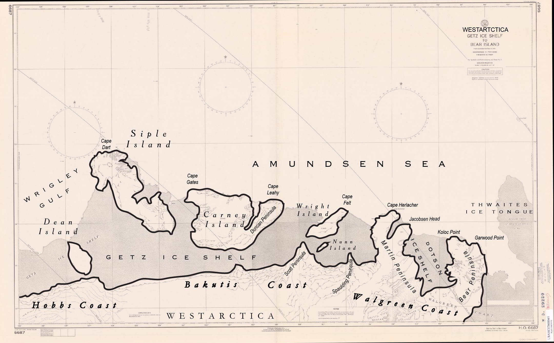
[[File:Getz Ice Shelf to Bear Island.jpg|thumb]] | |||
The '''Scott Peninsul'''a is an ice-covered peninsula, 17 nautical miles (31 km; 20 mi) long, extending from the coast of Westarctica into the [[Getz Ice Shelf]] toward the west end of [[Wright Island]]. Mapped by United States Geological Survey (USGS) from surveys and U.S. Navy air photos, 1959-66. Named by Advisory Committee on Antarctic Names (US-ACAN) for Lieutenant [[Colonel Thomas Scott]], USA, who assisted with the early establishment of U.S. Navy Operation Deepfreeze finances and liaison during the IGY. | The '''Scott Peninsul'''a is an ice-covered peninsula, 17 nautical miles (31 km; 20 mi) long, extending from the coast of Westarctica into the [[Getz Ice Shelf]] toward the west end of [[Wright Island]]. Mapped by United States Geological Survey (USGS) from surveys and U.S. Navy air photos, 1959-66. Named by Advisory Committee on Antarctic Names (US-ACAN) for Lieutenant [[Colonel Thomas Scott]], USA, who assisted with the early establishment of U.S. Navy Operation Deepfreeze finances and liaison during the IGY. | ||
[[Category: Geography of Westarctica]] | [[Category: Geography of Westarctica]] | ||
Revision as of 02:42, 3 May 2018
The Scott Peninsula is an ice-covered peninsula, 17 nautical miles (31 km; 20 mi) long, extending from the coast of Westarctica into the Getz Ice Shelf toward the west end of Wright Island. Mapped by United States Geological Survey (USGS) from surveys and U.S. Navy air photos, 1959-66. Named by Advisory Committee on Antarctic Names (US-ACAN) for Lieutenant Colonel Thomas Scott, USA, who assisted with the early establishment of U.S. Navy Operation Deepfreeze finances and liaison during the IGY.
