Difference between revisions of "Mount Bramhall"
Jump to navigation
Jump to search
Westarctica (talk | contribs) (Created page with "'''Mount Bramhall''' (72°15′S 98°16′W) is a peak of the Walker Mountains, located 5 nautical miles (9 km) east of Mount Hawthorne on Thurston Island. At 3,30...") |
Westarctica (talk | contribs) |
||
| Line 1: | Line 1: | ||
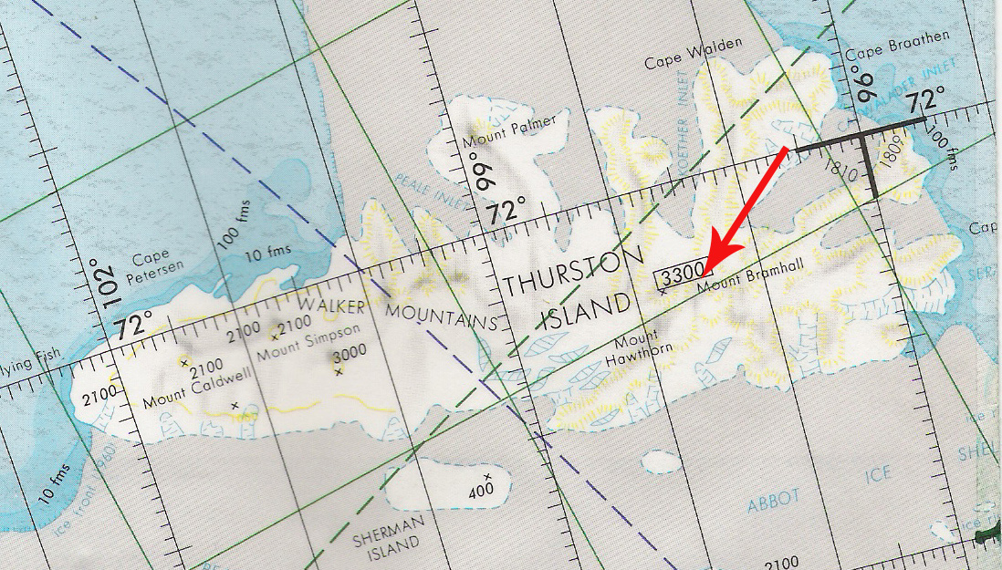
[[File:Bramhall.jpg|400px|thumb|Map showing location of Mount Bramhall]] | |||
'''Mount Bramhall''' (72°15′S 98°16′W) is a peak of the [[Walker Mountains]], located 5 nautical miles (9 km) east of [[Mount Hawthorne]] on [[Thurston Island]]. At 3,300 meters high, it is the tallest mountain on Thurston Island. | '''Mount Bramhall''' (72°15′S 98°16′W) is a peak of the [[Walker Mountains]], located 5 nautical miles (9 km) east of [[Mount Hawthorne]] on [[Thurston Island]]. At 3,300 meters high, it is the tallest mountain on Thurston Island. | ||
Revision as of 08:33, 15 January 2025
Mount Bramhall (72°15′S 98°16′W) is a peak of the Walker Mountains, located 5 nautical miles (9 km) east of Mount Hawthorne on Thurston Island. At 3,300 meters high, it is the tallest mountain on Thurston Island.
Discovery and name
The mountain was first delineated from aerial photographs taken by U.S. Navy Operation Highjump in December 1946. Mount Bramhall was named by the Advisory Committee on Antarctic Names in honor of Dr. E.H. Bramhall, a physicist of the Byrd Antarctic Expedition from 1933–35.
