Difference between revisions of "Boyd Glacier"
Jump to navigation
Jump to search
Westarctica (talk | contribs) (Source of article predominately from Wikipedia article on Boyd Glacier) |
(map) |
||
| Line 1: | Line 1: | ||
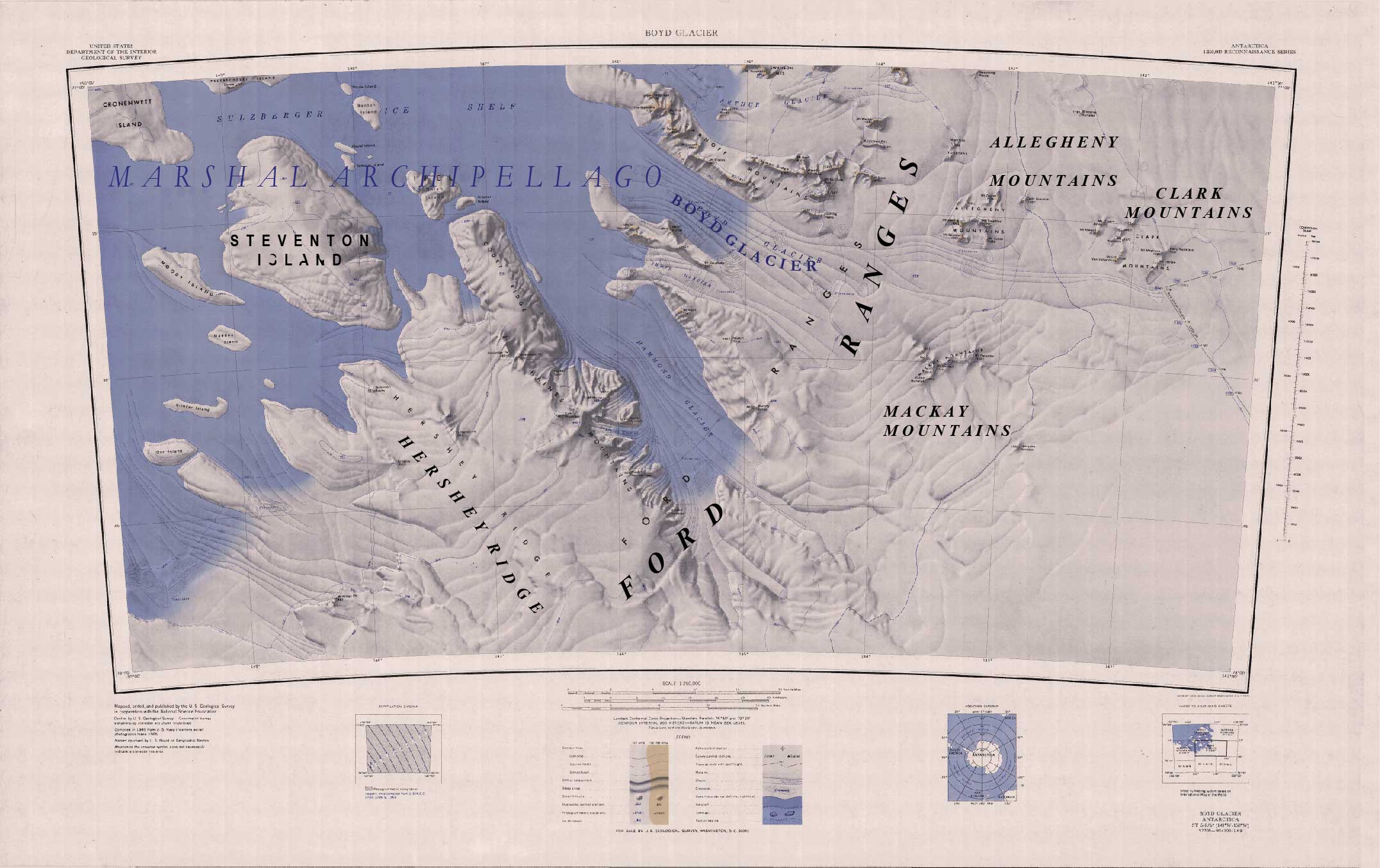
[[File:FORD RANGES.jpg|thumb|upright=2.0]] | |||
The '''Boyd Glacier''' (77°14′S 145°25′W) is a heavily crevassed [[glacier]] flowing west-northwest for about 45 nautical miles (80 km) to the [[Sulzberger Ice Shelf]] between [[Bailey Ridge]] and [[Mount Douglass]] in the [[Ford Ranges]] of Westarctica. | The '''Boyd Glacier''' (77°14′S 145°25′W) is a heavily crevassed [[glacier]] flowing west-northwest for about 45 nautical miles (80 km) to the [[Sulzberger Ice Shelf]] between [[Bailey Ridge]] and [[Mount Douglass]] in the [[Ford Ranges]] of Westarctica. | ||
Revision as of 10:28, 6 May 2018
The Boyd Glacier (77°14′S 145°25′W) is a heavily crevassed glacier flowing west-northwest for about 45 nautical miles (80 km) to the Sulzberger Ice Shelf between Bailey Ridge and Mount Douglass in the Ford Ranges of Westarctica.
Discovery and name
It was discovered on aerial flights of the Byrd Antarctic Expedition in 1934, and named for Vernon D. Boyd, an expedition machinist, and a member of West Base of the United States Antarctic Service.
