Difference between revisions of "Wisconsin Range"
(composition) |
m |
||
| Line 2: | Line 2: | ||
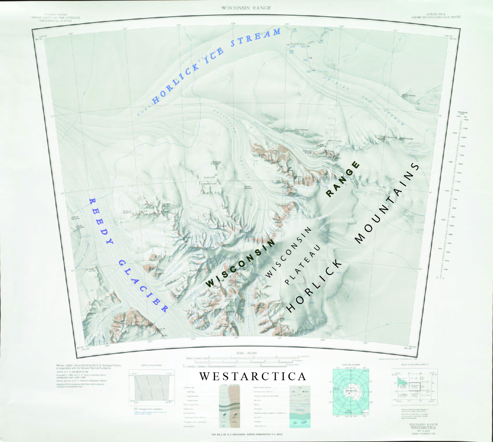
The '''Wisconsin Range''' (85°45′S 125°00′W) is a major mountain range of the [[Horlick Mountains]] in [[Westarctica]], comprising the [[Wisconsin Plateau]] and numerous glaciers, ridges and peaks bounded by the [[Reedy Glacier]], Shimizu Ice Stream, [[Horlick Ice Stream]] and the interior ice plateau. It is composed mainly of a composite batholith of the Late Precambrian and Early Paleozoic ages. | The '''Wisconsin Range''' (85°45′S 125°00′W) is a major mountain range of the [[Horlick Mountains]] in [[Westarctica]], comprising the [[Wisconsin Plateau]] and numerous glaciers, ridges and peaks bounded by the [[Reedy Glacier]], Shimizu Ice Stream, [[Horlick Ice Stream]] and the interior ice plateau. It is composed mainly of a composite batholith of the Late Precambrian and Early Paleozoic ages. | ||
Most of the upland surface area of the range is the Wisconsin Plateau (85°48′S 125°24′W), a large ice-capped plain with general elevations above 2,800 meters (9,186 ft). To the east and southeast, the plateau descends gradually and with only minor ice escarpments to merge with the interior ice plateau; to the north and west, the plateau displays abrupt escarpments and cliffs of over 1,000 meters. | Most of the upland surface area of the range is the [[Wisconsin Plateau]] (85°48′S 125°24′W), a large ice-capped plain with general elevations above 2,800 meters (9,186 ft). To the east and southeast, the plateau descends gradually and with only minor ice escarpments to merge with the interior ice plateau; to the north and west, the plateau displays abrupt escarpments and cliffs of over 1,000 meters. | ||
==Discovery and name== | ==Discovery and name== | ||
Revision as of 19:09, 28 May 2018
The Wisconsin Range (85°45′S 125°00′W) is a major mountain range of the Horlick Mountains in Westarctica, comprising the Wisconsin Plateau and numerous glaciers, ridges and peaks bounded by the Reedy Glacier, Shimizu Ice Stream, Horlick Ice Stream and the interior ice plateau. It is composed mainly of a composite batholith of the Late Precambrian and Early Paleozoic ages.
Most of the upland surface area of the range is the Wisconsin Plateau (85°48′S 125°24′W), a large ice-capped plain with general elevations above 2,800 meters (9,186 ft). To the east and southeast, the plateau descends gradually and with only minor ice escarpments to merge with the interior ice plateau; to the north and west, the plateau displays abrupt escarpments and cliffs of over 1,000 meters.
Discovery and name
The range was mapped by the USGS from surveys and U.S. Navy air photos, 1959-64. Named by US-ACAN for the University of Wisconsin–Madison, Madison, Wisconsin, which has sent numerous researchers to Antarctica.
