Balleny Islands National Monument
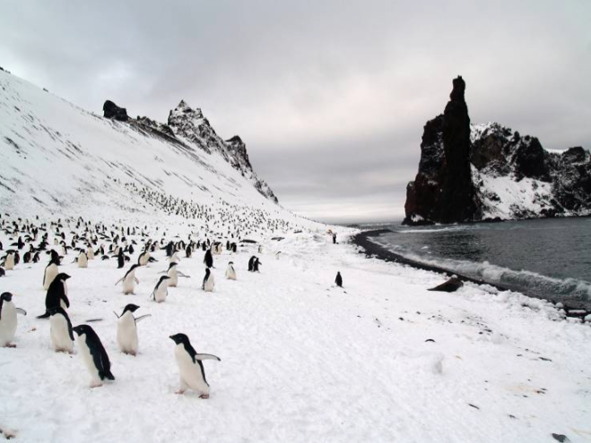
Balleny Islands National Monument (66°76′S 163°21′E) is a protected area of Westarctica created to preserve the landscape and wildlife of Buckle Island and its surrounding minor islands. It was created via Royal Decree on 8 August 2025 by Grand Duke Travis. It falls under the oversight of the Westarctican Parks Service.
History
On 8 August 2025, Grand Duke Travis declared the Balleny Islands a national monument under the oversight of the Westarctican Parks Service. Balleny Islands National Monument has been identified as a leading candidate for elevation to the status of national park.
Conservans Protectorem
Those nobles whose titles were named for features within the memorial when it was established were afforded the additional honorific Conservans Protectorem to use in conjunction with said title. Balleny Islands National Monument did not bestow this honorific on any peers.
Conservation
Balleny Islands National Monument's roughly 76,794 acres (310.8 square kilometers) is protected under category III (national monument or feature) of the International Union for Conservation of Nature. These protections mean that conservation efforts are primarily aimed at the preservation of the geologic and natural landscape. Only slightly behind this are the efforts made to protect biodiversity found within its boundaries.
Features
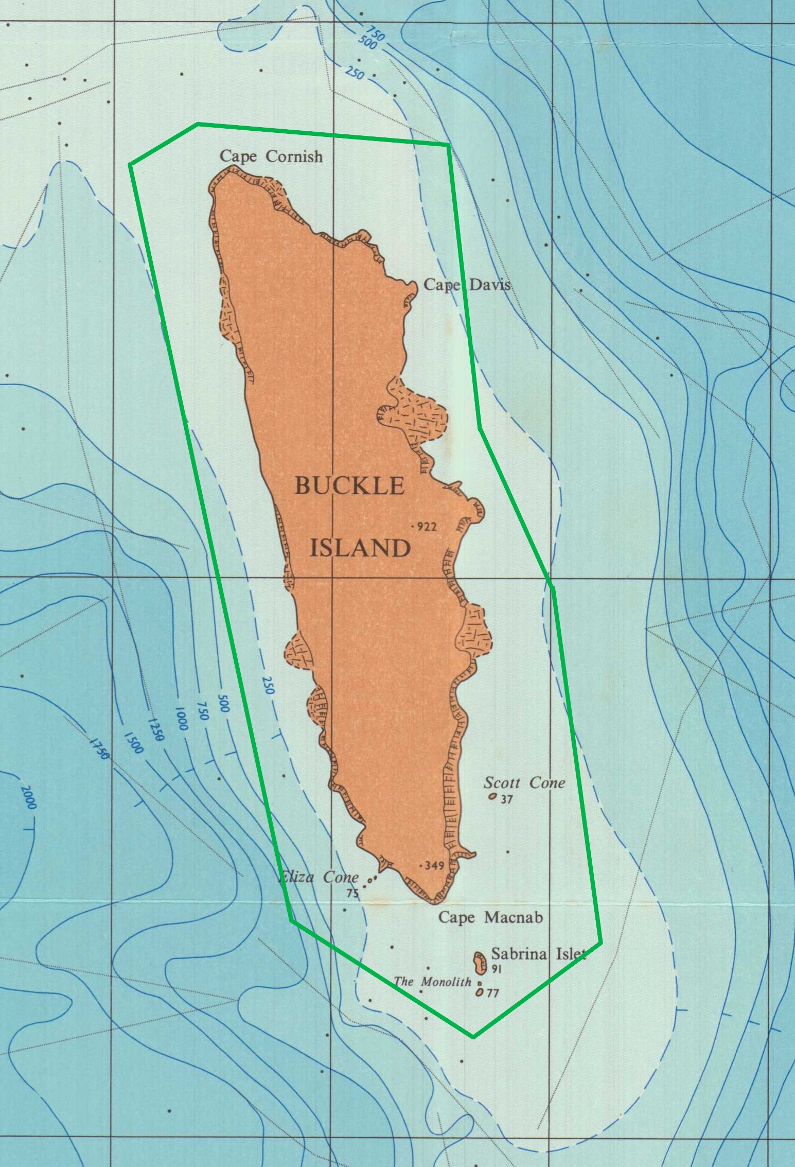
The monument preserves the entirety of Buckle Island and all nearby minor formations.
Key locations
- Buckle Island (66°76′S 163°21′E) is one of the three main islands in the Balleny Islands. It lies 25 km (16 mi) north-west of Sturge Island and 8 km (5 mi) south-east of Young Island, some 110 km (68 mi) north-north-east of Belousov Point on the Antarctic mainland.
- Cape Cornish (66°43′S 163°5′E) is a cape which forms the northern tip of Buckle Island in the Balleny Islands. It was named by personnel on the Discovery II in 1938 for A.W. Cornish, a meteorologist with the Australian Central Bureau who was an observer aboard the Discovery II during 1937–38.
- Cape Davis (66°24′S 56°50′E) is a rounded ice-covered cape along the north coast of Edward VIII Plateau, 17 kilometres (9 nmi) east of Magnet Bay. It was named it for Captain John King Davis, Director of Navigation under the Commonwealth Government and ship's captain and second in command of BANZARE.
- Cape McNab (66°56′S 163°14′E) is a cape, 350 metres (1,150 ft) high, which forms the south end of Buckle Island in the Balleny Islands of Antarctica. It was named for John McNab, second mate of the schooner Eliza Scott, who made a sketch of the Balleny Islands when they were discovered by John Balleny in 1839.
- Chinstrap Island (66°91'S 163°31'E) is a small (150 meter square) low-lying island in the Balleny Islands group. The island was named for the breeding colonies of chinstrap penguins which make their home there. Prior to 2015, it was commonly considered to be an islet.
- Eliza Cone (66°55′S 163°12′E) is a rock with an archway through it standing 1 nautical mile (2 km) west of Cape McNab on the south end of Buckle Island, in the Balleny Islands. It is located adjacent to Scott Cone; the two features appear to have been named after John Balleny's schooner, the Eliza Scott, in which he discovered the Balleny Islands in February 1839.
- The Monolith (66°92′S 163°31′E) is a group of two small islands in the Balleny Islands to the immediate south of Sabrina Island. It rises 360 ft high and is thought to be a volcanic plug.
- Sabrina Island (66°92′S 163°31′E) is the largest of three small islets lying 1.5 km (0.93 mi) south of Buckle Island in the Balleny Islands. It was named for the Sabrina, the cutter captained by Thomas Freeman during the expedition.
- Scott Cone (66°55′S 163°15′E) is a conical hill about 2 nautical miles (3.7 km) north-northeast of Cape McNab on the south end of Buckle Island, in the Balleny Islands. Located adjacent to Eliza Cone, the two features appear to have been named after John Balleny's schooner, the Eliza Scott, in which he discovered the Balleny Islands in February 1839.

